
| Memorials | : | 0 |
| Location | : | Sullivan County, USA |
| Coordinate | : | 41.6572420, -74.6663110 |
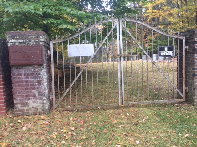
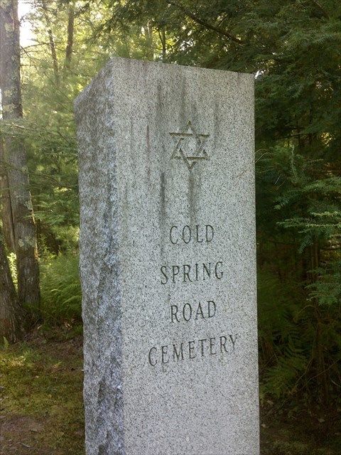
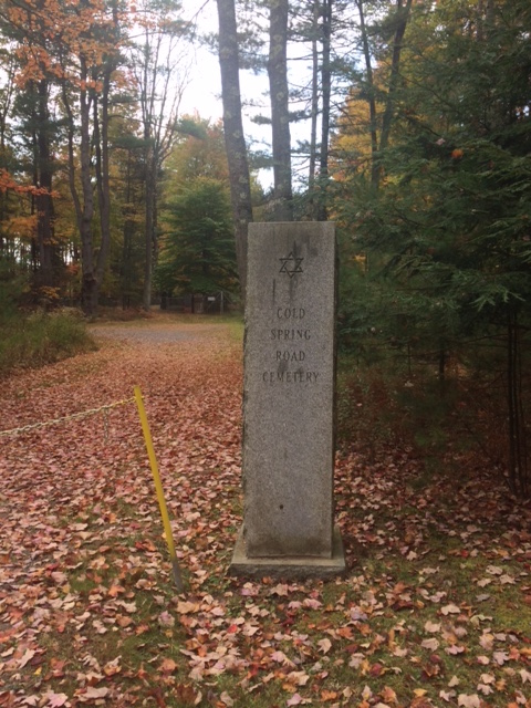
| Description | : | (Old Ahavath Zion Synvagogue) Thompsonville Road Monticello, NY |
frequently asked questions (FAQ):
-
Where is Cold Spring Road Cemetery?
Cold Spring Road Cemetery is located at Thompsonville Road Sullivan County ,New York , 12701USA.
-
Cold Spring Road Cemetery cemetery's updated grave count on graveviews.com?
0 memorials
-
Where are the coordinates of the Cold Spring Road Cemetery?
Latitude: 41.6572420
Longitude: -74.6663110
Nearby Cemetories:
1. Monticello Brotherhood Aid Society Cemetery
Monticello, Sullivan County, USA
Coordinate: 41.6577350, -74.6663000
2. Workman Circle #601 Cemetery
Monticello, Sullivan County, USA
Coordinate: 41.6574430, -74.6675850
3. Saint Peter's Cemetery
Monticello, Sullivan County, USA
Coordinate: 41.6543999, -74.6669006
4. Rock Ridge Cemetery
Monticello, Sullivan County, USA
Coordinate: 41.6514015, -74.6686020
5. Saint John Street Cemetery
Monticello, Sullivan County, USA
Coordinate: 41.6524400, -74.6860400
6. Temple Sholom Cemetery
Monticello, Sullivan County, USA
Coordinate: 41.6383200, -74.6388900
7. Messenger Cemetery
Monticello, Sullivan County, USA
Coordinate: 41.6247500, -74.6395600
8. North Settlement Cemetery
Monticello, Sullivan County, USA
Coordinate: 41.6929520, -74.7060870
9. Bridgeville Cemetery
Bridgeville, Sullivan County, USA
Coordinate: 41.6305800, -74.6149600
10. South Fallsburg Hebrew Cemetery
Glen Wild, Sullivan County, USA
Coordinate: 41.6606278, -74.5979095
11. Glen Wild Cemetery
Glen Wild, Sullivan County, USA
Coordinate: 41.6599800, -74.5977600
12. Hebrew Congregation Cemetery
Glen Wild, Sullivan County, USA
Coordinate: 41.6600090, -74.5963860
13. Jewish General Aid Cemetery
Sullivan County, USA
Coordinate: 41.6944200, -74.7161700
14. Congregation Ohave Shalom Synagogue Cemetery
Glen Wild, Sullivan County, USA
Coordinate: 41.6597420, -74.5959360
15. Glen Wild Synagogue Cemetery
Glen Wild, Sullivan County, USA
Coordinate: 41.6597870, -74.5957680
16. Congregation B'nai Israel Cemetery
Glen Wild, Sullivan County, USA
Coordinate: 41.6606800, -74.5955900
17. Grays Cemetery
Fallsburg, Sullivan County, USA
Coordinate: 41.6793900, -74.6014200
18. Workmans Circle #281 Cemetery
Glen Wild, Sullivan County, USA
Coordinate: 41.6599167, -74.5950250
19. Mapes Cemetery
Monticello, Sullivan County, USA
Coordinate: 41.6119400, -74.7103100
20. Luna Cemetery
Rock Hill, Sullivan County, USA
Coordinate: 41.6336288, -74.5953293
21. Rock Hill Cemetery
Rock Hill, Sullivan County, USA
Coordinate: 41.6334600, -74.5950200
22. Hornbeck Cemetery
Hurleyville, Sullivan County, USA
Coordinate: 41.7171340, -74.6782850
23. Brookside Cemetery
Harris, Sullivan County, USA
Coordinate: 41.7155600, -74.7264800
24. Fallsburg Cemetery
Fallsburg, Sullivan County, USA
Coordinate: 41.7199200, -74.6108300