
| Memorials | : | 0 |
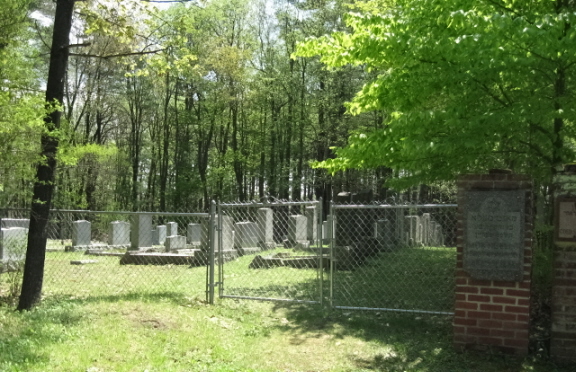
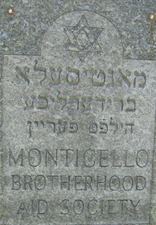
| Location | : | Monticello, Sullivan County, USA |
| Coordinate | : | 41.6577350, -74.6663000 |
| Description | : | In Monticello, take Rock Ridge Ave and turn on to Rock Ridge Drive which will take you over Rte 17. Take the first right turn onto Thompsonville Road. Brotherhood Aid Society is the third cemetery on the right. |
frequently asked questions (FAQ):
-
Where is Monticello Brotherhood Aid Society Cemetery?
Monticello Brotherhood Aid Society Cemetery is located at Thompsonville Road Monticello, Sullivan County ,New York , 12701USA.
-
Monticello Brotherhood Aid Society Cemetery cemetery's updated grave count on graveviews.com?
0 memorials
-
Where are the coordinates of the Monticello Brotherhood Aid Society Cemetery?
Latitude: 41.6577350
Longitude: -74.6663000
Nearby Cemetories:
1. Cold Spring Road Cemetery
Sullivan County, USA
Coordinate: 41.6572420, -74.6663110
2. Workman Circle #601 Cemetery
Monticello, Sullivan County, USA
Coordinate: 41.6574430, -74.6675850
3. Saint Peter's Cemetery
Monticello, Sullivan County, USA
Coordinate: 41.6543999, -74.6669006
4. Rock Ridge Cemetery
Monticello, Sullivan County, USA
Coordinate: 41.6514015, -74.6686020
5. Saint John Street Cemetery
Monticello, Sullivan County, USA
Coordinate: 41.6524400, -74.6860400
6. Temple Sholom Cemetery
Monticello, Sullivan County, USA
Coordinate: 41.6383200, -74.6388900
7. Messenger Cemetery
Monticello, Sullivan County, USA
Coordinate: 41.6247500, -74.6395600
8. North Settlement Cemetery
Monticello, Sullivan County, USA
Coordinate: 41.6929520, -74.7060870
9. Bridgeville Cemetery
Bridgeville, Sullivan County, USA
Coordinate: 41.6305800, -74.6149600
10. South Fallsburg Hebrew Cemetery
Glen Wild, Sullivan County, USA
Coordinate: 41.6606278, -74.5979095
11. Glen Wild Cemetery
Glen Wild, Sullivan County, USA
Coordinate: 41.6599800, -74.5977600
12. Jewish General Aid Cemetery
Sullivan County, USA
Coordinate: 41.6944200, -74.7161700
13. Hebrew Congregation Cemetery
Glen Wild, Sullivan County, USA
Coordinate: 41.6600090, -74.5963860
14. Congregation Ohave Shalom Synagogue Cemetery
Glen Wild, Sullivan County, USA
Coordinate: 41.6597420, -74.5959360
15. Glen Wild Synagogue Cemetery
Glen Wild, Sullivan County, USA
Coordinate: 41.6597870, -74.5957680
16. Congregation B'nai Israel Cemetery
Glen Wild, Sullivan County, USA
Coordinate: 41.6606800, -74.5955900
17. Grays Cemetery
Fallsburg, Sullivan County, USA
Coordinate: 41.6793900, -74.6014200
18. Workmans Circle #281 Cemetery
Glen Wild, Sullivan County, USA
Coordinate: 41.6599167, -74.5950250
19. Mapes Cemetery
Monticello, Sullivan County, USA
Coordinate: 41.6119400, -74.7103100
20. Luna Cemetery
Rock Hill, Sullivan County, USA
Coordinate: 41.6336288, -74.5953293
21. Rock Hill Cemetery
Rock Hill, Sullivan County, USA
Coordinate: 41.6334600, -74.5950200
22. Hornbeck Cemetery
Hurleyville, Sullivan County, USA
Coordinate: 41.7171340, -74.6782850
23. Brookside Cemetery
Harris, Sullivan County, USA
Coordinate: 41.7155600, -74.7264800
24. Fallsburg Cemetery
Fallsburg, Sullivan County, USA
Coordinate: 41.7199200, -74.6108300