
| Memorials | : | 1 |
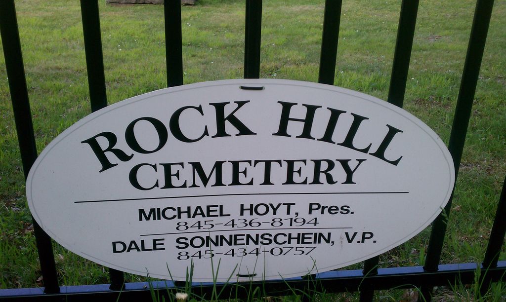
| Location | : | Rock Hill, Sullivan County, USA |
| Coordinate | : | 41.6334600, -74.5950200 |
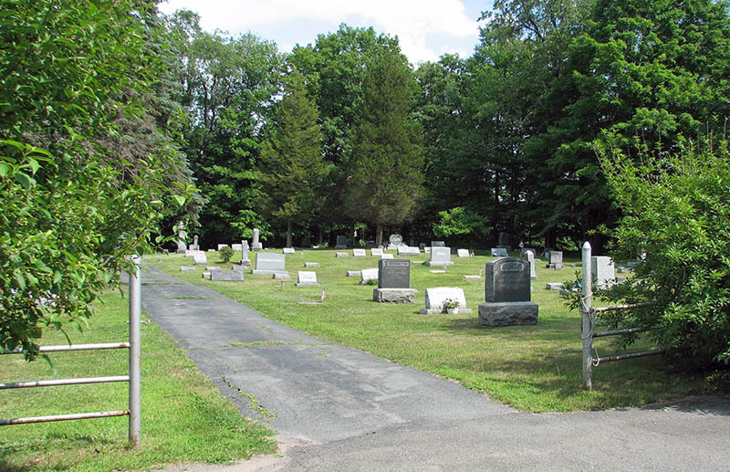
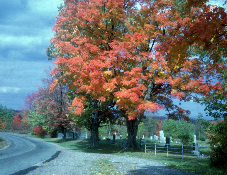
| Description | : | Entrance to the Rock Hill Cemetery, on the east side of Glen Wild Road, approximately one mile north of the intersection of Rock Hill Drive and Glen Wild Road. The cemetery is open from sunrise to sunset. |
frequently asked questions (FAQ):
-
Where is Rock Hill Cemetery?
Rock Hill Cemetery is located at 110 Glen Wild Road Rock Hill, Sullivan County ,New York , 12775USA.
-
Rock Hill Cemetery cemetery's updated grave count on graveviews.com?
1 memorials
-
Where are the coordinates of the Rock Hill Cemetery?
Latitude: 41.6334600
Longitude: -74.5950200
Nearby Cemetories:
1. Luna Cemetery
Rock Hill, Sullivan County, USA
Coordinate: 41.6336288, -74.5953293
2. Bridgeville Cemetery
Bridgeville, Sullivan County, USA
Coordinate: 41.6305800, -74.6149600
3. Congregation Ohave Shalom Synagogue Cemetery
Glen Wild, Sullivan County, USA
Coordinate: 41.6597420, -74.5959360
4. Glen Wild Synagogue Cemetery
Glen Wild, Sullivan County, USA
Coordinate: 41.6597870, -74.5957680
5. Workmans Circle #281 Cemetery
Glen Wild, Sullivan County, USA
Coordinate: 41.6599167, -74.5950250
6. Hebrew Congregation Cemetery
Glen Wild, Sullivan County, USA
Coordinate: 41.6600090, -74.5963860
7. Glen Wild Cemetery
Glen Wild, Sullivan County, USA
Coordinate: 41.6599800, -74.5977600
8. Congregation B'nai Israel Cemetery
Glen Wild, Sullivan County, USA
Coordinate: 41.6606800, -74.5955900
9. South Fallsburg Hebrew Cemetery
Glen Wild, Sullivan County, USA
Coordinate: 41.6606278, -74.5979095
10. Temple Sholom Cemetery
Monticello, Sullivan County, USA
Coordinate: 41.6383200, -74.6388900
11. Messenger Cemetery
Monticello, Sullivan County, USA
Coordinate: 41.6247500, -74.6395600
12. Grays Cemetery
Fallsburg, Sullivan County, USA
Coordinate: 41.6793900, -74.6014200
13. Hillside Cemetery
Mountain Dale, Sullivan County, USA
Coordinate: 41.6711006, -74.5378036
14. Saint Peter's Cemetery
Monticello, Sullivan County, USA
Coordinate: 41.6543999, -74.6669006
15. Rock Ridge Cemetery
Monticello, Sullivan County, USA
Coordinate: 41.6514015, -74.6686020
16. Cold Spring Road Cemetery
Sullivan County, USA
Coordinate: 41.6572420, -74.6663110
17. Monticello Brotherhood Aid Society Cemetery
Monticello, Sullivan County, USA
Coordinate: 41.6577350, -74.6663000
18. Workman Circle #601 Cemetery
Monticello, Sullivan County, USA
Coordinate: 41.6574430, -74.6675850
19. Chesed Shel Emes Cemetery
Woodridge, Sullivan County, USA
Coordinate: 41.6937110, -74.5502380
20. Saint John Street Cemetery
Monticello, Sullivan County, USA
Coordinate: 41.6524400, -74.6860400
21. Fallsburg Cemetery
Fallsburg, Sullivan County, USA
Coordinate: 41.7199200, -74.6108300
22. Mapes Cemetery
Monticello, Sullivan County, USA
Coordinate: 41.6119400, -74.7103100
23. Sylvan Cemetery
Wurtsboro, Sullivan County, USA
Coordinate: 41.5732994, -74.4938965
24. Wurtsboro Hebrew Cemetery
Wurtsboro, Sullivan County, USA
Coordinate: 41.5752800, -74.4917600