
| Memorials | : | 0 |
| Location | : | Mayking, Letcher County, USA |
| Coordinate | : | 37.1348720, -82.7682810 |
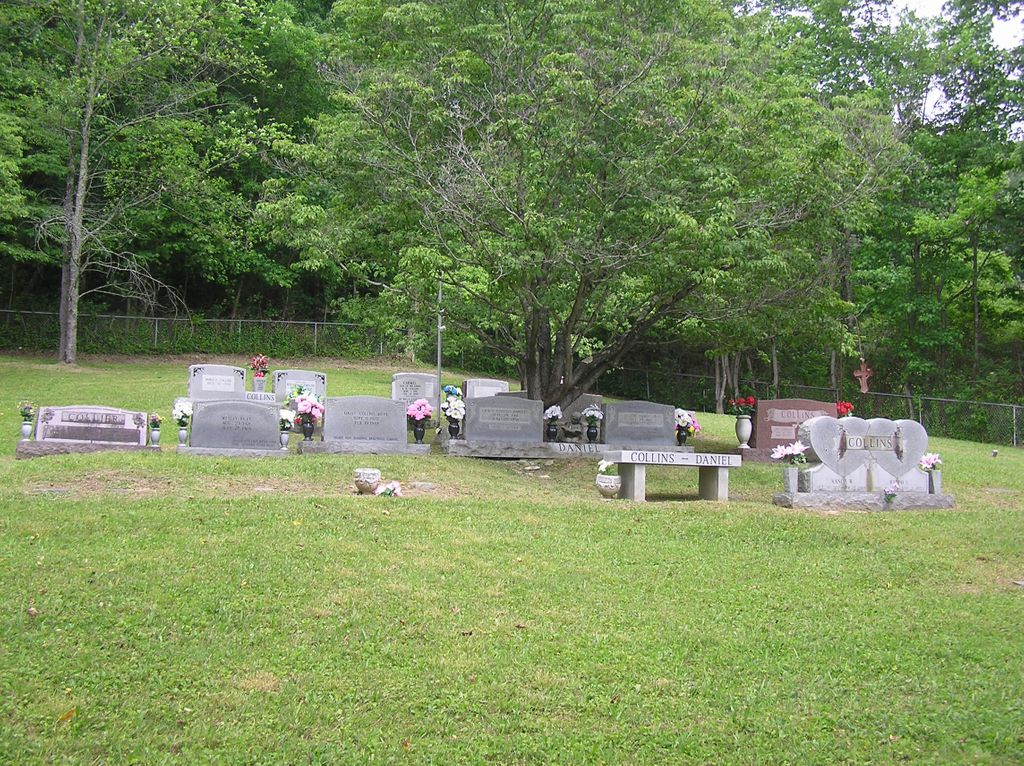
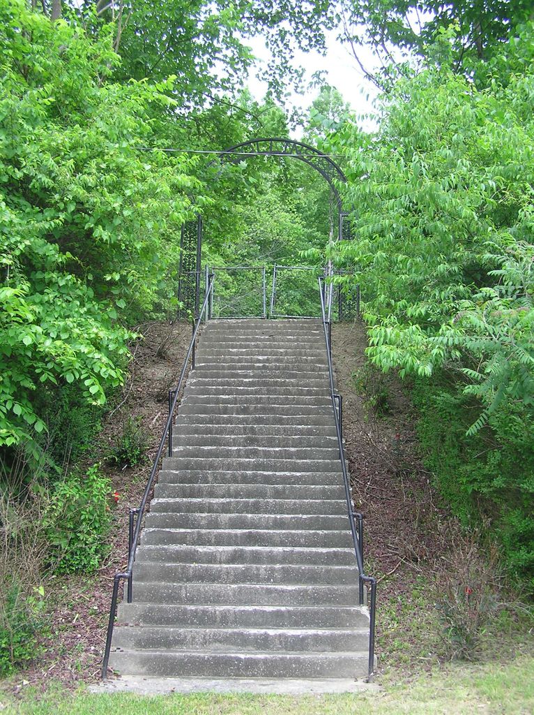
| Description | : | The Collins Cemetery, also known as the Sanders A. Collins or S. A. Collins Cemetery, is located on Thornton Road (Route 1862) in Mayking, KY, about 0.1 miles west of Jct US119 (see map). Twenty-nine steps lead up to the cemetery which is surrounded by a chain-link fence. Most all of the graves are located in the center of the cemetery with the exception of Dr. Thomas Reed Collier's grave marker which is off to the left by itself. |
frequently asked questions (FAQ):
-
Where is Collins Cemetery?
Collins Cemetery is located at Mayking, Letcher County ,Kentucky ,USA.
-
Collins Cemetery cemetery's updated grave count on graveviews.com?
0 memorials
-
Where are the coordinates of the Collins Cemetery?
Latitude: 37.1348720
Longitude: -82.7682810
Nearby Cemetories:
1. Webb Cemetery
Mayking, Letcher County, USA
Coordinate: 37.1314300, -82.7652510
2. Holbrook Cemetery
Mayking, Letcher County, USA
Coordinate: 37.1372250, -82.7611660
3. Haven of Rest Cemetery
Mayking, Letcher County, USA
Coordinate: 37.1372090, -82.7611020
4. Hall Cemetery
Mayking, Letcher County, USA
Coordinate: 37.1225880, -82.7797270
5. Cram Creek Cemetery
Mayking, Letcher County, USA
Coordinate: 37.1164790, -82.7706700
6. Fugate Cemetery
Mayking, Letcher County, USA
Coordinate: 37.1159000, -82.7703770
7. Colson Cemetery
Colson, Letcher County, USA
Coordinate: 37.1228790, -82.7483495
8. Adams Cemetery
Isom, Letcher County, USA
Coordinate: 37.1369019, -82.7944031
9. Melvin Adams Cemetery
Ermine, Letcher County, USA
Coordinate: 37.1370000, -82.7944000
10. Craft's Colly Cemetery
Ermine, Letcher County, USA
Coordinate: 37.1280240, -82.7950290
11. Adams and Franklin Cemetery
Letcher County, USA
Coordinate: 37.1469370, -82.7940920
12. Combs Cemetery
Ermine, Letcher County, USA
Coordinate: 37.1193620, -82.7948360
13. Green Acres Cemetery
Ermine, Letcher County, USA
Coordinate: 37.1176987, -82.7956009
14. Day Cemetery
Ermine, Letcher County, USA
Coordinate: 37.1123100, -82.7967900
15. Webb Cemetery
Millstone, Letcher County, USA
Coordinate: 37.1671330, -82.7504380
16. Caudill Cemetery
Dongola, Letcher County, USA
Coordinate: 37.0919620, -82.8045430
17. Chunk Craft Cemetery
Millstone, Letcher County, USA
Coordinate: 37.1886111, -82.7463889
18. Hop Gibson Cemetery
Letcher County, USA
Coordinate: 37.0896190, -82.8163350
19. Fields Cemetery
Dongola, Letcher County, USA
Coordinate: 37.0932270, -82.8220650
20. Wright Cemetery
Jenkins, Letcher County, USA
Coordinate: 37.1505620, -82.6942880
21. Wright Cemetery
Neon, Letcher County, USA
Coordinate: 37.1808330, -82.7161110
22. Bentley Cemetery
Neon, Letcher County, USA
Coordinate: 37.1809200, -82.7157500
23. Mullins Family Cemetery
Eolia, Letcher County, USA
Coordinate: 37.0713400, -82.7839220
24. Bentley Family Cemetery
Millstone, Letcher County, USA
Coordinate: 37.1972616, -82.7351418