
| Memorials | : | 0 |
| Location | : | Narrows, Giles County, USA |
| Coordinate | : | 37.2695778, -80.9513694 |
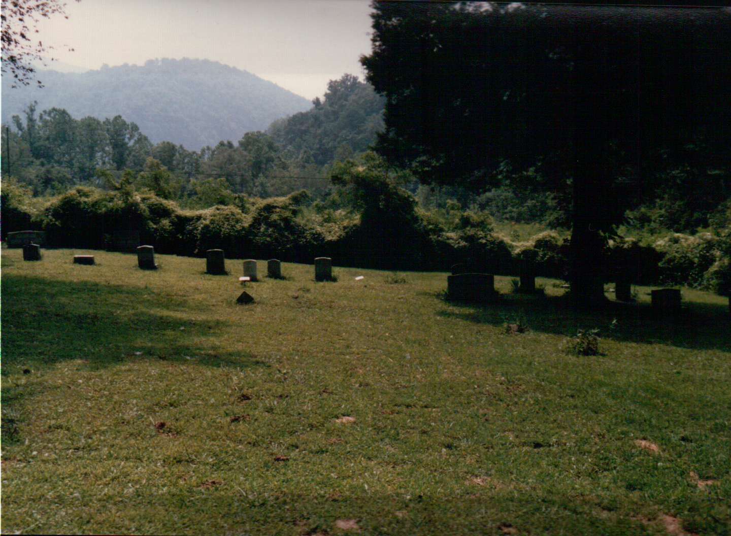
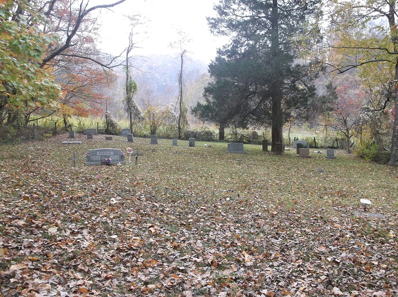
| Description | : | The cemetery gate is located on the southeasterly side of Old Wolf Creek Road, aproximately 425 feet northeast of the intersection of Conley Hollow Road. Once through the gate, follow the dirt road a short distance to the opening of the cemetery. The cemetery sits on the property designated as Parcel 50-3 (lands now or formerly of William Wendell Millirons) on the Giles County, VA GIS Mapping Website. http://arcims.webgis.net/va/giles/default.asp |
frequently asked questions (FAQ):
-
Where is Conley Cemetery?
Conley Cemetery is located at Narrows, Giles County ,Virginia ,USA.
-
Conley Cemetery cemetery's updated grave count on graveviews.com?
0 memorials
-
Where are the coordinates of the Conley Cemetery?
Latitude: 37.2695778
Longitude: -80.9513694
Nearby Cemetories:
1. French-Turner Family Cemetery
Narrows, Giles County, USA
Coordinate: 37.2736200, -80.9390000
2. Ferrell Cemetery
Narrows, Giles County, USA
Coordinate: 37.2734800, -80.9386500
3. Shrader Family Cemetery
Narrows, Giles County, USA
Coordinate: 37.2776800, -80.9312900
4. Hales Chapel Cemetery
Giles County, USA
Coordinate: 37.2774200, -80.9287300
5. Millirons Family Cemetery
Giles County, USA
Coordinate: 37.2744900, -80.9257900
6. Beamer Cemetery
Narrows, Giles County, USA
Coordinate: 37.2752000, -80.9254200
7. Johnston-Conley Cemetery
Narrows, Giles County, USA
Coordinate: 37.2797700, -80.9209500
8. Lambert Cemetery
Giles County, USA
Coordinate: 37.2605400, -80.9888600
9. Dodson-Clark Cemetery
Bland County, USA
Coordinate: 37.2591000, -81.0045200
10. Boyd Cemetery
Giles County, USA
Coordinate: 37.2902500, -80.9018500
11. Patteson Family Cemetery
Narrows, Giles County, USA
Coordinate: 37.2922300, -80.8940600
12. Wagner Cemetery
Rocky Gap, Bland County, USA
Coordinate: 37.2839012, -81.0194016
13. Bivins Cemetery
Grapefield, Bland County, USA
Coordinate: 37.2557300, -81.0197300
14. Shrader Cemetery
Narrows, Giles County, USA
Coordinate: 37.2963880, -80.8823670
15. Clark Cemetery
Niday, Bland County, USA
Coordinate: 37.2561240, -81.0320940
16. Lambert Family Cemetery
Niday, Bland County, USA
Coordinate: 37.2516057, -81.0311343
17. Shrader Cemetery
Niday, Bland County, USA
Coordinate: 37.2511000, -81.0322000
18. Hogans Cemetery
Rocky Gap, Bland County, USA
Coordinate: 37.2789001, -81.0355988
19. Cedar Grove Cemetery
Narrows, Giles County, USA
Coordinate: 37.2943993, -80.8719025
20. Brown Cemetery
Hardy, Mercer County, USA
Coordinate: 37.3070800, -81.0265208
21. Bray Cemetery
Mercer County, USA
Coordinate: 37.3102989, -81.0258026
22. Potter's Shop Cemetery
Hardy, Mercer County, USA
Coordinate: 37.3134420, -81.0235750
23. Mountain Field Cemetery
Holly Brook, Bland County, USA
Coordinate: 37.1966000, -80.9374000
24. Shields Cemetery
Rocky Gap, Bland County, USA
Coordinate: 37.2797012, -81.0438995