| Memorials | : | 1 |
| Location | : | Cloverland, Douglas County, USA |
| Coordinate | : | 46.6768600, -91.6846400 |
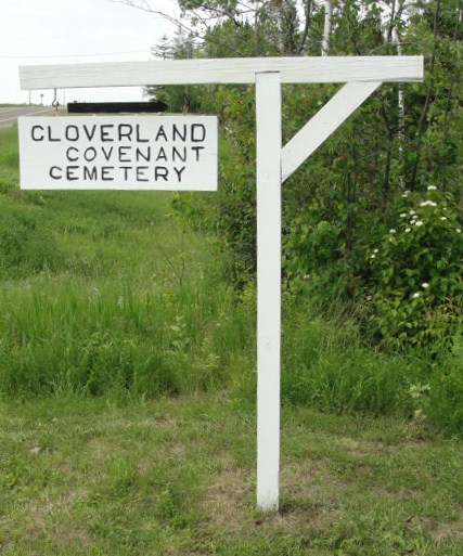
| Description | : | Cloverland Covenant Church is located on the north side of Hwy 13. The church cemetery is located behind the church and slightly to the northwest. The driveway to the left will take you to the cemetery, although it is within walking distance. |
frequently asked questions (FAQ):
-
Where is Covenant Cemetery?
Covenant Cemetery is located at Cloverland, Douglas County ,Wisconsin ,USA.
-
Covenant Cemetery cemetery's updated grave count on graveviews.com?
0 memorials
-
Where are the coordinates of the Covenant Cemetery?
Latitude: 46.6768600
Longitude: -91.6846400
Nearby Cemetories:
1. Faith Lutheran Cemetery
Maple, Douglas County, USA
Coordinate: 46.6258340, -91.7206050
2. Maple Memorial Cemetery
Maple, Douglas County, USA
Coordinate: 46.6255390, -91.7206050
3. Resthaven Cemetery
Cloverland, Douglas County, USA
Coordinate: 46.6925011, -91.5738983
4. Lakeside Cemetery
Wentworth, Douglas County, USA
Coordinate: 46.6488991, -91.8063965
5. Ever-Rest Cemetery
Waino, Douglas County, USA
Coordinate: 46.6389008, -91.5631027
6. Saint Anns Cemetery
Maple, Douglas County, USA
Coordinate: 46.5821080, -91.6784190
7. Oulu Lutheran Cemetery
Oulu, Bayfield County, USA
Coordinate: 46.6549988, -91.5318985
8. Hillcrest Cemetery
Oulu, Bayfield County, USA
Coordinate: 46.6507300, -91.5097200
9. Poplar Cemetery
Poplar, Douglas County, USA
Coordinate: 46.5802994, -91.7956009
10. Pine Glade Cemetery
Oulu, Bayfield County, USA
Coordinate: 46.6232986, -91.5113983
11. Pine Ridge Cemetery
Brule, Douglas County, USA
Coordinate: 46.5363998, -91.5749969
12. Lake Nebagamon Cemetery
Lake Nebagamon, Douglas County, USA
Coordinate: 46.5132200, -91.7256100
13. Hillside Cemetery
Port Wing, Bayfield County, USA
Coordinate: 46.6963997, -91.4113998
14. Old Parkview Cemetery
Hawthorne, Douglas County, USA
Coordinate: 46.4996920, -91.8615820
15. Parkview Cemetery
Hawthorne, Douglas County, USA
Coordinate: 46.5008011, -91.8711014
16. Saint Michaels Cemetery
Iron River, Bayfield County, USA
Coordinate: 46.5602989, -91.4150009
17. Greenwood Cemetery
Port Wing, Bayfield County, USA
Coordinate: 46.7668991, -91.3886032
18. Iron River City Cemetery
Iron River, Bayfield County, USA
Coordinate: 46.5668983, -91.3981018
19. Parkland Cemetery
Parkland, Douglas County, USA
Coordinate: 46.6522900, -92.0117600
20. Valley View Cemetery
Iron River, Bayfield County, USA
Coordinate: 46.6227989, -91.3600006
21. Lutheran Cemetery
Bennett, Douglas County, USA
Coordinate: 46.4598150, -91.8462820
22. Nemadji Cemetery
Superior, Douglas County, USA
Coordinate: 46.6917000, -92.0432968
23. Saint Francis Cemetery
Superior, Douglas County, USA
Coordinate: 46.6906013, -92.0438995
24. Woodlawn Cemetery
Ambridge, Douglas County, USA
Coordinate: 46.6539001, -92.0453033


