
| Memorials | : | 0 |
| Location | : | Brownwood, Ashe County, USA |
| Coordinate | : | 36.2702000, -81.5389900 |
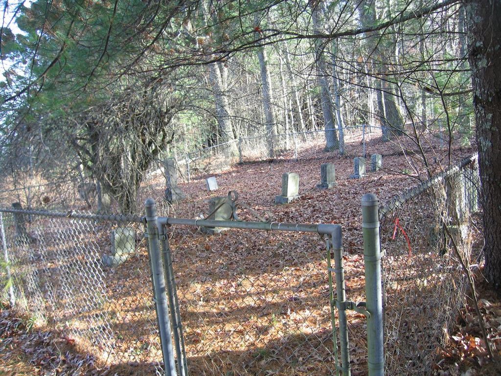
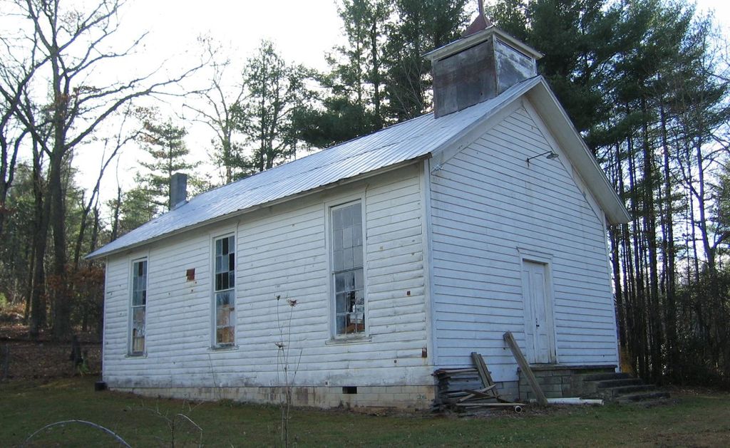
| Description | : | Cemetery is directly behind the abandoned church and appears to be no longer in use. As of Nov., 2012 all engraved tombstones have been photographed. |
frequently asked questions (FAQ):
-
Where is Cranberry Methodist Church Cemetery?
Cranberry Methodist Church Cemetery is located at Cranberry Springs Rd Brownwood, Ashe County ,North Carolina ,USA.
-
Cranberry Methodist Church Cemetery cemetery's updated grave count on graveviews.com?
0 memorials
-
Where are the coordinates of the Cranberry Methodist Church Cemetery?
Latitude: 36.2702000
Longitude: -81.5389900

Nearby Cemetories:
1. Watson Cemetery
Brownwood, Ashe County, USA
Coordinate: 36.2662500, -81.5358500
2. Cooper Cemetery
Ashe County, USA
Coordinate: 36.2724000, -81.5460500
3. John Alexander Miller Family Cemetery
Watauga County, USA
Coordinate: 36.2613000, -81.5441400
4. Rev Asa Brown Family Cemetery
Brownwood, Ashe County, USA
Coordinate: 36.2770100, -81.5568700
5. Waters Family Cemetery
Brownwood, Ashe County, USA
Coordinate: 36.2636000, -81.5180600
6. Greene Family Cemetery
Brownwood, Ashe County, USA
Coordinate: 36.2622900, -81.5168400
7. Moretz Greer Cemetery
Deep Gap, Watauga County, USA
Coordinate: 36.2681860, -81.5661740
8. Idol Family Cemetery
Watauga County, USA
Coordinate: 36.2487380, -81.5300720
9. Hardin Road Baptist Church Cemetery
Boone, Watauga County, USA
Coordinate: 36.2651240, -81.5754180
10. Powers-Miller Family Cemetery
Brownwood, Ashe County, USA
Coordinate: 36.2614300, -81.5029600
11. Watson Family Cemetery
Deep Gap, Watauga County, USA
Coordinate: 36.2406300, -81.5244000
12. Columbus Phillips Family Cemetery
Watauga County, USA
Coordinate: 36.2707800, -81.5808900
13. Trinity Baptist Church Cemetery
Deep Gap, Watauga County, USA
Coordinate: 36.2375060, -81.5277400
14. Old Gap Creek Church Cemetery
Boone, Watauga County, USA
Coordinate: 36.2504500, -81.5035500
15. Pilot Mountain Baptist Church Cemetery
Watauga County, USA
Coordinate: 36.2790000, -81.5814000
16. Phillips Family Cemetery
Watauga County, USA
Coordinate: 36.2654500, -81.5827100
17. Laurel Springs Cemetery
Deep Gap, Watauga County, USA
Coordinate: 36.2352300, -81.5484670
18. Calvin Howell Family Cemetery
Ashe County, USA
Coordinate: 36.3014800, -81.5618000
19. Hardin-Day Cemetery
Boone, Watauga County, USA
Coordinate: 36.2390800, -81.5656800
20. Samuel Greer Family Cemetery
Laxon, Watauga County, USA
Coordinate: 36.2302700, -81.5353100
21. Norris Tabernacle Baptist Church Cemetery
Watauga County, USA
Coordinate: 36.2537800, -81.5871900
22. Castle Cemetery
Laxon, Watauga County, USA
Coordinate: 36.2688400, -81.5920500
23. Sanders Cemetery
Deep Gap, Watauga County, USA
Coordinate: 36.2263600, -81.5295800
24. Fairview Cemetery
Boone, Watauga County, USA
Coordinate: 36.2470600, -81.5867700