
| Memorials | : | 0 |
| Location | : | Augusta, Carroll County, USA |
| Coordinate | : | 40.6664009, -81.0036011 |
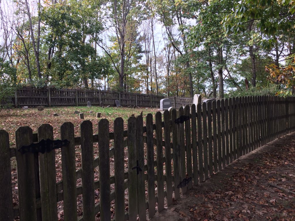
| Description | : | The cemetery is located on the highest point of old Crawford Homestead on northwest side of Meter Road NE (Township Road 269) about 1.1 mile west of its intersection with Mark Road NE (Township Road 260). The cemetery is located in Augusta Township, Carroll County, Ohio, and is # 1383 (Crawford Cemetery) in “Ohio Cemeteries 1803-2003”, compiled by the Ohio Genealogical Society. The U.S. Geological Survey (USGS) Geographic Names Information System (GNIS) feature ID for the cemetery is 1039458 (Crawford Cemetery). |
frequently asked questions (FAQ):
-
Where is Crawford Cemetery?
Crawford Cemetery is located at Meter Road NE Augusta, Carroll County ,Ohio , 44651USA.
-
Crawford Cemetery cemetery's updated grave count on graveviews.com?
0 memorials
-
Where are the coordinates of the Crawford Cemetery?
Latitude: 40.6664009
Longitude: -81.0036011

Nearby Cemetories:
1. Herrington Bethel Cemetery
Carroll County, USA
Coordinate: 40.6493988, -81.0128021
2. Augusta Christian Church Cemetery
Augusta, Carroll County, USA
Coordinate: 40.6880989, -81.0211029
3. Upper Glade Run Cemetery
Carroll County, USA
Coordinate: 40.6691400, -80.9653910
4. Bird Cemetery
Carroll County, USA
Coordinate: 40.6761017, -81.0406036
5. Glade Run Cemetery
East Township, Carroll County, USA
Coordinate: 40.6680984, -80.9642029
6. Pattersonville Presbyterian Cemetery
Augusta, Carroll County, USA
Coordinate: 40.6845047, -81.0367607
7. Glade Run Mennonite Church Cemetery
East Township, Carroll County, USA
Coordinate: 40.6760920, -80.9639470
8. Stillfork Cemetery
Augusta, Carroll County, USA
Coordinate: 40.6720050, -81.0503730
9. Still Fork Church Cemetery
Carroll County, USA
Coordinate: 40.6719017, -81.0505981
10. Mount Zion Cemetery
Augusta, Carroll County, USA
Coordinate: 40.6982994, -81.0492020
11. Stuller Cemetery
Carroll County, USA
Coordinate: 40.6302986, -81.0513992
12. Snyder Cemetery
Carroll County, USA
Coordinate: 40.6169014, -80.9766998
13. Moore Cemetery
Augusta, Carroll County, USA
Coordinate: 40.7064018, -81.0539017
14. Roudebush Cemetery
Carroll County, USA
Coordinate: 40.7097015, -80.9563980
15. Quaker Ridge Cemetery
Carroll County, USA
Coordinate: 40.7268982, -81.0119019
16. Corinth-Mechanicstown Cemetery
Mechanicstown, Carroll County, USA
Coordinate: 40.6156006, -80.9578018
17. Chestnut Knob Cemetery
Carroll County, USA
Coordinate: 40.6772003, -81.0886002
18. County Home Cemetery
Carroll County, USA
Coordinate: 40.6175003, -81.0674973
19. Harsh-Swamp Cemetery
Carroll County, USA
Coordinate: 40.6413994, -81.0892029
20. Mount Olivet Cemetery
Carroll County, USA
Coordinate: 40.5905991, -81.0081024
21. Pleasant Grove Cemetery
Carroll County, USA
Coordinate: 40.6589012, -81.1089020
22. Saint John's Catholic Cemetery
Summitville, Columbiana County, USA
Coordinate: 40.6722984, -80.8980026
23. Bethesda Cemetery
Hanoverton, Columbiana County, USA
Coordinate: 40.7089005, -80.8992004
24. Sandy Springs Cemetery
Hanoverton, Columbiana County, USA
Coordinate: 40.7491989, -80.9561005