
| Memorials | : | 2 |
| Location | : | Augusta, Carroll County, USA |
| Coordinate | : | 40.6845047, -81.0367607 |
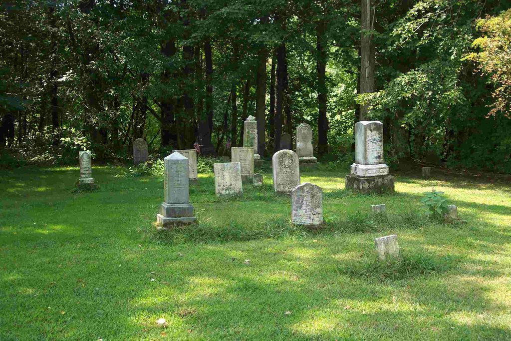
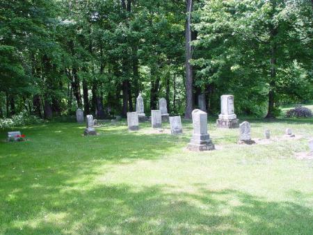
| Description | : | The cemetery is located on the west side of Abbey Road NE (County Road 7) about 0.5 mile south of its intersection with Aurora Road NE (County Road 18). The cemetery is located in Augusta Township, Carroll County, Ohio, and is # 1382 (Patterson Presbyterian Cemetery / Still Fork Church Cemetery) in “Ohio Cemeteries 1803-2003”, compiled by the Ohio Genealogical Society. The U.S. Geological Survey (USGS) Geographic Names Information System (GNIS) feature ID for the cemetery is 1061210 (Still Fork Church Cemetery / Cameron Cemetery / Pattersonville Presbyterian Cemetery). |
frequently asked questions (FAQ):
-
Where is Pattersonville Presbyterian Cemetery?
Pattersonville Presbyterian Cemetery is located at Abbet Road NE (County Road 7) Augusta, Carroll County ,Ohio , 44615USA.
-
Pattersonville Presbyterian Cemetery cemetery's updated grave count on graveviews.com?
1 memorials
-
Where are the coordinates of the Pattersonville Presbyterian Cemetery?
Latitude: 40.6845047
Longitude: -81.0367607
Nearby Cemetories:
1. Bird Cemetery
Carroll County, USA
Coordinate: 40.6761017, -81.0406036
2. Augusta Christian Church Cemetery
Augusta, Carroll County, USA
Coordinate: 40.6880989, -81.0211029
3. Stillfork Cemetery
Augusta, Carroll County, USA
Coordinate: 40.6720050, -81.0503730
4. Still Fork Church Cemetery
Carroll County, USA
Coordinate: 40.6719017, -81.0505981
5. Mount Zion Cemetery
Augusta, Carroll County, USA
Coordinate: 40.6982994, -81.0492020
6. Moore Cemetery
Augusta, Carroll County, USA
Coordinate: 40.7064018, -81.0539017
7. Crawford Cemetery
Augusta, Carroll County, USA
Coordinate: 40.6664009, -81.0036011
8. Herrington Bethel Cemetery
Carroll County, USA
Coordinate: 40.6493988, -81.0128021
9. Chestnut Knob Cemetery
Carroll County, USA
Coordinate: 40.6772003, -81.0886002
10. Quaker Ridge Cemetery
Carroll County, USA
Coordinate: 40.7268982, -81.0119019
11. Stuller Cemetery
Carroll County, USA
Coordinate: 40.6302986, -81.0513992
12. Glade Run Mennonite Church Cemetery
East Township, Carroll County, USA
Coordinate: 40.6760920, -80.9639470
13. Upper Glade Run Cemetery
Carroll County, USA
Coordinate: 40.6691400, -80.9653910
14. Glade Run Cemetery
East Township, Carroll County, USA
Coordinate: 40.6680984, -80.9642029
15. Harsh-Swamp Cemetery
Carroll County, USA
Coordinate: 40.6413994, -81.0892029
16. Pleasant Grove Cemetery
Carroll County, USA
Coordinate: 40.6589012, -81.1089020
17. East Lawn Cemetery
Minerva, Stark County, USA
Coordinate: 40.7289009, -81.0960999
18. Plaines Cemetery
West Township, Columbiana County, USA
Coordinate: 40.7419270, -81.0762320
19. Roudebush Cemetery
Carroll County, USA
Coordinate: 40.7097015, -80.9563980
20. Valley Street Cemetery
Carroll County, USA
Coordinate: 40.7248001, -81.1065979
21. Devils Half Acre Cemetery
Oneida, Carroll County, USA
Coordinate: 40.6697006, -81.1235962
22. County Home Cemetery
Carroll County, USA
Coordinate: 40.6175003, -81.0674973
23. Pekin Burial Ground
Pekin, Carroll County, USA
Coordinate: 40.7170380, -81.1254630
24. Heritage Memorial Gardens
Paris Township, Stark County, USA
Coordinate: 40.7498016, -81.0898972