
| Memorials | : | 3 |
| Location | : | Celina, Clay County, USA |
| Coordinate | : | 36.5979660, -85.4976660 |
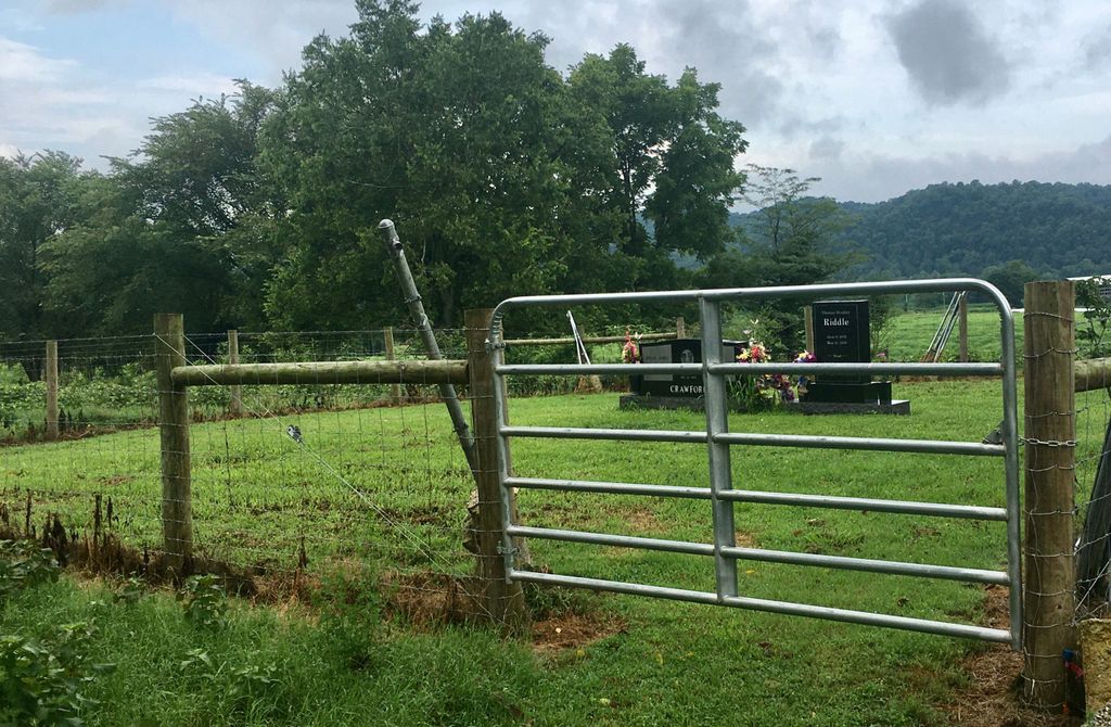
| Description | : | This cemetery is located on the farm owned by James and Betty Crawford at 750 Lower Ford Road, Celina, TN 38551 in the Neely Creek community. |
frequently asked questions (FAQ):
-
Where is Crawford Cemetery?
Crawford Cemetery is located at Celina, Clay County ,Tennessee ,USA.
-
Crawford Cemetery cemetery's updated grave count on graveviews.com?
3 memorials
-
Where are the coordinates of the Crawford Cemetery?
Latitude: 36.5979660
Longitude: -85.4976660
Nearby Cemetories:
1. Edens-Smith Cemetery
Clay County, USA
Coordinate: 36.5979390, -85.4976300
2. Thompson Cemetery
Clay County, USA
Coordinate: 36.6123700, -85.4666600
3. Stone Cemetery
Clay County, USA
Coordinate: 36.5713997, -85.5136032
4. Grover Rich Cemetery
Pea Ridge, Clay County, USA
Coordinate: 36.5946370, -85.4602970
5. Ray Williams Cemetery
Pea Ridge, Clay County, USA
Coordinate: 36.5856130, -85.4598120
6. Free Hill Cemetery
Clay County, USA
Coordinate: 36.5628014, -85.4955978
7. Page Family Cemetery
Free Hill, Clay County, USA
Coordinate: 36.5623018, -85.4844294
8. Plumlee Cemetery
Celina, Clay County, USA
Coordinate: 36.5694280, -85.5282830
9. Key Cemetery
Pea Ridge, Clay County, USA
Coordinate: 36.5875015, -85.4518967
10. Stephens Cemetery
Monroe County, USA
Coordinate: 36.6314011, -85.5252991
11. Varney Andrews Cemetery
Celina, Clay County, USA
Coordinate: 36.5604650, -85.5209530
12. Short's Chapel Cemetery
Monroe County, USA
Coordinate: 36.6281013, -85.4589005
13. Sims Cemetery
Vernon, Monroe County, USA
Coordinate: 36.6413147, -85.4999328
14. Donaldson Cemetery
Pea Ridge, Clay County, USA
Coordinate: 36.5952988, -85.4424973
15. Bowe Cemetery
Pea Ridge, Clay County, USA
Coordinate: 36.5833015, -85.4439011
16. Fitzgerald Cemetery
Celina, Clay County, USA
Coordinate: 36.5518990, -85.4966965
17. Hamilton Cemetery
Celina, Clay County, USA
Coordinate: 36.5517271, -85.4970509
18. Walker Reecer Cemetery
Celina, Clay County, USA
Coordinate: 36.5746290, -85.5480270
19. Old Fitzgerald Cemetery
Celina, Clay County, USA
Coordinate: 36.5509750, -85.4958417
20. Tinsley Cemetery
Cave Springs, Clay County, USA
Coordinate: 36.5527992, -85.4800034
21. Green Cemetery
Celina, Clay County, USA
Coordinate: 36.5496418, -85.5024450
22. Hattie's Houses Cemetery
Pea Ridge, Clay County, USA
Coordinate: 36.6159200, -85.4360040
23. Mullins - Kerr Cemetery
Pea Ridge, Clay County, USA
Coordinate: 36.5951330, -85.4317470
24. New Hope Cemetery
Clay County, USA
Coordinate: 36.6021996, -85.5653000