
| Memorials | : | 0 |
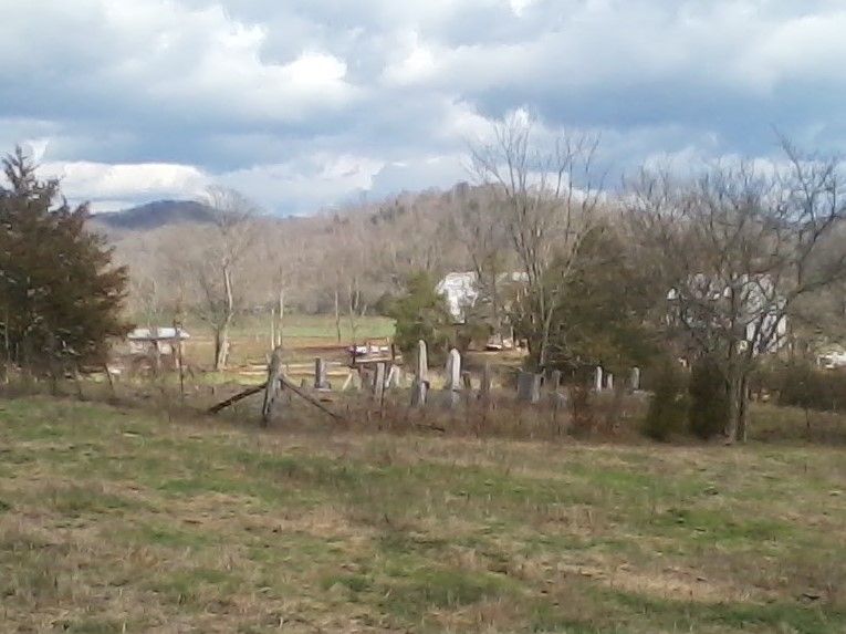
| Location | : | Vernon, Monroe County, USA |
| Coordinate | : | 36.6413147, -85.4999328 |
frequently asked questions (FAQ):
-
Where is Sims Cemetery?
Sims Cemetery is located at Vernon, Monroe County ,Kentucky ,USA.
-
Sims Cemetery cemetery's updated grave count on graveviews.com?
0 memorials
-
Where are the coordinates of the Sims Cemetery?
Latitude: 36.6413147
Longitude: -85.4999328
Nearby Cemetories:
1. Stephens Cemetery
Monroe County, USA
Coordinate: 36.6314011, -85.5252991
2. Jones Cemetery
Coe, Monroe County, USA
Coordinate: 36.6641998, -85.4955978
3. Short's Chapel Cemetery
Monroe County, USA
Coordinate: 36.6281013, -85.4589005
4. Thompson Cemetery
Clay County, USA
Coordinate: 36.6123700, -85.4666600
5. Long Cemetery #2
Judio, Cumberland County, USA
Coordinate: 36.6622009, -85.4582977
6. Crawford Cemetery
Celina, Clay County, USA
Coordinate: 36.5979660, -85.4976660
7. Edens-Smith Cemetery
Clay County, USA
Coordinate: 36.5979390, -85.4976300
8. Coe Ridge Cemetery
Cumberland County, USA
Coordinate: 36.6746510, -85.4622650
9. Ball Cemetery
Monroe County, USA
Coordinate: 36.6871000, -85.5162000
10. Dodson Cemetery
Judio, Cumberland County, USA
Coordinate: 36.6925460, -85.4892410
11. Lollar Cemetery
Cumberland County, USA
Coordinate: 36.6947100, -85.4817700
12. Grover Rich Cemetery
Pea Ridge, Clay County, USA
Coordinate: 36.5946370, -85.4602970
13. Hattie's Houses Cemetery
Pea Ridge, Clay County, USA
Coordinate: 36.6159200, -85.4360040
14. Killman Cemetery
Ashlock, Cumberland County, USA
Coordinate: 36.6325850, -85.4256430
15. Ashlock Cemetery
Ashlock, Cumberland County, USA
Coordinate: 36.6208380, -85.4283620
16. Judio-Murley Cemetery
Cumberland County, USA
Coordinate: 36.6990110, -85.4746970
17. Center Point Cemetery
Meshack, Monroe County, USA
Coordinate: 36.7016000, -85.5184000
18. Smith Cemetery
Monroe County, USA
Coordinate: 36.6439881, -85.4203414
19. Ray Williams Cemetery
Pea Ridge, Clay County, USA
Coordinate: 36.5856130, -85.4598120
20. Donaldson Cemetery
Pea Ridge, Clay County, USA
Coordinate: 36.5952988, -85.4424973
21. New Hope Cemetery
Clay County, USA
Coordinate: 36.6021996, -85.5653000
22. Key Cemetery
Pea Ridge, Clay County, USA
Coordinate: 36.5875015, -85.4518967
23. Stone Cemetery
Clay County, USA
Coordinate: 36.5713997, -85.5136032
24. Mullins - Kerr Cemetery
Pea Ridge, Clay County, USA
Coordinate: 36.5951330, -85.4317470