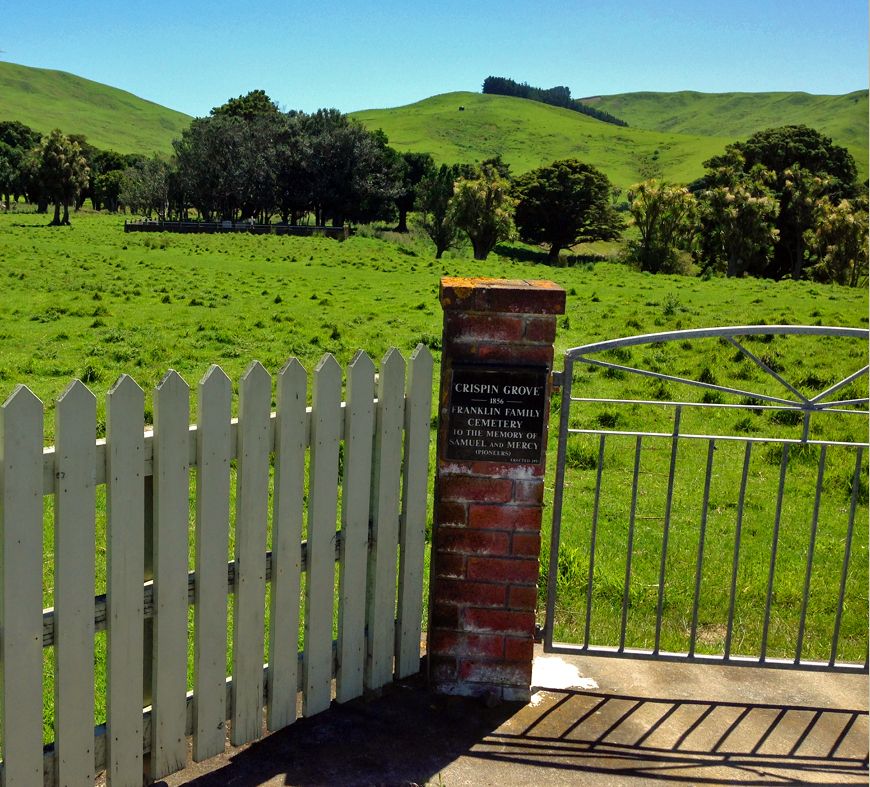
| Memorials | : | 0 |
| Location | : | Herbertville, Tararua District, New Zealand |
| Coordinate | : | -40.4650000, 176.5550000 |
| Description | : | This is a private family cemetery for the Franklin family located on 'Crispin Grove' Property, at 595 Herbertville Road, Herbertville on land that was owned by Mr William Speedy. It is 67 km east of Dannevirke Waipawa District, Hawke’s Bay. Headstones were transcribed on the 20 Oct 1989 by Anne Cross. Researchers are referred to 'Early Stations of Hawkes Bay' by Miriam MacGregor published 1970 for the history of this Station. |
frequently asked questions (FAQ):
-
Where is Crispin Grove Cemetery?
Crispin Grove Cemetery is located at 595 Herbertville Road Herbertville, Tararua District ,Manawatū-Whanganui ,New Zealand.
-
Crispin Grove Cemetery cemetery's updated grave count on graveviews.com?
0 memorials
-
Where are the coordinates of the Crispin Grove Cemetery?
Latitude: -40.4650000
Longitude: 176.5550000
Nearby Cemetories:
1. Wainui Cemetery
Herbertville, Tararua District, New Zealand
Coordinate: -40.5066410, 176.5331160
2. Pokakanui Urupā
Porangahau, Central Hawke's Bay District, New Zealand
Coordinate: -40.3190660, 176.5985750
3. Akitio Station Cemetery
Akitio, Tararua District, New Zealand
Coordinate: -40.5936554, 176.4251922
4. Waipuna Urupā
Porangahau, Central Hawke's Bay District, New Zealand
Coordinate: -40.3104480, 176.6227650
5. Kaiwhitikitiki Urupā
Porangahau, Central Hawke's Bay District, New Zealand
Coordinate: -40.3064010, 176.6087780
6. St Michael & All Angel's Anglican Church Cemetery
Porangahau, Central Hawke's Bay District, New Zealand
Coordinate: -40.3022980, 176.6154250
7. Weber Cemetery
Dannevirke, Tararua District, New Zealand
Coordinate: -40.4011600, 176.3112550
8. Owananga Station Cemetery
Pongaroa, Tararua District, New Zealand
Coordinate: -40.6692650, 176.3413350
9. Pongaroa cemetery
Pahiatua, Tararua District, New Zealand
Coordinate: -40.5448890, 176.1975300
10. Ormondville Cemetery
Ormondville, Tararua District, New Zealand
Coordinate: -40.1036470, 176.2605290
11. Kumeroa Cemetery
Kumeroa, Tararua District, New Zealand
Coordinate: -40.3294480, 176.0238960
12. Settlers Cemetery
Dannevirke, Tararua District, New Zealand
Coordinate: -40.2046600, 176.1107900
13. Mangatera Cemetery
Dannevirke, Tararua District, New Zealand
Coordinate: -40.1883520, 176.1180990
14. Pourerere Station Cemetery
Pourerere, Central Hawke's Bay District, New Zealand
Coordinate: -40.0955450, 176.8649650
15. Southern Star Abbey Cemetery
Takapau, Central Hawke's Bay District, New Zealand
Coordinate: -40.0808560, 176.2766900
16. Tahoraiti Urupā
Dannevirke, Tararua District, New Zealand
Coordinate: -40.2428680, 176.0574580
17. Matamau Cemetery
Matamau, Tararua District, New Zealand
Coordinate: -40.1483730, 176.1531760
18. Waipukurau Cemetery
Waipukurau, Central Hawke's Bay District, New Zealand
Coordinate: -40.0070560, 176.5484260
19. Kahukuru Cemetery
Takapau, Central Hawke's Bay District, New Zealand
Coordinate: -40.0348340, 176.3413110
20. Norsewood Cemetery
Norsewood, Tararua District, New Zealand
Coordinate: -40.0676530, 176.2138900
21. Takapau Cemetery
Takapau, Central Hawke's Bay District, New Zealand
Coordinate: -40.0202390, 176.3190200
22. Harding Family Cemetery
Waipukurau, Central Hawke's Bay District, New Zealand
Coordinate: -39.9817240, 176.5448760
23. Mataweka Urupā
Waipawa, Central Hawke's Bay District, New Zealand
Coordinate: -39.9662600, 176.6079600
24. Castlepoint Cemetery
Masterton, Masterton District, New Zealand
Coordinate: -40.8972060, 176.2189360

