
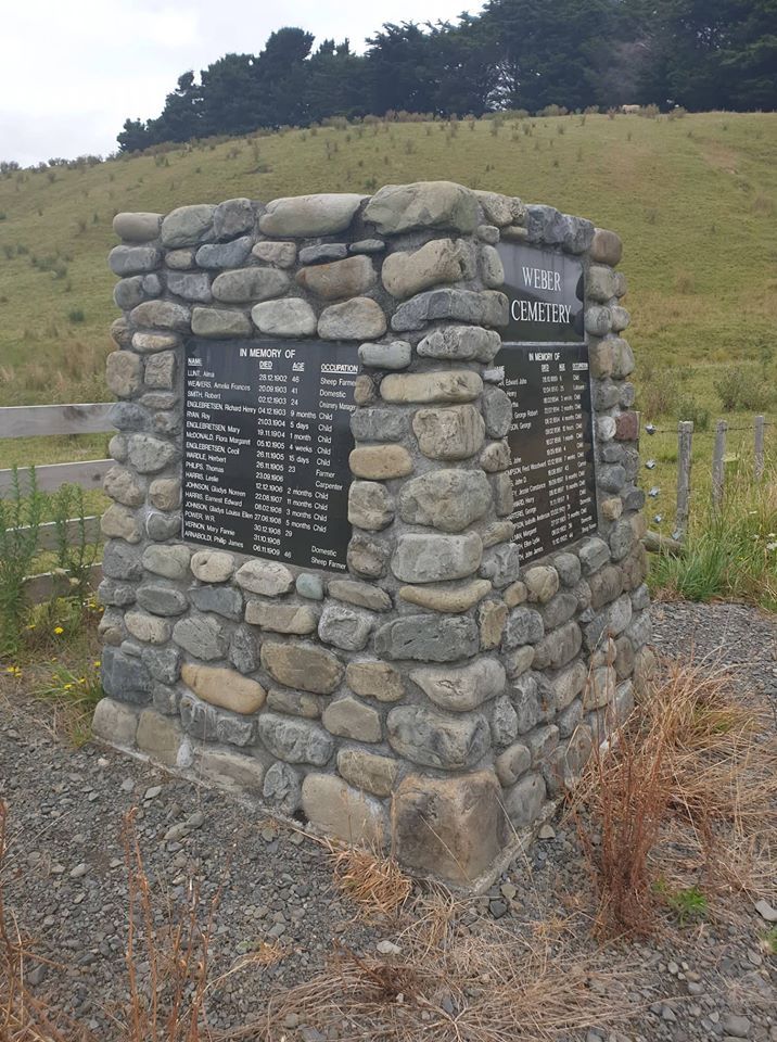
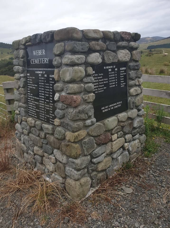
| Memorials | : | 2 |
| Location | : | Dannevirke, Tararua District, New Zealand |
| Coordinate | : | -40.4011600, 176.3112550 |
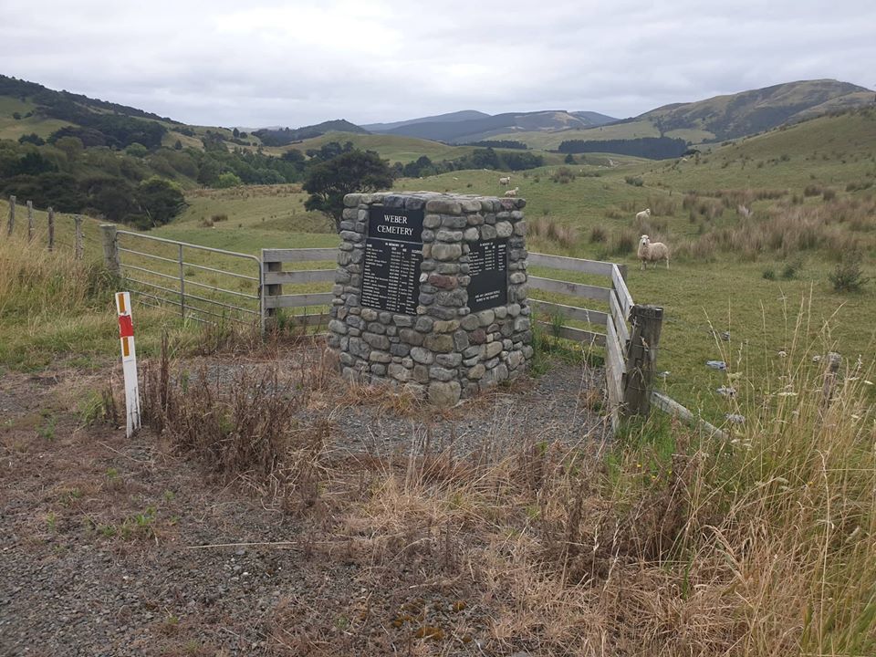
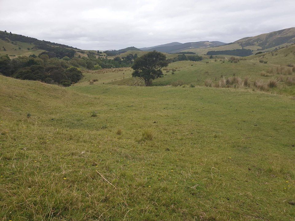
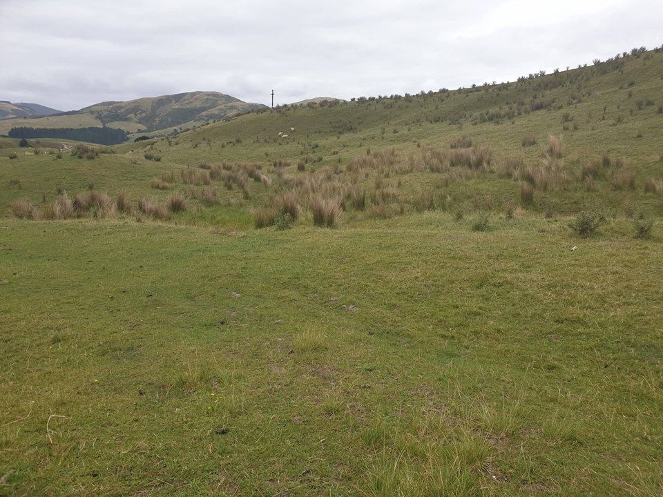
| Description | : | Weber is situated 62km east of Woodville via Dannevirke, Mangatoro and Waipatiki It was founded in the late 19th century as an overnight stop for coach teams on the journey to and from the coast. This was the distance a team of 6 horses and a coach could travel in one day. At the turn of the century it was a thriving small community. It had a police station and one cell jail, a large hotel, shops and a post office. Today (2009) it consists of a church, a school, a pub, a rural fire depot, a community centre and several houses Of... Read More |
frequently asked questions (FAQ):
-
Where is Weber Cemetery?
Weber Cemetery is located at Dannevirke, Tararua District ,Manawatū-Whanganui ,New Zealand.
-
Weber Cemetery cemetery's updated grave count on graveviews.com?
2 memorials
-
Where are the coordinates of the Weber Cemetery?
Latitude: -40.4011600
Longitude: 176.3112550
Nearby Cemetories:
1. Pongaroa cemetery
Pahiatua, Tararua District, New Zealand
Coordinate: -40.5448890, 176.1975300
2. Crispin Grove Cemetery
Herbertville, Tararua District, New Zealand
Coordinate: -40.4650000, 176.5550000
3. Wainui Cemetery
Herbertville, Tararua District, New Zealand
Coordinate: -40.5066410, 176.5331160
4. Akitio Station Cemetery
Akitio, Tararua District, New Zealand
Coordinate: -40.5936554, 176.4251922
5. Kumeroa Cemetery
Kumeroa, Tararua District, New Zealand
Coordinate: -40.3294480, 176.0238960
6. Pokakanui Urupā
Porangahau, Central Hawke's Bay District, New Zealand
Coordinate: -40.3190660, 176.5985750
7. Kaiwhitikitiki Urupā
Porangahau, Central Hawke's Bay District, New Zealand
Coordinate: -40.3064010, 176.6087780
8. Settlers Cemetery
Dannevirke, Tararua District, New Zealand
Coordinate: -40.2046600, 176.1107900
9. Tahoraiti Urupā
Dannevirke, Tararua District, New Zealand
Coordinate: -40.2428680, 176.0574580
10. St Michael & All Angel's Anglican Church Cemetery
Porangahau, Central Hawke's Bay District, New Zealand
Coordinate: -40.3022980, 176.6154250
11. Waipuna Urupā
Porangahau, Central Hawke's Bay District, New Zealand
Coordinate: -40.3104480, 176.6227650
12. Mangatera Cemetery
Dannevirke, Tararua District, New Zealand
Coordinate: -40.1883520, 176.1180990
13. Owananga Station Cemetery
Pongaroa, Tararua District, New Zealand
Coordinate: -40.6692650, 176.3413350
14. Matamau Cemetery
Matamau, Tararua District, New Zealand
Coordinate: -40.1483730, 176.1531760
15. Ormondville Cemetery
Ormondville, Tararua District, New Zealand
Coordinate: -40.1036470, 176.2605290
16. Southern Star Abbey Cemetery
Takapau, Central Hawke's Bay District, New Zealand
Coordinate: -40.0808560, 176.2766900
17. Lawn Woodville Cemetery
Woodville, Tararua District, New Zealand
Coordinate: -40.3390540, 175.8807710
18. Kaitawa Cemetery
Kaitawa, Tararua District, New Zealand
Coordinate: -40.4939310, 175.8824710
19. Norsewood Cemetery
Norsewood, Tararua District, New Zealand
Coordinate: -40.0676530, 176.2138900
20. Mangatainoka Cemetery
Pahiatua, Tararua District, New Zealand
Coordinate: -40.4250620, 175.8597850
21. Kahukuru Cemetery
Takapau, Central Hawke's Bay District, New Zealand
Coordinate: -40.0348340, 176.3413110
22. RSA Woodville Cemetery
Woodville, Tararua District, New Zealand
Coordinate: -40.3362310, 175.8345210
23. Old Gorge Cemetery
Woodville, Tararua District, New Zealand
Coordinate: -40.3361206, 175.8332520
24. Takapau Cemetery
Takapau, Central Hawke's Bay District, New Zealand
Coordinate: -40.0202390, 176.3190200