
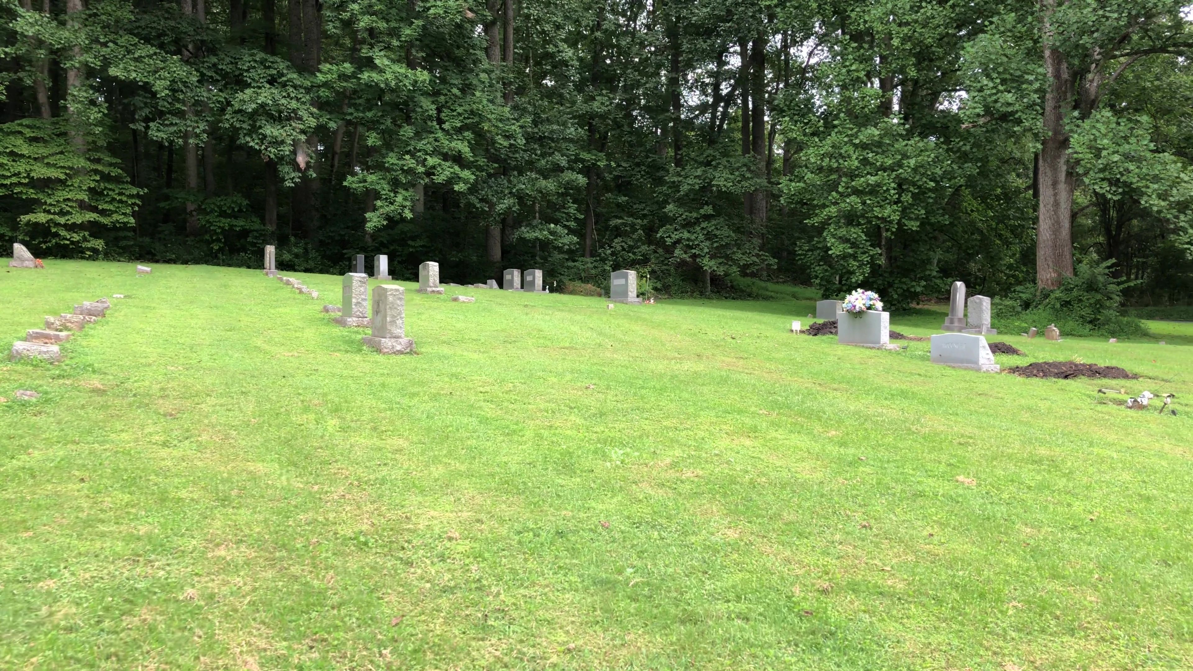
| Memorials | : | 24 |
| Location | : | Rapidan, Culpeper County, USA |
| Phone | : | (540) 672-2700 |
| Coordinate | : | 38.3629140, -78.1073150 |
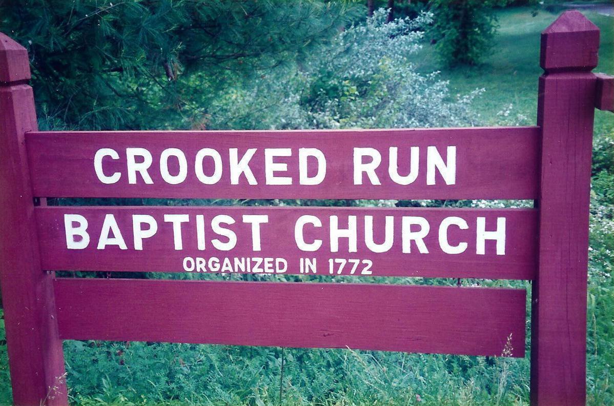
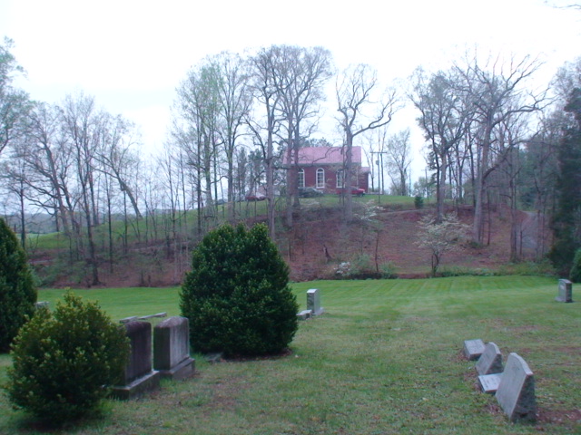
| Description | : | Crooked Run Baptist Church was organized in 1772 and is named for the stream that flows nearby. James Garnett Sr., one of the early pastors, served the congregation from 1774 until close to his death in 1830. Another member, Thomas Ammon, became a minister and was imprisoned in the Culpeper jail for preaching in the late 1700s. The first meeting of the Orange Baptist Association occurred here in 1789. At first the members met in a meeting house, but by 1856 they had built a brick structure. This church was destroyed by a fire in... Read More |
frequently asked questions (FAQ):
-
Where is Crooked Run Baptist Church Cemetery?
Crooked Run Baptist Church Cemetery is located at 7351 N James Madison Highway (Rt. 15) Rapidan, Culpeper County ,Virginia , 22733USA.
-
Crooked Run Baptist Church Cemetery cemetery's updated grave count on graveviews.com?
24 memorials
-
Where are the coordinates of the Crooked Run Baptist Church Cemetery?
Latitude: 38.3629140
Longitude: -78.1073150


Nearby Cemetories:
1. White Oak Run Baptist Church Cemetery
Rapidan, Culpeper County, USA
Coordinate: 38.3652800, -78.1062600
2. Locust Dale Cemetery
Locust Dale, Madison County, USA
Coordinate: 38.3451140, -78.1237920
3. Ford-Aylor Cemetery
Madison County, USA
Coordinate: 38.4006320, -78.1141300
4. Ford Family Cemetery
Leon, Madison County, USA
Coordinate: 38.4032920, -78.1154440
5. Thoroughfare Community Chapel Cemetery
Madison County, USA
Coordinate: 38.4047012, -78.1391983
6. All Saints Cemetery
Rapidan, Culpeper County, USA
Coordinate: 38.3852997, -78.0516968
7. Beahm Family Cemetery
Oakpark, Madison County, USA
Coordinate: 38.3919400, -78.1580600
8. Mount Zion United Methodist Church Cemetery
Oakpark, Madison County, USA
Coordinate: 38.3643700, -78.1704300
9. Lay Family Cemetery
Rapidan, Culpeper County, USA
Coordinate: 38.3276270, -78.0630130
10. Mount Zion Baptist Church Cemetery
Oakpark, Madison County, USA
Coordinate: 38.3676610, -78.1710340
11. Cedar Grove Baptist Church Cemetery
Buena, Culpeper County, USA
Coordinate: 38.3412960, -78.0481880
12. Cedar Mountain Battlefield Cemetery #2
Rapidan, Culpeper County, USA
Coordinate: 38.4055767, -78.0705520
13. Cedar Mountain Battlefield Cemetery #3
Rapidan, Culpeper County, USA
Coordinate: 38.4057550, -78.0689182
14. Rose Hill Cemetery
Orange County, USA
Coordinate: 38.3126370, -78.0764850
15. Strother Cemetery
Waylands Mill, Culpeper County, USA
Coordinate: 38.4202900, -78.0971100
16. Pilgrim Cemetery
Mitchells, Culpeper County, USA
Coordinate: 38.3800011, -78.0355988
17. Bethel Baptist Church Cemetery
Mitchells, Culpeper County, USA
Coordinate: 38.3774130, -78.0307330
18. Bushong-Hawkins Cemetery
Culpeper County, USA
Coordinate: 38.4230620, -78.0855050
19. Waddell Memorial Presbyterian Church Cemetery
Rapidan, Culpeper County, USA
Coordinate: 38.3083300, -78.0627000
20. Mount Pisgah Baptist Church Cemetery
Tanners, Madison County, USA
Coordinate: 38.3072900, -78.1519200
21. Emmanuel Cemetery
Orange County, USA
Coordinate: 38.3072014, -78.0597000
22. Mitchells Presbyterian Church Cemetery
Mitchells, Culpeper County, USA
Coordinate: 38.3797200, -78.0244900
23. Cedar Run Cemetery
Culpeper, Culpeper County, USA
Coordinate: 38.4126570, -78.0484330
24. Woodberry Forest School Columbarium
Five Forks, Madison County, USA
Coordinate: 38.2909930, -78.1229230