
| Memorials | : | 37 |
| Location | : | Rapidan, Culpeper County, USA |
| Coordinate | : | 38.3652800, -78.1062600 |
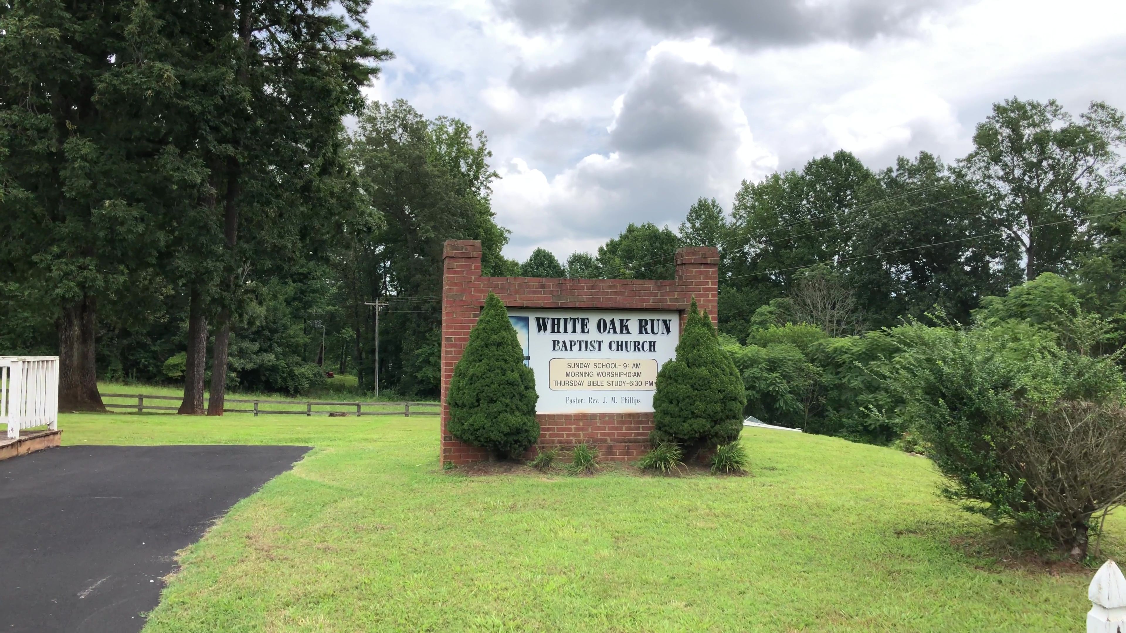
| Description | : | Small cemetery to the right of the church on White Oak Road just off of N. James Madison Highway. |
frequently asked questions (FAQ):
-
Where is White Oak Run Baptist Church Cemetery?
White Oak Run Baptist Church Cemetery is located at 7412 White Oak Rd Rapidan, Culpeper County ,Virginia , 22733USA.
-
White Oak Run Baptist Church Cemetery cemetery's updated grave count on graveviews.com?
37 memorials
-
Where are the coordinates of the White Oak Run Baptist Church Cemetery?
Latitude: 38.3652800
Longitude: -78.1062600


Nearby Cemetories:
1. Crooked Run Baptist Church Cemetery
Rapidan, Culpeper County, USA
Coordinate: 38.3629140, -78.1073150
2. Locust Dale Cemetery
Locust Dale, Madison County, USA
Coordinate: 38.3451140, -78.1237920
3. Ford-Aylor Cemetery
Madison County, USA
Coordinate: 38.4006320, -78.1141300
4. Ford Family Cemetery
Leon, Madison County, USA
Coordinate: 38.4032920, -78.1154440
5. Thoroughfare Community Chapel Cemetery
Madison County, USA
Coordinate: 38.4047012, -78.1391983
6. All Saints Cemetery
Rapidan, Culpeper County, USA
Coordinate: 38.3852997, -78.0516968
7. Beahm Family Cemetery
Oakpark, Madison County, USA
Coordinate: 38.3919400, -78.1580600
8. Cedar Mountain Battlefield Cemetery #2
Rapidan, Culpeper County, USA
Coordinate: 38.4055767, -78.0705520
9. Cedar Mountain Battlefield Cemetery #3
Rapidan, Culpeper County, USA
Coordinate: 38.4057550, -78.0689182
10. Mount Zion United Methodist Church Cemetery
Oakpark, Madison County, USA
Coordinate: 38.3643700, -78.1704300
11. Lay Family Cemetery
Rapidan, Culpeper County, USA
Coordinate: 38.3276270, -78.0630130
12. Mount Zion Baptist Church Cemetery
Oakpark, Madison County, USA
Coordinate: 38.3676610, -78.1710340
13. Cedar Grove Baptist Church Cemetery
Buena, Culpeper County, USA
Coordinate: 38.3412960, -78.0481880
14. Strother Cemetery
Waylands Mill, Culpeper County, USA
Coordinate: 38.4202900, -78.0971100
15. Pilgrim Cemetery
Mitchells, Culpeper County, USA
Coordinate: 38.3800011, -78.0355988
16. Rose Hill Cemetery
Orange County, USA
Coordinate: 38.3126370, -78.0764850
17. Bushong-Hawkins Cemetery
Culpeper County, USA
Coordinate: 38.4230620, -78.0855050
18. Bethel Baptist Church Cemetery
Mitchells, Culpeper County, USA
Coordinate: 38.3774130, -78.0307330
19. Cedar Run Cemetery
Culpeper, Culpeper County, USA
Coordinate: 38.4126570, -78.0484330
20. Mitchells Presbyterian Church Cemetery
Mitchells, Culpeper County, USA
Coordinate: 38.3797200, -78.0244900
21. Waddell Memorial Presbyterian Church Cemetery
Rapidan, Culpeper County, USA
Coordinate: 38.3083300, -78.0627000
22. Mount Pisgah Baptist Church Cemetery
Tanners, Madison County, USA
Coordinate: 38.3072900, -78.1519200
23. Emmanuel Cemetery
Orange County, USA
Coordinate: 38.3072014, -78.0597000
24. Woodberry Forest School Columbarium
Five Forks, Madison County, USA
Coordinate: 38.2909930, -78.1229230