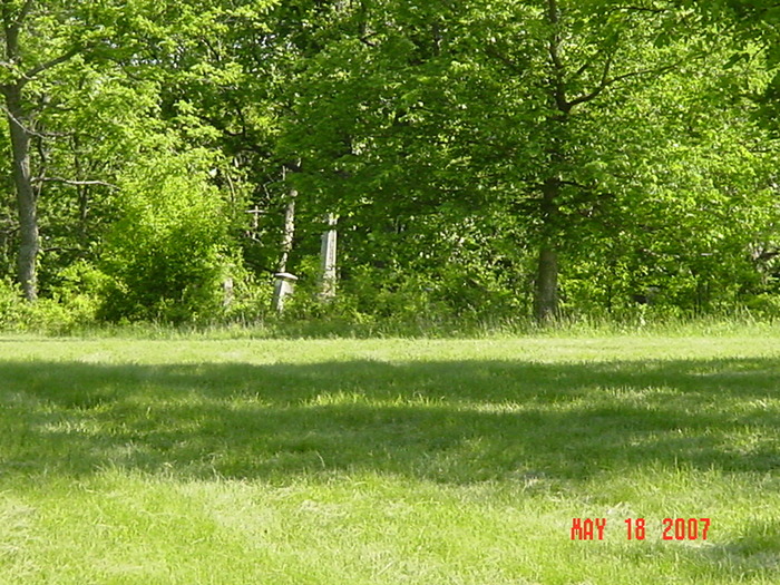
| Memorials | : | 0 |
| Location | : | Vibbard, Ray County, USA |
| Coordinate | : | 39.3807793, -94.1616745 |
| Description | : | From Excelsior Springs, MO go east on 10 Hwy to Wood Heights; take M Highway north to Vibbard. Turn west (160th Street) at crossroad, turn at first right and then left again. Go on road CA 1/2 to 3/4 miles to first road (Fishing River Road). Turn left. Go to first driveway left (about 100 feet). Go to top of hill. Cemetery is on the left (north) side of the drive. A small cemetery north of other one, is fenced by itself. This may be the negro part. WATCH FOR RATTLESNAKES! |
frequently asked questions (FAQ):
-
Where is Crowley Cemetery?
Crowley Cemetery is located at Vibbard, Ray County ,Missouri ,USA.
-
Crowley Cemetery cemetery's updated grave count on graveviews.com?
0 memorials
-
Where are the coordinates of the Crowley Cemetery?
Latitude: 39.3807793
Longitude: -94.1616745
Nearby Cemetories:
1. Clevenger Cemetery
Crystal Lakes, Ray County, USA
Coordinate: 39.3600006, -94.1560974
2. John Cleavenger Cemetery
Crystal Lakes, Ray County, USA
Coordinate: 39.3551407, -94.1542053
3. John Clevenger Cemetery
Crystal Lakes, Ray County, USA
Coordinate: 39.3551300, -94.1540600
4. Hamers Farm Cemetery
Ray County, USA
Coordinate: 39.3560400, -94.1762900
5. Windy Hill Cemetery
Wood Heights, Ray County, USA
Coordinate: 39.3407364, -94.1462250
6. Salem Christian Union Church Cemetery
Excelsior Springs, Clay County, USA
Coordinate: 39.3766708, -94.2157745
7. Pisgah Cemetery
Wood Heights, Ray County, USA
Coordinate: 39.3376846, -94.1775055
8. Cox Cemetery
Wood Heights, Ray County, USA
Coordinate: 39.3368988, -94.1819000
9. Old Union Cemetery
Lawson, Ray County, USA
Coordinate: 39.4166756, -94.1221619
10. Atkins Cemetery
Lawson, Ray County, USA
Coordinate: 39.4055595, -94.1063156
11. North New Garden Primitive Baptist Church Cemetery
Wood Heights, Ray County, USA
Coordinate: 39.3271027, -94.1648026
12. Bower Cemetery
Knoxville, Ray County, USA
Coordinate: 39.4095383, -94.0997009
13. Old New Garden Primitive Baptist Cemetery
Wood Heights, Ray County, USA
Coordinate: 39.3227005, -94.1669006
14. Lawson Cemetery
Lawson, Ray County, USA
Coordinate: 39.4368248, -94.1954880
15. Joiner Family Cemetery
Knoxville, Ray County, USA
Coordinate: 39.3880100, -94.0820200
16. McGaugh Cemetery
Rayville, Ray County, USA
Coordinate: 39.3608017, -94.0849991
17. Gant Cemetery
Rayville, Ray County, USA
Coordinate: 39.3548393, -94.0880280
18. Hollingsworth Family Cemetery
Excelsior Springs, Clay County, USA
Coordinate: 39.4293940, -94.2230050
19. Majors Family Cemetery
Excelsior Springs, Clay County, USA
Coordinate: 39.4042358, -94.2513657
20. John Jack Crowley Graveyard
Clay County, USA
Coordinate: 39.3659167, -94.2566111
21. Crown Hill Cemetery
Excelsior Springs, Clay County, USA
Coordinate: 39.3446999, -94.2474976
22. Masonic Cemetery
Excelsior Springs, Clay County, USA
Coordinate: 39.3432655, -94.2482910
23. Hyder Cemetery
Lawson, Ray County, USA
Coordinate: 39.4557200, -94.1314500
24. Pleasant View Cemetery
Lawson, Ray County, USA
Coordinate: 39.4590263, -94.1513290


