
| Memorials | : | 0 |
| Location | : | Crystal Lakes, Ray County, USA |
| Coordinate | : | 39.3551407, -94.1542053 |
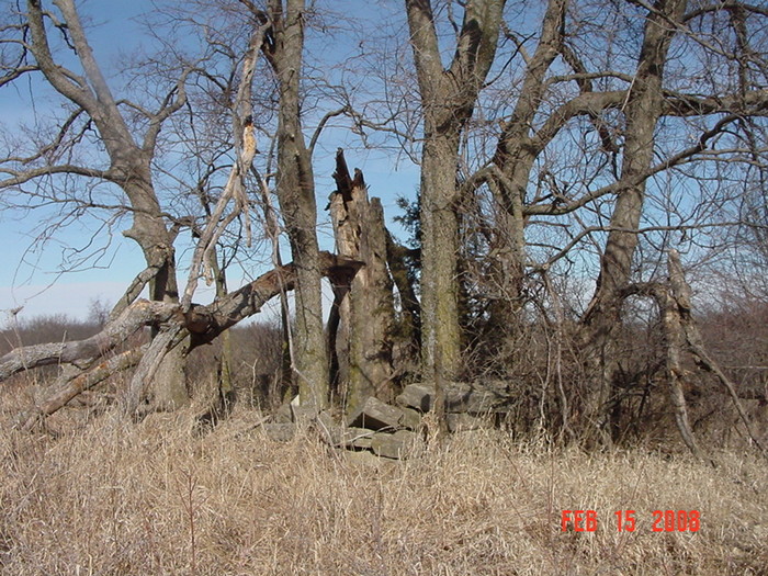
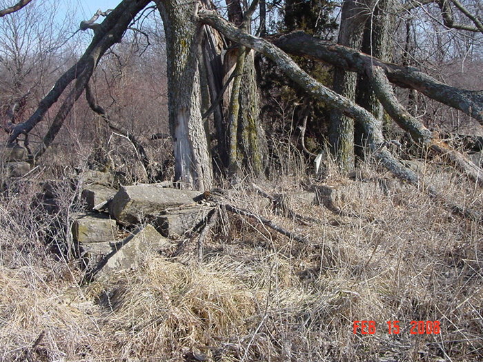
| Description | : | Cemetery is located on private property on formerly the John Cleavenger farm. Located south of the Samuel Clevenger Cemetery. Gravesite is surrounded by a rock wall that has deteriorated. Trees have grown up inside the rock wall. |
frequently asked questions (FAQ):
-
Where is John Cleavenger Cemetery?
John Cleavenger Cemetery is located at Crystal Lakes, Ray County ,Missouri ,USA.
-
John Cleavenger Cemetery cemetery's updated grave count on graveviews.com?
0 memorials
-
Where are the coordinates of the John Cleavenger Cemetery?
Latitude: 39.3551407
Longitude: -94.1542053
Nearby Cemetories:
1. John Clevenger Cemetery
Crystal Lakes, Ray County, USA
Coordinate: 39.3551300, -94.1540600
2. Clevenger Cemetery
Crystal Lakes, Ray County, USA
Coordinate: 39.3600006, -94.1560974
3. Windy Hill Cemetery
Wood Heights, Ray County, USA
Coordinate: 39.3407364, -94.1462250
4. Hamers Farm Cemetery
Ray County, USA
Coordinate: 39.3560400, -94.1762900
5. Pisgah Cemetery
Wood Heights, Ray County, USA
Coordinate: 39.3376846, -94.1775055
6. Crowley Cemetery
Vibbard, Ray County, USA
Coordinate: 39.3807793, -94.1616745
7. Cox Cemetery
Wood Heights, Ray County, USA
Coordinate: 39.3368988, -94.1819000
8. North New Garden Primitive Baptist Church Cemetery
Wood Heights, Ray County, USA
Coordinate: 39.3271027, -94.1648026
9. Old New Garden Primitive Baptist Cemetery
Wood Heights, Ray County, USA
Coordinate: 39.3227005, -94.1669006
10. Gant Cemetery
Rayville, Ray County, USA
Coordinate: 39.3548393, -94.0880280
11. Salem Christian Union Church Cemetery
Excelsior Springs, Clay County, USA
Coordinate: 39.3766708, -94.2157745
12. McGaugh Cemetery
Rayville, Ray County, USA
Coordinate: 39.3608017, -94.0849991
13. Cravens Headstone
Ray County, USA
Coordinate: 39.3134300, -94.1080300
14. O'Dell Cemetery
Excelsior Springs, Ray County, USA
Coordinate: 39.2995987, -94.1346970
15. Hamilton Cemetery
Ray County, USA
Coordinate: 39.3107986, -94.1007996
16. Atkins Cemetery
Lawson, Ray County, USA
Coordinate: 39.4055595, -94.1063156
17. Joiner Family Cemetery
Knoxville, Ray County, USA
Coordinate: 39.3880100, -94.0820200
18. Old Union Cemetery
Lawson, Ray County, USA
Coordinate: 39.4166756, -94.1221619
19. Sanderson Cemetery
Rayville, Ray County, USA
Coordinate: 39.3333015, -94.0699997
20. Bower Cemetery
Knoxville, Ray County, USA
Coordinate: 39.4095383, -94.0997009
21. Siegel Cemetery
Excelsior Springs, Ray County, USA
Coordinate: 39.2943993, -94.1977997
22. Rock Falls Church Cemetery
Elkhorn, Ray County, USA
Coordinate: 39.2893500, -94.1221800
23. Crown Hill Cemetery
Excelsior Springs, Clay County, USA
Coordinate: 39.3446999, -94.2474976
24. Masonic Cemetery
Excelsior Springs, Clay County, USA
Coordinate: 39.3432655, -94.2482910