
| Memorials | : | 10 |
| Location | : | Hemple, Clinton County, USA |
| Coordinate | : | 39.7432518, -94.5774612 |
| Description | : | Go west from the town of Hemple on 348 Road to Bower Road. Turn right, go one mile to 356 Road. Turn left and go .3 mile to Kerns Road. The Cemetery is a short distance on Kerns Road. |
frequently asked questions (FAQ):
-
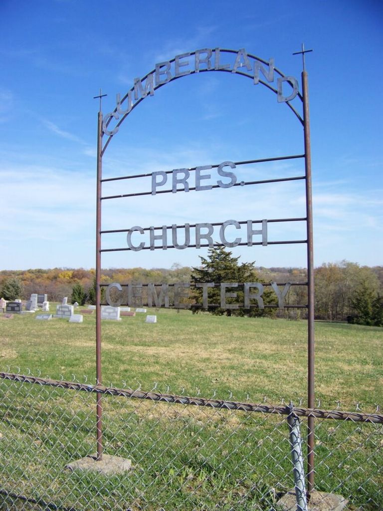
Where is Cumberland Presbyterian Church Cemetery?
Cumberland Presbyterian Church Cemetery is located at Kerns Road Hemple, Clinton County ,Missouri ,USA.
-
Cumberland Presbyterian Church Cemetery cemetery's updated grave count on graveviews.com?
10 memorials
-
Where are the coordinates of the Cumberland Presbyterian Church Cemetery?
Latitude: 39.7432518
Longitude: -94.5774612
Nearby Cemetories:
1. Kerns-Freeman Cemetery
Easton, Buchanan County, USA
Coordinate: 39.7411919, -94.6044006
2. Todd Cemetery
Clarksdale, DeKalb County, USA
Coordinate: 39.7752991, -94.5774994
3. Antle Cemetery
Buchanan County, USA
Coordinate: 39.7576450, -94.6181790
4. Thornton Cemetery
Clarksdale, DeKalb County, USA
Coordinate: 39.7846985, -94.5978012
5. Saint Joseph Cemetery Old
Easton, Buchanan County, USA
Coordinate: 39.7372017, -94.6363983
6. Saint Josephs Cemetery
Easton, Buchanan County, USA
Coordinate: 39.7291985, -94.6406021
7. Keller Cemetery
Hemple, Clinton County, USA
Coordinate: 39.6869011, -94.5428009
8. Moxley Cemetery
Easton, Buchanan County, USA
Coordinate: 39.7164001, -94.6532974
9. Stewartsville Cemetery
Stewartsville, DeKalb County, USA
Coordinate: 39.7480011, -94.4920578
10. DeKalb Cemetery
Stewartsville, DeKalb County, USA
Coordinate: 39.7839012, -94.5089035
11. Saint Marys Cemetery
Hurlingen, Buchanan County, USA
Coordinate: 39.7971992, -94.6303024
12. Bowen Cemetery
Boyers Settlement, Buchanan County, USA
Coordinate: 39.7809900, -94.6509900
13. Stone Cemetery
Clarksdale, DeKalb County, USA
Coordinate: 39.8163986, -94.5686035
14. Old School Presbyterian Cemetery
Clinton County, USA
Coordinate: 39.7472000, -94.4792023
15. Silver Cemetery
Clarksdale, DeKalb County, USA
Coordinate: 39.8133011, -94.5335999
16. Clarksdale Cemetery
Clarksdale, DeKalb County, USA
Coordinate: 39.8227997, -94.5697021
17. Minor Cemetery
Buchanan County, USA
Coordinate: 39.7532997, -94.6825027
18. New Harmony Cemetery
Buchanan County, USA
Coordinate: 39.6650009, -94.6074982
19. Lebanon Church Cemetery
Starfield, Clinton County, USA
Coordinate: 39.6816711, -94.4936066
20. Maple Grove Cemetery
Stewartsville, DeKalb County, USA
Coordinate: 39.8060188, -94.4898224
21. Blakely Cemetery
Easton, Buchanan County, USA
Coordinate: 39.7407990, -94.7031021
22. Pleasant Grove Cemetery
Clarksdale, DeKalb County, USA
Coordinate: 39.8208008, -94.5006027
23. Zion United Methodist Cemetery
Cosby, Andrew County, USA
Coordinate: 39.8342600, -94.6541200
24. Courtney Cemetery
Buchanan County, USA
Coordinate: 39.7722015, -94.7136002