
| Memorials | : | 0 |
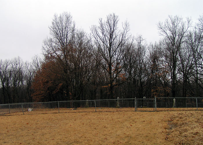
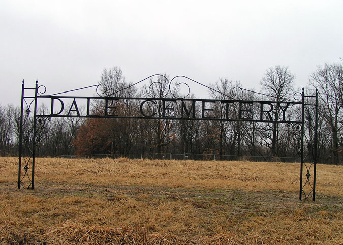
| Location | : | Richmond, Ray County, USA |
| Coordinate | : | 39.3339800, -93.9862900 |
| Description | : | From Highway 13 north of Richmond, turn west onto W. 134th Street. Drive about 6/10 miles; road will turn north and then curve back west. As the road curves back west, the cemetery is on the right (north) side of the road. Cemetery is well maintained. |
frequently asked questions (FAQ):
-
Where is Dale Cemetery?
Dale Cemetery is located at Richmond, Ray County ,Missouri ,USA.
-
Dale Cemetery cemetery's updated grave count on graveviews.com?
0 memorials
-
Where are the coordinates of the Dale Cemetery?
Latitude: 39.3339800
Longitude: -93.9862900
Nearby Cemetories:
1. Cumberland Old Presbyterian Church Cemetery
Richmond, Ray County, USA
Coordinate: 39.3252373, -93.9963837
2. Mount Pleasant Cemetery
Richmond, Ray County, USA
Coordinate: 39.3255997, -93.9972000
3. Boone Cemetery
Richmond, Ray County, USA
Coordinate: 39.3342400, -94.0029300
4. Jacobs Cemetery
Richmond, Ray County, USA
Coordinate: 39.3217010, -94.0064011
5. Johnson Cemetery
Richmond, Ray County, USA
Coordinate: 39.3157997, -93.9630966
6. Absolem McDonald Cemetery
Lawson, Ray County, USA
Coordinate: 39.3610992, -93.9841995
7. Dockery Cemetery
Dockery, Ray County, USA
Coordinate: 39.3612860, -93.9837620
8. Patton Family Cemetery
Richmond, Ray County, USA
Coordinate: 39.3199300, -94.0259400
9. Gunnell Cemetery
Richmond, Ray County, USA
Coordinate: 39.3072014, -93.9569016
10. Ray County Poor Farm Cemetery
Richmond, Ray County, USA
Coordinate: 39.3377110, -93.9391770
11. Moses Dale Cemetery
Richmond, Ray County, USA
Coordinate: 39.2996500, -94.0157800
12. Robert Manley Family Cemetery
Richmond, Ray County, USA
Coordinate: 39.3756900, -93.9969400
13. Major Williams Cemetery
Richmond, Ray County, USA
Coordinate: 39.3153000, -94.0363998
14. Dunn Family Cemetery
Richmond, Ray County, USA
Coordinate: 39.2898500, -93.9816100
15. Oliphant Cemetery
Richmond, Ray County, USA
Coordinate: 39.3573300, -93.9362200
16. Wall Cemetery
Ray County, USA
Coordinate: 39.3671989, -93.9458008
17. Crowley Cemetery
Rayville, Ray County, USA
Coordinate: 39.3410988, -94.0492020
18. Pioneer Cemetery
Richmond, Ray County, USA
Coordinate: 39.2849800, -93.9762200
19. Shotwell Cemetery
Richmond, Ray County, USA
Coordinate: 39.2807999, -93.9850006
20. Woodland Cemetery
Richmond, Ray County, USA
Coordinate: 39.2807999, -93.9835968
21. Hill Cemetery
Richmond, Ray County, USA
Coordinate: 39.2933006, -93.9419022
22. Cates Cemetery
Richmond, Ray County, USA
Coordinate: 39.2832900, -94.0076500
23. Sunny Slope Cemetery
Richmond, Ray County, USA
Coordinate: 39.2803001, -93.9867020
24. Lile Cemetery
Richmond, Ray County, USA
Coordinate: 39.2881700, -93.9477800