
| Memorials | : | 0 |
| Location | : | Richmond, Ray County, USA |
| Coordinate | : | 39.3573300, -93.9362200 |
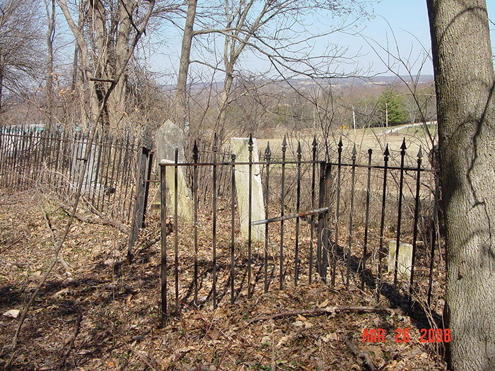
| Description | : | From 13 Highway north of Richmond, turn east onto B Highway. About 1-1/2 miles after B Highway turns northeast begin looking for a blue and white mobile home on the left (west) side of the highway. Approximate address is 14905. Cemetery is located half way up the hill just south of the mobile home. It's difficult to see from the road. It's on private property, and I wasn't able to get very close. Ray County History 1973: p. 232 Cemeteries Not Listed on Map, #5; on route B, across road, J.R. Oliphant farm Ray County Library (big black cemetery binder): located... Read More |
frequently asked questions (FAQ):
-
Where is Oliphant Cemetery?
Oliphant Cemetery is located at Richmond, Ray County ,Missouri ,USA.
-
Oliphant Cemetery cemetery's updated grave count on graveviews.com?
0 memorials
-
Where are the coordinates of the Oliphant Cemetery?
Latitude: 39.3573300
Longitude: -93.9362200
Nearby Cemetories:
1. Wall Cemetery
Ray County, USA
Coordinate: 39.3671989, -93.9458008
2. Ray County Poor Farm Cemetery
Richmond, Ray County, USA
Coordinate: 39.3377110, -93.9391770
3. Bethel Mennonite Church Cemetery
Richmond, Ray County, USA
Coordinate: 39.3936900, -93.9330400
4. Dockery Cemetery
Dockery, Ray County, USA
Coordinate: 39.3612860, -93.9837620
5. Absolem McDonald Cemetery
Lawson, Ray County, USA
Coordinate: 39.3610992, -93.9841995
6. Hickory Grove Cemetery
Richmond, Ray County, USA
Coordinate: 39.3288120, -93.9006293
7. Dale Cemetery
Richmond, Ray County, USA
Coordinate: 39.3339800, -93.9862900
8. Johnson Cemetery
Richmond, Ray County, USA
Coordinate: 39.3157997, -93.9630966
9. Millville Community Cemetery
Millville, Ray County, USA
Coordinate: 39.4041100, -93.9351600
10. Gorham Cemetery
Knoxville, Ray County, USA
Coordinate: 39.4011002, -93.9608002
11. Belt Cemetery
Millville, Ray County, USA
Coordinate: 39.4014100, -93.9613000
12. Robert Manley Family Cemetery
Richmond, Ray County, USA
Coordinate: 39.3756900, -93.9969400
13. Gunnell Cemetery
Richmond, Ray County, USA
Coordinate: 39.3072014, -93.9569016
14. Pugh Cemetery
Richmond, Ray County, USA
Coordinate: 39.3124800, -93.8968700
15. Boone Cemetery
Richmond, Ray County, USA
Coordinate: 39.3342400, -94.0029300
16. Cumberland Old Presbyterian Church Cemetery
Richmond, Ray County, USA
Coordinate: 39.3252373, -93.9963837
17. Mount Pleasant Cemetery
Richmond, Ray County, USA
Coordinate: 39.3255997, -93.9972000
18. Nutter Cemetery
Richmond, Ray County, USA
Coordinate: 39.2966995, -93.9344025
19. Berry Cemetery
Hardin, Ray County, USA
Coordinate: 39.3913800, -93.8710800
20. Van Wall Cemetery
Ray County, USA
Coordinate: 39.4078140, -93.9830627
21. Smith Cemetery
Ray County, USA
Coordinate: 39.4028015, -93.8799973
22. Hill Cemetery
Richmond, Ray County, USA
Coordinate: 39.2933006, -93.9419022
23. Jacobs Cemetery
Richmond, Ray County, USA
Coordinate: 39.3217010, -94.0064011
24. Nuckles Cemetery
Richmond, Ray County, USA
Coordinate: 39.4143700, -93.8950300