| Memorials | : | 1 |
| Location | : | De Soto, Washington County, USA |
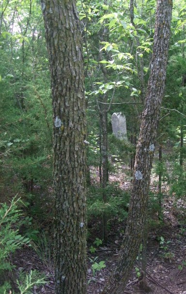
| Description | : | The abandoned De Soto Cemetery is located 3-1/2 miles South of Blair, Nebraska. The cemetery is on private property owned partly by Al Latwaitis and partly Curt Barr. The area is quite large and markers may have been missed in when it was read in 1977. Some of the graves may have been moved to the Blair Cemetery decades ago. Old Desoto (a 14 pg manuscript) Cachelin, Constant 28 July 1933 Pg. 13 “In the pioneer days there were few doctors and some of them were said to practice without hardly any education or diplomas. Also money was scarce. There were no undertakers. Carpenters made... Read More |
frequently asked questions (FAQ):
-
Where is De Soto Cemetery?
De Soto Cemetery is located at De Soto, Washington County, USA.
-
De Soto Cemetery cemetery's updated grave count on graveviews.com?
1 memorials
Nearby Cemetories:
1. Fontanelle Lutheran Cemetery
Fontanelle, Washington County, USA
Coordinate: 41.5814060, -96.2698940
2. Blair Potters Field
Washington County, USA
Coordinate: 41.5824100, -96.3866000
3. Fairview Cemetery
De Soto, Washington County, USA
Coordinate: 41.4225006, -96.2241974
4. Brewster Cemetery
Kennard, Washington County, USA
Coordinate: 41.4597015, -96.3392029
5. Kennard Cemetery
Kennard, Washington County, USA
Coordinate: 41.4664050, -96.3126470
6. Herman Cemetery
Herman, Washington County, USA
Coordinate: 41.5060997, -96.3677979
7. Thone Cemetery
Herman, Washington County, USA
Coordinate: 41.5964012, -96.4300003
8. West Admah Cemetery
Washington County, USA
Coordinate: 41.3932991, -95.9828033
9. Fort Calhoun Cemetery
Fort Calhoun, Washington County, USA
Coordinate: 41.6130981, -96.3478012
10. Pioneer Memorial Cemetery
Fort Calhoun, Washington County, USA
Coordinate: 41.5508003, -96.1185989
11. Wilcox Cemetery
Fort Calhoun, Washington County, USA
Coordinate: 41.5867004, -96.1727982
12. Lincoln Lutheran Cemetery
Orum, Washington County, USA
Coordinate: 41.5493600, -96.1187700
13. Rose Hill Cemetery
Orum, Washington County, USA
Coordinate: 41.5814060, -96.2698940
14. Telbasta Cemetery
Washington County, USA
Coordinate: 41.5824100, -96.3866000
15. Prairie View Cemetery
Washington, Washington County, USA
Coordinate: 41.4225006, -96.2241974
16. Arlington Cemetery
Arlington, Washington County, USA
Coordinate: 41.4597015, -96.3392029
17. Colby-Morley Cemetery
Arlington, Washington County, USA
Coordinate: 41.4664050, -96.3126470
18. Gods Acre Cemetery
Arlington, Washington County, USA
Coordinate: 41.5060997, -96.3677979
19. Immanuel Cemetery Old
Washington County, USA
Coordinate: 41.5964012, -96.4300003
20. Shipley Cemetery
Washington County, USA
Coordinate: 41.3932991, -95.9828033
21. Vacoma Cemetery
Washington County, USA
Coordinate: 41.6130981, -96.3478012
22. Blair Cemetery
Blair, Washington County, USA
Coordinate: 41.5508003, -96.1185989
23. Cuming City Cemetery
Blair, Washington County, USA
Coordinate: 41.5867004, -96.1727982
24. Holy Cross Cemetery
Blair, Washington County, USA
Coordinate: 41.5493600, -96.1187700

