
| Memorials | : | 1 |
| Location | : | Monroe County, USA |
| Coordinate | : | 39.6136017, -91.8985977 |
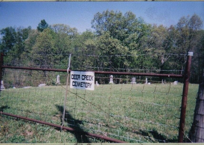
| Description | : | In Hunnewell take V highway South-5 miles. Junction V & FF, Take FF (right turn) approximately 3 1/2 miles, cemetery is on the right, sign on the gate. Cemetery is fenced, and mowed, but many stones have fallen, broken and many graves marked by field stones. Many unmarked graves. |
frequently asked questions (FAQ):
-
Where is Deer Creek Cemetery?
Deer Creek Cemetery is located at Monroe County ,Missouri ,USA.
-
Deer Creek Cemetery cemetery's updated grave count on graveviews.com?
0 memorials
-
Where are the coordinates of the Deer Creek Cemetery?
Latitude: 39.6136017
Longitude: -91.8985977


Nearby Cemetories:
1. Mount Joy Cemetery
Monroe County, USA
Coordinate: 39.6130981, -91.9032974
2. Saint Peter Cemetery
North Fork, Monroe County, USA
Coordinate: 39.6131300, -91.9197400
3. Ellis Cemetery
North Fork, Monroe County, USA
Coordinate: 39.6159910, -91.9270720
4. Worland-Jarboe Cemetery
Monroe County, USA
Coordinate: 39.6100197, -91.9299011
5. Lasley Cemetery
Monroe County, USA
Coordinate: 39.5971985, -91.9325027
6. Gillispie Cemetery
North Fork, Monroe County, USA
Coordinate: 39.5973360, -91.9326950
7. Crutcher Cemetery
Monroe County, USA
Coordinate: 39.5842018, -91.8831024
8. Jeter Cemetery
Monroe County, USA
Coordinate: 39.6175003, -91.8563995
9. Saint Johns Cemetery
Hunnewell, Shelby County, USA
Coordinate: 39.6617012, -91.8778000
10. Henderson-Tipton Family Cemetery
Stoutsville, Monroe County, USA
Coordinate: 39.5624780, -91.8678030
11. Godfrey Cemetery
Hunnewell, Shelby County, USA
Coordinate: 39.6699982, -91.8788986
12. Collins Cemetery
Monroe County, USA
Coordinate: 39.6164017, -91.9766998
13. Dooley Family Cemetery
Stoutsville, Monroe County, USA
Coordinate: 39.5573250, -91.8665630
14. Saint Andrew Cemetery
Stoutsville, Monroe County, USA
Coordinate: 39.5558014, -91.8593979
15. IOOF Cemetery
Hunnewell, Shelby County, USA
Coordinate: 39.6736800, -91.8523800
16. Browne Cemetery
Hunnewell, Shelby County, USA
Coordinate: 39.6737500, -91.8509600
17. Greenwood Cemetery
Monroe County, USA
Coordinate: 39.6203003, -91.9927979
18. Stoutsville Cemetery
Stoutsville, Monroe County, USA
Coordinate: 39.5468400, -91.8515600
19. Saint Stephens Catholic Cemetery
Indian Creek, Monroe County, USA
Coordinate: 39.5925800, -91.7762400
20. Kendall Mount Olive Cemetery
Shelby County, USA
Coordinate: 39.7167900, -91.9150900
21. Union Chapel Cemetery
Hunnewell, Shelby County, USA
Coordinate: 39.7162323, -91.8602524
22. Harris Family Cemetery
Monroe County, USA
Coordinate: 39.5028330, -91.9037990
23. Salem Baptist Church Cemetery
Monroe County, USA
Coordinate: 39.5358800, -92.0031900
24. Crooked Creek African American Cemetery
Paris, Monroe County, USA
Coordinate: 39.6173990, -92.0509360