
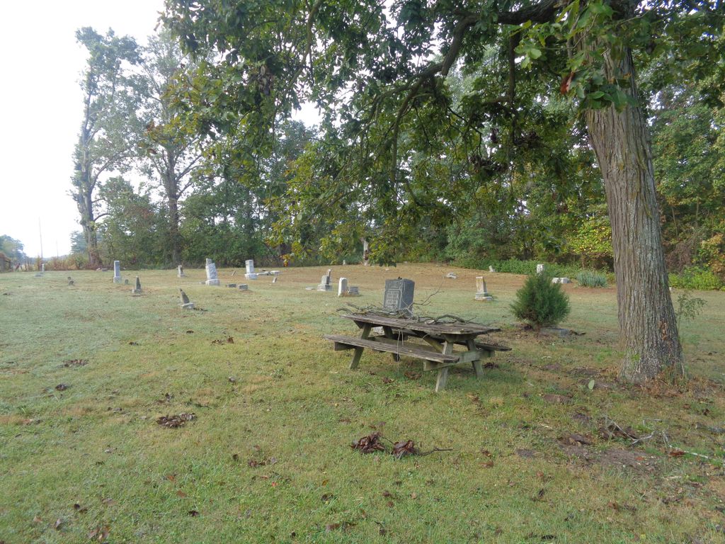
| Memorials | : | 5 |
| Location | : | Hunnewell, Shelby County, USA |
| Coordinate | : | 39.7162323, -91.8602524 |
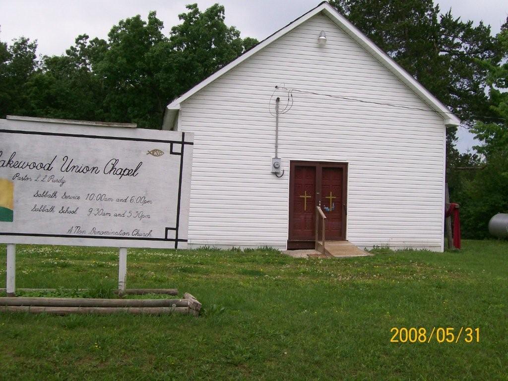
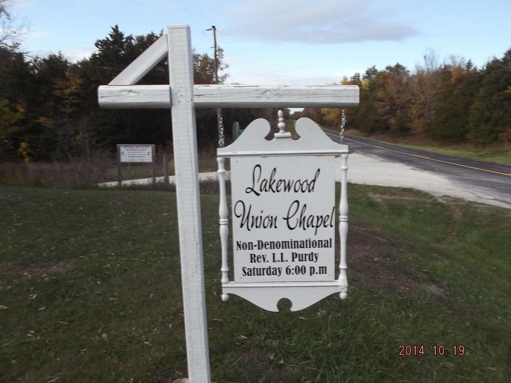
| Description | : | A community in the southeastern part of the county in Jackson Township, three miles north of Hunnewell. The community was earlier known as "Ribbon Ridge," so nicknamed, it is said, by the young men of the neighboring "Grab All" (q.v.) community because of the great number of ribbons worn by the young ladies. The name more likely was applied to the narrow ridge of land lying between Black Creek and the North Fork of the Salt River within the southeastern corner, the earliest settled part of the county. Later the name was changed to Union Chapel, for the church and... Read More |
frequently asked questions (FAQ):
-
Where is Union Chapel Cemetery?
Union Chapel Cemetery is located at Hunnewell, Shelby County ,Missouri ,USA.
-
Union Chapel Cemetery cemetery's updated grave count on graveviews.com?
5 memorials
-
Where are the coordinates of the Union Chapel Cemetery?
Latitude: 39.7162323
Longitude: -91.8602524
Nearby Cemetories:
1. Prairie View Baptist Cemetery
Hunnewell, Shelby County, USA
Coordinate: 39.7353400, -91.8836300
2. Kendall Mount Olive Cemetery
Shelby County, USA
Coordinate: 39.7167900, -91.9150900
3. IOOF Cemetery
Hunnewell, Shelby County, USA
Coordinate: 39.6736800, -91.8523800
4. Browne Cemetery
Hunnewell, Shelby County, USA
Coordinate: 39.6737500, -91.8509600
5. Godfrey Cemetery
Hunnewell, Shelby County, USA
Coordinate: 39.6699982, -91.8788986
6. Saint Johns Cemetery
Hunnewell, Shelby County, USA
Coordinate: 39.6617012, -91.8778000
7. Shaw Family Gravesite
Sharpsburg, Marion County, USA
Coordinate: 39.6874900, -91.7736050
8. Kincaid Cemetery
Warren, Marion County, USA
Coordinate: 39.7498110, -91.7764030
9. Oak Dale Cemetery
Shelby County, USA
Coordinate: 39.7620700, -91.9336900
10. Howe Cemetery
Marion County, USA
Coordinate: 39.7155991, -91.7630997
11. Young Burial Ground
Sharpsburg, Marion County, USA
Coordinate: 39.6997200, -91.7611100
12. Cissna Farm Cemetery
Marion County, USA
Coordinate: 39.7745400, -91.7926600
13. Sharpsburg Cemetery
Marion County, USA
Coordinate: 39.6822160, -91.7678850
14. Andrew Chapel Cemetery
Warren, Marion County, USA
Coordinate: 39.7747002, -91.7913971
15. Emden Memorial Gardens
Emden, Shelby County, USA
Coordinate: 39.7983600, -91.8632300
16. Calvert Cemetery
Marion County, USA
Coordinate: 39.7806015, -91.7902985
17. Jeter Cemetery
Monroe County, USA
Coordinate: 39.6175003, -91.8563995
18. Warren Cemetery
Warren, Marion County, USA
Coordinate: 39.7712200, -91.7517200
19. Gilchrist Cemetery
Shelbina, Shelby County, USA
Coordinate: 39.7483531, -91.9854958
20. Cobb Cemetery
Marion County, USA
Coordinate: 39.7393990, -91.7292023
21. Deer Creek Cemetery
Monroe County, USA
Coordinate: 39.6136017, -91.8985977
22. Mount Joy Cemetery
Monroe County, USA
Coordinate: 39.6130981, -91.9032974
23. Saint Jude Cemetery
Monroe City, Monroe County, USA
Coordinate: 39.6528015, -91.7450027
24. Holy Rosary Cemetery
Monroe City, Monroe County, USA
Coordinate: 39.6528000, -91.7450000