
| Memorials | : | 1 |
| Location | : | Bad Nauheim, Wetteraukreis, Germany |
| Website | : | www.alterfriedhof-badnauheim.de/ |
| Coordinate | : | 50.3623990, 8.7368570 |
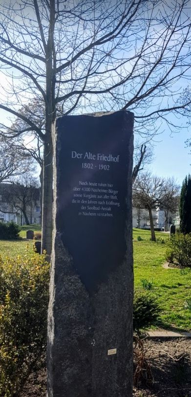
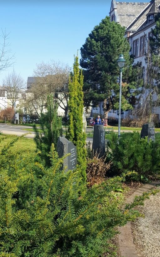
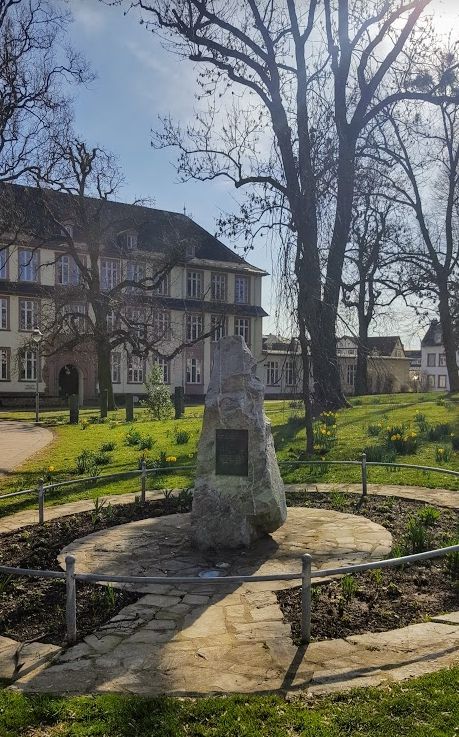
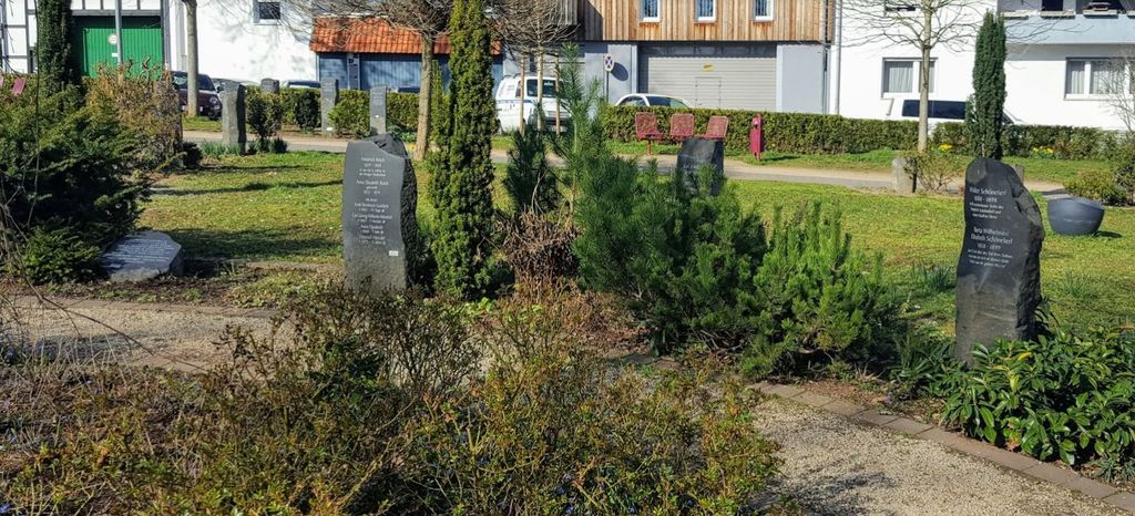
| Description | : | Der Alte Friedhof (The Old Cemetery) was originally opened in 1802 and was used to bury Bad Nauheim residents and visitors to this spa town until 1902, with almost 5,000 people buried here in 100 years. Thanks to a local historical society the area has been thoughtfully preserved. There are few gravestones, but the church register has been made accessible to the public and the people buried here are listed reliably. |
frequently asked questions (FAQ):
-
Where is Der Alte Friedhof in Bad Nauheim?
Der Alte Friedhof in Bad Nauheim is located at Ernst-Ludwig-Ring 18 Bad Nauheim, Wetteraukreis ,Hessen , 61231Germany.
-
Der Alte Friedhof in Bad Nauheim cemetery's updated grave count on graveviews.com?
1 memorials
-
Where are the coordinates of the Der Alte Friedhof in Bad Nauheim?
Latitude: 50.3623990
Longitude: 8.7368570
Nearby Cemetories:
1. Alter Friedhof Bad Nauheim
Friedberg, Wetteraukreis, Germany
Coordinate: 50.3622000, 8.7363300
2. Zisterzienserinnen-Kloster
Rockenberg, Wetteraukreis, Germany
Coordinate: 50.4308330, 8.7355560
3. Markuskirche Butzbach
Butzbach, Wetteraukreis, Germany
Coordinate: 50.4350000, 8.6735000
4. Friedhof Reichelsheim
Reichelsheim, Wetteraukreis, Germany
Coordinate: 50.3553800, 8.8698600
5. Basilika Mariä Empfängnis und SS. Peter und Paul
Wetteraukreis, Germany
Coordinate: 50.2803000, 8.8026000
6. Bestattungswald am Ketzerborn
Rosbach vor der Höhe, Wetteraukreis, Germany
Coordinate: 50.2867992, 8.6503860
7. Alter Friedhof Köppern
Friedrichsdorf, Hochtaunuskreis, Germany
Coordinate: 50.2793590, 8.6494540
8. Waldfriedhof Köppern
Friedrichsdorf, Hochtaunuskreis, Germany
Coordinate: 50.2730009, 8.6603922
9. Friedhof Bönstadt
Bönstadt, Wetteraukreis, Germany
Coordinate: 50.2861900, 8.8517600
10. Friedhof Dillingen
Friedrichsdorf, Hochtaunuskreis, Germany
Coordinate: 50.2644669, 8.6292466
11. Hauptfriedhof Friedrichsdorf
Friedrichsdorf, Hochtaunuskreis, Germany
Coordinate: 50.2496200, 8.6428100
12. Jüdischer Friedhof Kirch-Göns
Butzbach, Wetteraukreis, Germany
Coordinate: 50.4789800, 8.6546800
13. Friedhof Seulberg
Friedrichsdorf, Hochtaunuskreis, Germany
Coordinate: 50.2456980, 8.6507630
14. Güll Hofgut Cemetery
Dorf-Güll, Landkreis Gießen, Germany
Coordinate: 50.4880410, 8.7848070
15. Arnsburg Monastery
Lich, Landkreis Gießen, Germany
Coordinate: 50.4938600, 8.7933850
16. Kloster Engelthal
Altenstadt, Wetteraukreis, Germany
Coordinate: 50.2825000, 8.9130560
17. Friedhof Nieder Mockstadt
Nieder Mockstadt, Wetteraukreis, Germany
Coordinate: 50.3338480, 8.9489250
18. Alter Jüdischer Friedhof
Nieder Mockstadt, Wetteraukreis, Germany
Coordinate: 50.3291192, 8.9625355
19. Jüdischer Friedhof Hungen
Hungen, Landkreis Gießen, Germany
Coordinate: 50.4722800, 8.8978000
20. Kirchgemeinde Rodenbach Cemetery
Rodenbach, Main-Kinzig-Kreis, Germany
Coordinate: 50.3010900, 8.9539900
21. Friedhof Nieder-Erlenbach - Neuer Friedhof
Frankfurt am Main, Stadtkreis Frankfurt, Germany
Coordinate: 50.2083874, 8.7061275
22. Schlosskirche Bad Homburg
Bad Homburg, Hochtaunuskreis, Germany
Coordinate: 50.2275000, 8.6100000
23. Alter Friedhof Büdesheim
Büdesheim, Main-Kinzig-Kreis, Germany
Coordinate: 50.2165133, 8.8386229
24. Friedhof Nieder-Erlenbach - Alter Friedhof
Frankfurt am Main, Stadtkreis Frankfurt, Germany
Coordinate: 50.2027120, 8.7066370