
| Memorials | : | 65 |
| Location | : | Sydney, City of Sydney, Australia |
| Coordinate | : | -33.8828080, 151.2066180 |
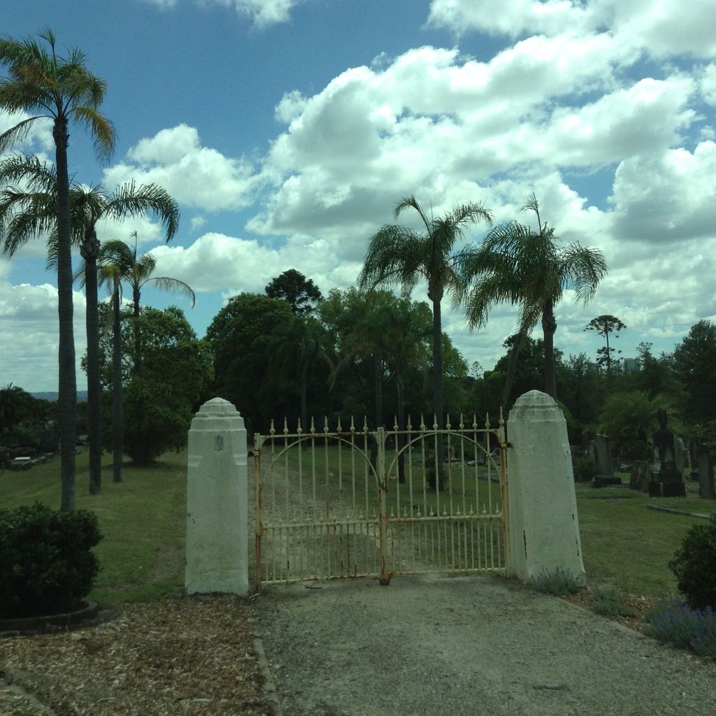
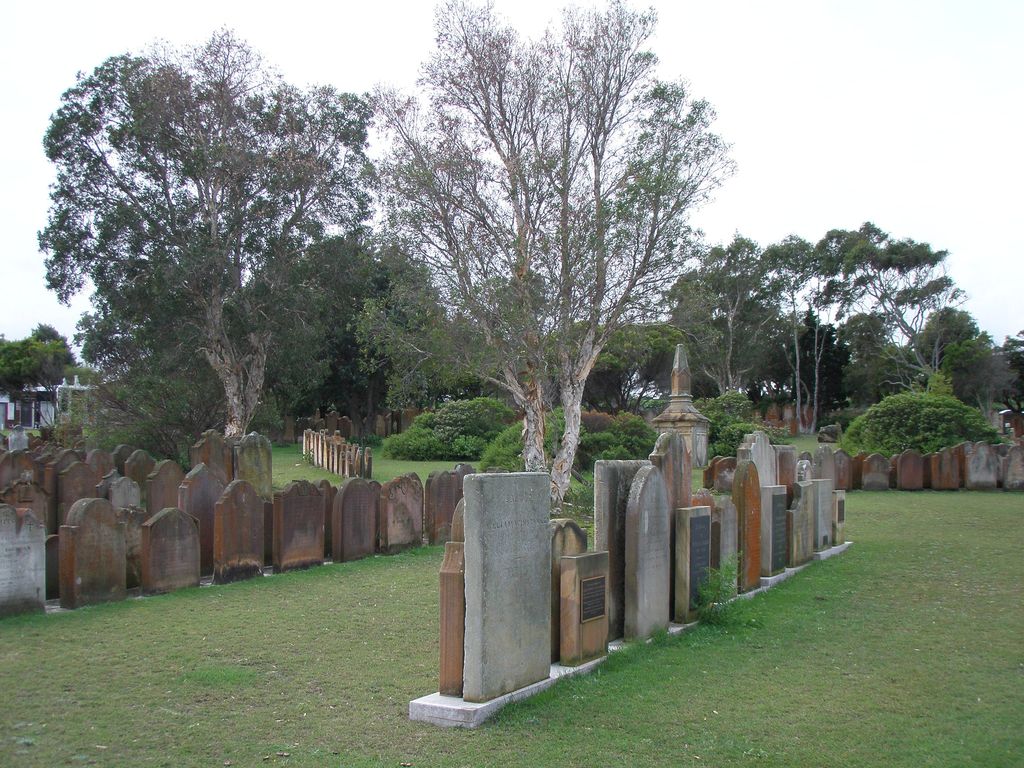
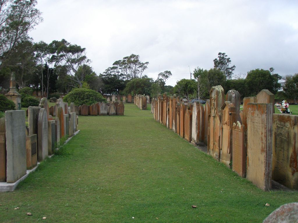
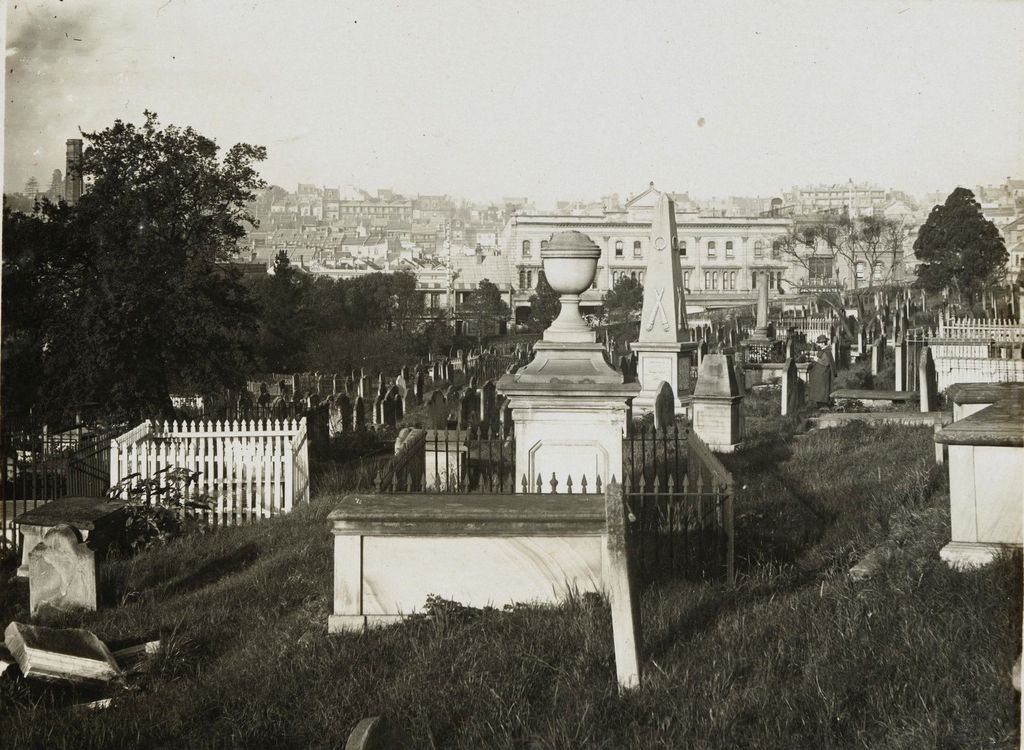
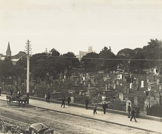
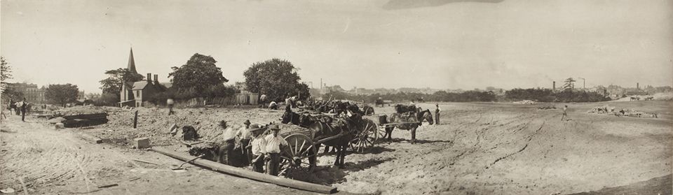
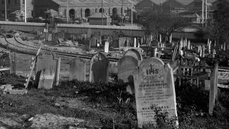
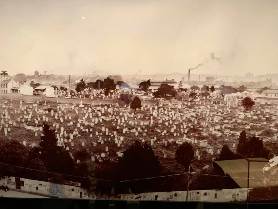
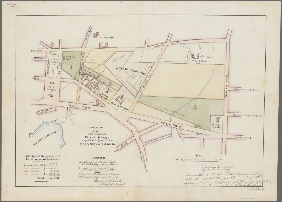
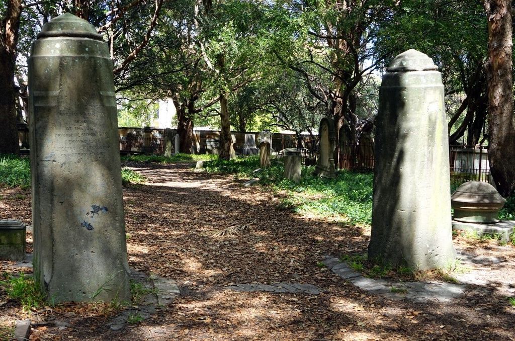
| Description | : | The Devonshire Street Cemetery (also known incorrectly as the Brickfield Cemetery or Sandhills Cemetery) was located between Eddy Avenue and Elizabeth Street, and between Chalmers and Devonshire Streets, at Brickfield Hill, in Sydney, Australia. It was consecrated in 1820. By 1860, the cemetery was full, and it was closed in 1888, the last interment was in 1891. In 1901, the cemetery was resumed to allow for the development of Central railway station, Remains that were claimed were transferred to a number of cemeteries, including Gore Hill Cemetery, St Thomas Cemetery in Crows Nest, Rookwood Cemetery, Waverley Cemetery, Balmain... Read More |
frequently asked questions (FAQ):
-
Where is Devonshire Street Cemetery (Defunct)?
Devonshire Street Cemetery (Defunct) is located at Sydney, City of Sydney ,New South Wales ,Australia.
-
Devonshire Street Cemetery (Defunct) cemetery's updated grave count on graveviews.com?
65 memorials
-
Where are the coordinates of the Devonshire Street Cemetery (Defunct)?
Latitude: -33.8828080
Longitude: 151.2066180
Nearby Cemetories:
1. Old Sydney Burial Ground
Sydney, City of Sydney, Australia
Coordinate: -33.8731750, 151.2063850
2. Saint Mary's Cathedral
Sydney, City of Sydney, Australia
Coordinate: -33.8708540, 151.2135820
3. Parish Church of Saint James
Sydney, City of Sydney, Australia
Coordinate: -33.8693760, 151.2111540
4. Royal Botanic Gardens
Sydney, City of Sydney, Australia
Coordinate: -33.8647440, 151.2170610
5. Camperdown Cemetery
Newtown, City of Sydney, Australia
Coordinate: -33.8942220, 151.1804900
6. Garden Island
Potts Point, City of Sydney, Australia
Coordinate: -33.8613635, 151.2280308
7. St Luke's Anglican Church
Enmore, Inner West Council, Australia
Coordinate: -33.8989218, 151.1700724
8. St. Peters Cooks River Cemetery
Saint Peters, Inner West Council, Australia
Coordinate: -33.9139390, 151.1775670
9. Saint Jude's Cemetery
Randwick, Randwick City, Australia
Coordinate: -33.9115460, 151.2417130
10. Pioneers Memorial Park
Leichhardt, Inner West Council, Australia
Coordinate: -33.8780800, 151.1575000
11. Mary MacKillop Memorial Chapel
North Sydney, North Sydney Council, Australia
Coordinate: -33.8388250, 151.2049160
12. Balmain Catholic Cemetery (Defunct)
Leichhardt, Inner West Council, Australia
Coordinate: -33.8797270, 151.1523730
13. Holy Trinity Church
Kingsford, Randwick City, Australia
Coordinate: -33.9267060, 151.2321180
14. St Thomas Becket Churchyard
Lewisham, Inner West Council, Australia
Coordinate: -33.8928760, 151.1480490
15. St David’s Presbyterian Cemetery
Haberfield, Inner West Council, Australia
Coordinate: -33.8823220, 151.1378500
16. St. Thomas Rest Park
Crows Nest, North Sydney Council, Australia
Coordinate: -33.8244490, 151.2063050
17. Botany Wesleyan Cemetery (Defunct)
Botany Bay, Bayside Council, Australia
Coordinate: -33.9421070, 151.1961480
18. Rawson Park
Mosman, Mosman Municipality, Australia
Coordinate: -33.8350640, 151.2504980
19. Randwick General Cemetery
South Coogee, Randwick City, Australia
Coordinate: -33.9295780, 151.2549810
20. Gore Hill Cemetery
St Leonards, North Sydney Council, Australia
Coordinate: -33.8229500, 151.1887590
21. St Aidan's Anglican Church
Longueville, Lane Cove Municipality, Australia
Coordinate: -33.8281510, 151.1709560
22. St. John's Anglican Church Cemetery
Ashfield, Inner West Council, Australia
Coordinate: -33.8817160, 151.1278730
23. St. Paul's Anglican Church Cemetery
Canterbury, Canterbury-Bankstown Council, Australia
Coordinate: -33.9081600, 151.1236000
24. Gladesville Asylum Cemetery
Gladesville, Hunter's Hill Municipality, Australia
Coordinate: -33.8393010, 151.1342490