
| Memorials | : | 302 |
| Location | : | Randwick, Randwick City, Australia |
| Coordinate | : | -33.9115460, 151.2417130 |
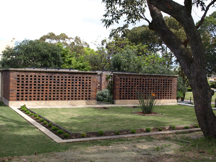
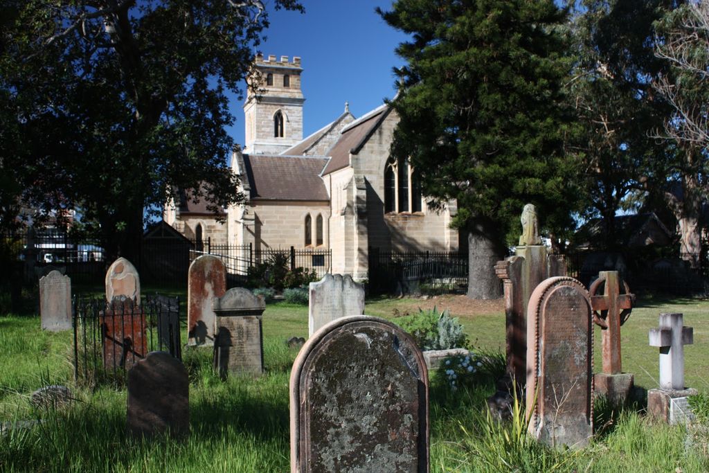
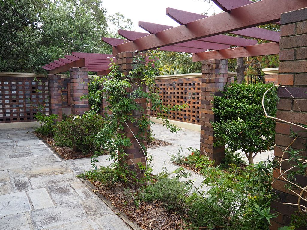
| Description | : | The Cemetery Occupies An Area Of Approximately .96 Hectares And Fronts The Avenue To The West. It Extends For The Full Width Of The Site At The Rear Of The Church, Rectory, Verger's Residence And Hall. The Cemetery Has Been Closed For Some Considerable Period And Since The Beginning Of This Century, Due Primarily To The Threat Of Pollution In Ihe Surface Water Run Off To The Low Level Catchment Areas About Centennial Park. It Is Now Reopened. The Columbarium Was Opened In 1956, As A Place Where The Ashes Of Loved Ones Can Be Interred. It Continues To Be... Read More |
frequently asked questions (FAQ):
-
Where is Saint Jude's Cemetery?
Saint Jude's Cemetery is located at 106 Avoca St Randwick, Randwick City ,New South Wales , 2031Australia.
-
Saint Jude's Cemetery cemetery's updated grave count on graveviews.com?
19 memorials
-
Where are the coordinates of the Saint Jude's Cemetery?
Latitude: -33.9115460
Longitude: 151.2417130
Nearby Cemetories:
1. Holy Trinity Church
Kingsford, Randwick City, Australia
Coordinate: -33.9267060, 151.2321180
2. Randwick General Cemetery
South Coogee, Randwick City, Australia
Coordinate: -33.9295780, 151.2549810
3. Devonshire Street Cemetery (Defunct)
Sydney, City of Sydney, Australia
Coordinate: -33.8828080, 151.2066180
4. Saint Mary's Cathedral
Sydney, City of Sydney, Australia
Coordinate: -33.8708540, 151.2135820
5. Old Sydney Burial Ground
Sydney, City of Sydney, Australia
Coordinate: -33.8731750, 151.2063850
6. Botany Wesleyan Cemetery (Defunct)
Botany Bay, Bayside Council, Australia
Coordinate: -33.9421070, 151.1961480
7. Parish Church of Saint James
Sydney, City of Sydney, Australia
Coordinate: -33.8693760, 151.2111540
8. Royal Botanic Gardens
Sydney, City of Sydney, Australia
Coordinate: -33.8647440, 151.2170610
9. Garden Island
Potts Point, City of Sydney, Australia
Coordinate: -33.8613635, 151.2280308
10. St. Peters Cooks River Cemetery
Saint Peters, Inner West Council, Australia
Coordinate: -33.9139390, 151.1775670
11. Camperdown Cemetery
Newtown, City of Sydney, Australia
Coordinate: -33.8942220, 151.1804900
12. St Luke's Anglican Church
Enmore, Inner West Council, Australia
Coordinate: -33.8989218, 151.1700724
13. Eastern Suburbs Memorial Park
Matraville, Randwick City, Australia
Coordinate: -33.9732410, 151.2297940
14. Rawson Park
Mosman, Mosman Municipality, Australia
Coordinate: -33.8350640, 151.2504980
15. Botany Bay National Park
Sydney, City of Sydney, Australia
Coordinate: -33.9881750, 151.2321090
16. Pioneers Memorial Park
Leichhardt, Inner West Council, Australia
Coordinate: -33.8780800, 151.1575000
17. Mary MacKillop Memorial Chapel
North Sydney, North Sydney Council, Australia
Coordinate: -33.8388250, 151.2049160
18. Coast Hospital Cemetery
La Perouse, Randwick City, Australia
Coordinate: -33.9906780, 151.2503300
19. St Thomas Becket Churchyard
Lewisham, Inner West Council, Australia
Coordinate: -33.8928760, 151.1480490
20. Balmain Catholic Cemetery (Defunct)
Leichhardt, Inner West Council, Australia
Coordinate: -33.8797270, 151.1523730
21. St David’s Presbyterian Cemetery
Haberfield, Inner West Council, Australia
Coordinate: -33.8823220, 151.1378500
22. St. Thomas Rest Park
Crows Nest, North Sydney Council, Australia
Coordinate: -33.8244490, 151.2063050
23. Rockdale Uniting Church Cemetery
Rockdale, Bayside Council, Australia
Coordinate: -33.9533350, 151.1381840
24. St. Paul's Anglican Church Cemetery
Canterbury, Canterbury-Bankstown Council, Australia
Coordinate: -33.9081600, 151.1236000