
| Memorials | : | 127 |
| Location | : | Sydney, City of Sydney, Australia |
| Coordinate | : | -33.8731750, 151.2063850 |
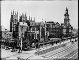
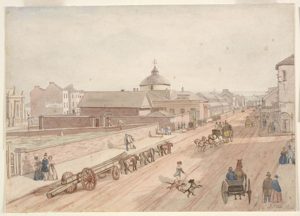
| Description | : | Dating back to the 1790s, the site is commonly called the Old Sydney Burial Ground. It is also known as the George Street Burial Ground, the Cathedral Close Cemetery and, retrospectively, the Town Hall Cemetery. Sydney Town Hall now sits on the site of what was once the principal cemetery of NSW. The site, on the outskirts of town, was chosen by Governor Phillip and the Reverend Richard Johnson in September 1792. In 1812, Governor Macquarie authorised the extension of the burial ground to the north and west, and granted a site for a new church, St Andrew's,... Read More |
frequently asked questions (FAQ):
-
Where is Old Sydney Burial Ground?
Old Sydney Burial Ground is located at Sydney, City of Sydney ,New South Wales ,Australia.
-
Old Sydney Burial Ground cemetery's updated grave count on graveviews.com?
126 memorials
-
Where are the coordinates of the Old Sydney Burial Ground?
Latitude: -33.8731750
Longitude: 151.2063850
Nearby Cemetories:
1. Parish Church of Saint James
Sydney, City of Sydney, Australia
Coordinate: -33.8693760, 151.2111540
2. Saint Mary's Cathedral
Sydney, City of Sydney, Australia
Coordinate: -33.8708540, 151.2135820
3. Devonshire Street Cemetery (Defunct)
Sydney, City of Sydney, Australia
Coordinate: -33.8828080, 151.2066180
4. Royal Botanic Gardens
Sydney, City of Sydney, Australia
Coordinate: -33.8647440, 151.2170610
5. Garden Island
Potts Point, City of Sydney, Australia
Coordinate: -33.8613635, 151.2280308
6. Camperdown Cemetery
Newtown, City of Sydney, Australia
Coordinate: -33.8942220, 151.1804900
7. Mary MacKillop Memorial Chapel
North Sydney, North Sydney Council, Australia
Coordinate: -33.8388250, 151.2049160
8. St Luke's Anglican Church
Enmore, Inner West Council, Australia
Coordinate: -33.8989218, 151.1700724
9. Pioneers Memorial Park
Leichhardt, Inner West Council, Australia
Coordinate: -33.8780800, 151.1575000
10. Balmain Catholic Cemetery (Defunct)
Leichhardt, Inner West Council, Australia
Coordinate: -33.8797270, 151.1523730
11. St. Peters Cooks River Cemetery
Saint Peters, Inner West Council, Australia
Coordinate: -33.9139390, 151.1775670
12. Saint Jude's Cemetery
Randwick, Randwick City, Australia
Coordinate: -33.9115460, 151.2417130
13. St. Thomas Rest Park
Crows Nest, North Sydney Council, Australia
Coordinate: -33.8244490, 151.2063050
14. St Thomas Becket Churchyard
Lewisham, Inner West Council, Australia
Coordinate: -33.8928760, 151.1480490
15. Gore Hill Cemetery
St Leonards, North Sydney Council, Australia
Coordinate: -33.8229500, 151.1887590
16. Rawson Park
Mosman, Mosman Municipality, Australia
Coordinate: -33.8350640, 151.2504980
17. St Aidan's Anglican Church
Longueville, Lane Cove Municipality, Australia
Coordinate: -33.8281510, 151.1709560
18. St David’s Presbyterian Cemetery
Haberfield, Inner West Council, Australia
Coordinate: -33.8823220, 151.1378500
19. Holy Trinity Church
Kingsford, Randwick City, Australia
Coordinate: -33.9267060, 151.2321180
20. St. John's Anglican Church Cemetery
Ashfield, Inner West Council, Australia
Coordinate: -33.8817160, 151.1278730
21. Gladesville Asylum Cemetery
Gladesville, Hunter's Hill Municipality, Australia
Coordinate: -33.8393010, 151.1342490
22. Randwick General Cemetery
South Coogee, Randwick City, Australia
Coordinate: -33.9295780, 151.2549810
23. Botany Wesleyan Cemetery (Defunct)
Botany Bay, Bayside Council, Australia
Coordinate: -33.9421070, 151.1961480
24. St. Paul's Anglican Church Cemetery
Canterbury, Canterbury-Bankstown Council, Australia
Coordinate: -33.9081600, 151.1236000