
| Memorials | : | 8 |
| Location | : | Doniphan County, USA |
| Coordinate | : | 39.7911000, -95.2364500 |
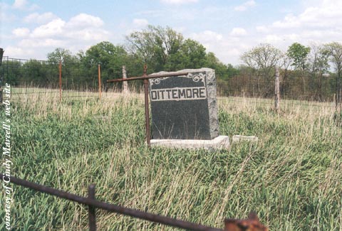
| Description | : | Cemetery is just north of Severance, KS. From hwy 120 go east on 185 road, north on Diamond Spring Rd, east on 195 Rd. SE of 195th road & Dove Creek Rd. intersection. It is on private land and permission should be obtained to enter. It is not maintained but does have cattle fencing around it. |
frequently asked questions (FAQ):
-
Where is Dittemore Cemetery?
Dittemore Cemetery is located at Doniphan County ,Kansas ,USA.
-
Dittemore Cemetery cemetery's updated grave count on graveviews.com?
8 memorials
-
Where are the coordinates of the Dittemore Cemetery?
Latitude: 39.7911000
Longitude: -95.2364500
Nearby Cemetories:
1. Oak Hill Cemetery
Severance, Doniphan County, USA
Coordinate: 39.7780991, -95.2557983
2. Wolf River Cemetery
Troy, Doniphan County, USA
Coordinate: 39.8125000, -95.2200012
3. Burrell Cemetery
Doniphan County, USA
Coordinate: 39.7838400, -95.1952300
4. Springer Cemetery
Doniphan County, USA
Coordinate: 39.7695389, -95.2683792
5. Steanson Family Cemetery
Moray, Doniphan County, USA
Coordinate: 39.7840004, -95.1903381
6. Bitner Cemetery
Severance, Doniphan County, USA
Coordinate: 39.7439003, -95.2466965
7. Wood Cemetery
Doniphan, Doniphan County, USA
Coordinate: 39.7956600, -95.1640800
8. Moray Cemetery
Moray, Doniphan County, USA
Coordinate: 39.7655106, -95.1713181
9. Victory Cemetery
Denton, Doniphan County, USA
Coordinate: 39.7327995, -95.2358017
10. Iola Cemetery
Sparks, Doniphan County, USA
Coordinate: 39.8417015, -95.1896973
11. Highland Cemetery
Highland, Doniphan County, USA
Coordinate: 39.8555984, -95.2514038
12. Pleasant Hill Cemetery
Leona, Doniphan County, USA
Coordinate: 39.8162193, -95.3224869
13. Saint Benedict Cemetery
Bendena, Doniphan County, USA
Coordinate: 39.7195015, -95.2285995
14. Denton Cemetery
Denton, Doniphan County, USA
Coordinate: 39.7263985, -95.2838974
15. Saint James Cemetery
Fanning, Doniphan County, USA
Coordinate: 39.8349310, -95.1533590
16. Fanning Cemetery
Fanning, Doniphan County, USA
Coordinate: 39.8347015, -95.1528015
17. Hedrick Cemetery
Iowa Point, Doniphan County, USA
Coordinate: 39.8672800, -95.1818500
18. Wolf River Cemetery
Brown County, USA
Coordinate: 39.7476900, -95.3397500
19. Pleasant Ridge Cemetery
Brown County, USA
Coordinate: 39.7928009, -95.3654022
20. Mount Olive Cemetery
Troy, Doniphan County, USA
Coordinate: 39.7677994, -95.1044006
21. Lafayette Cemetery
Sparks, Doniphan County, USA
Coordinate: 39.8707000, -95.1410600
22. Walnut Grove Cemetery
Highland, Doniphan County, USA
Coordinate: 39.9000702, -95.2438736
23. Saint Charles Cemetery
Troy, Doniphan County, USA
Coordinate: 39.7686005, -95.0971985
24. Mosquito Creek Cemetery
Doniphan County, USA
Coordinate: 39.8376400, -95.0988100