
| Memorials | : | 1 |
| Location | : | Leona, Doniphan County, USA |
| Coordinate | : | 39.8162193, -95.3224869 |
| Description | : | rom Leona, 2 miles north on Maple Street, which becomes Ashpoint Road. From Highland, 3 miles west on Highway 36, then 1.75 miles south on Ashpoint Road. The cemetery is just to the south of the Bellevue United Methodist Church which has a Leona address. In the past, local residents and old death certificates have used Bellevue, Bellvue and Pleasant Hill interchangeably to refer to this cemetery. |
frequently asked questions (FAQ):
-
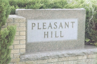
Where is Pleasant Hill Cemetery?
Pleasant Hill Cemetery is located at Leona, Doniphan County ,Kansas ,USA.
-
Pleasant Hill Cemetery cemetery's updated grave count on graveviews.com?
1 memorials
-
Where are the coordinates of the Pleasant Hill Cemetery?
Latitude: 39.8162193
Longitude: -95.3224869
Nearby Cemetories:
1. Pleasant Ridge Cemetery
Brown County, USA
Coordinate: 39.7928009, -95.3654022
2. Springer Cemetery
Doniphan County, USA
Coordinate: 39.7695389, -95.2683792
3. Oak Hill Cemetery
Severance, Doniphan County, USA
Coordinate: 39.7780991, -95.2557983
4. Highland Cemetery
Highland, Doniphan County, USA
Coordinate: 39.8555984, -95.2514038
5. Upper Wolf Lutheran Cemetery
Robinson, Brown County, USA
Coordinate: 39.7690010, -95.3893509
6. Wolf River Cemetery
Brown County, USA
Coordinate: 39.7476900, -95.3397500
7. Rose Hill Cemetery
Robinson, Brown County, USA
Coordinate: 39.8097000, -95.4139023
8. Dittemore Cemetery
Doniphan County, USA
Coordinate: 39.7911000, -95.2364500
9. Wolf River Cemetery
Troy, Doniphan County, USA
Coordinate: 39.8125000, -95.2200012
10. Ununda Cemetery
Robinson, Brown County, USA
Coordinate: 39.8582993, -95.4143982
11. Madison Cemetery
Robinson, Brown County, USA
Coordinate: 39.7717700, -95.4201700
12. Bitner Cemetery
Severance, Doniphan County, USA
Coordinate: 39.7439003, -95.2466965
13. Denton Cemetery
Denton, Doniphan County, USA
Coordinate: 39.7263985, -95.2838974
14. Burrell Cemetery
Doniphan County, USA
Coordinate: 39.7838400, -95.1952300
15. Walnut Grove Cemetery
Highland, Doniphan County, USA
Coordinate: 39.9000702, -95.2438736
16. Iola Cemetery
Sparks, Doniphan County, USA
Coordinate: 39.8417015, -95.1896973
17. Steanson Family Cemetery
Moray, Doniphan County, USA
Coordinate: 39.7840004, -95.1903381
18. Victory Cemetery
Denton, Doniphan County, USA
Coordinate: 39.7327995, -95.2358017
19. Collins Family Cemetery
White Cloud, Doniphan County, USA
Coordinate: 39.9221992, -95.2969284
20. Kenyon Cemetery
Robinson, Brown County, USA
Coordinate: 39.9122000, -95.3964600
21. Hedrick Cemetery
Iowa Point, Doniphan County, USA
Coordinate: 39.8672800, -95.1818500
22. Kimberlin Cemetery
Everest, Brown County, USA
Coordinate: 39.7111015, -95.3964005
23. Saint Benedict Cemetery
Bendena, Doniphan County, USA
Coordinate: 39.7195015, -95.2285995
24. Zion Lutheran Church Cemetery
Everest, Brown County, USA
Coordinate: 39.7290611, -95.4336777