
| Memorials | : | 1 |
| Location | : | Brown County, USA |
| Coordinate | : | 39.7928009, -95.3654022 |
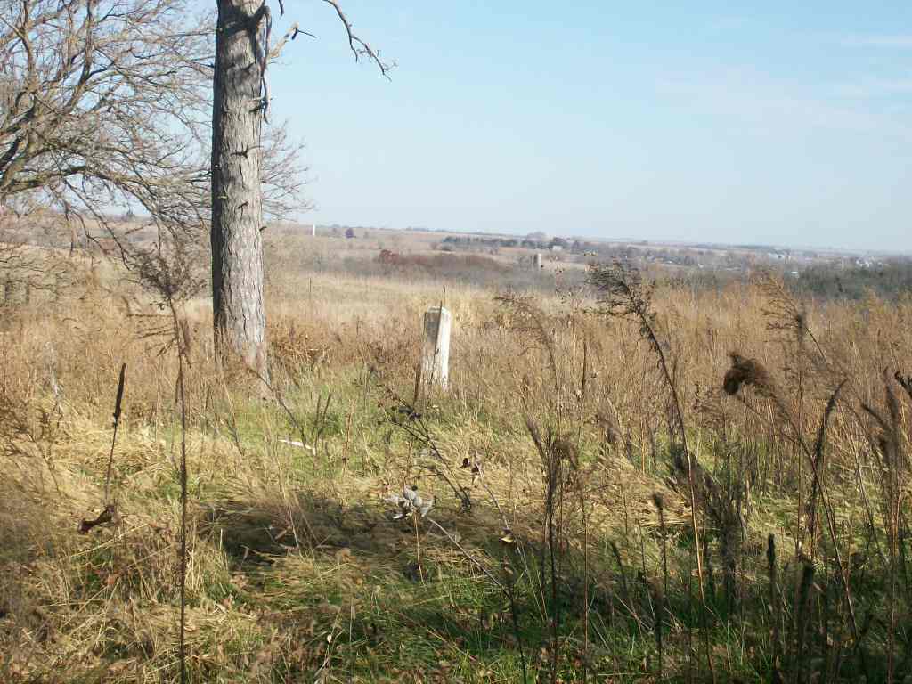
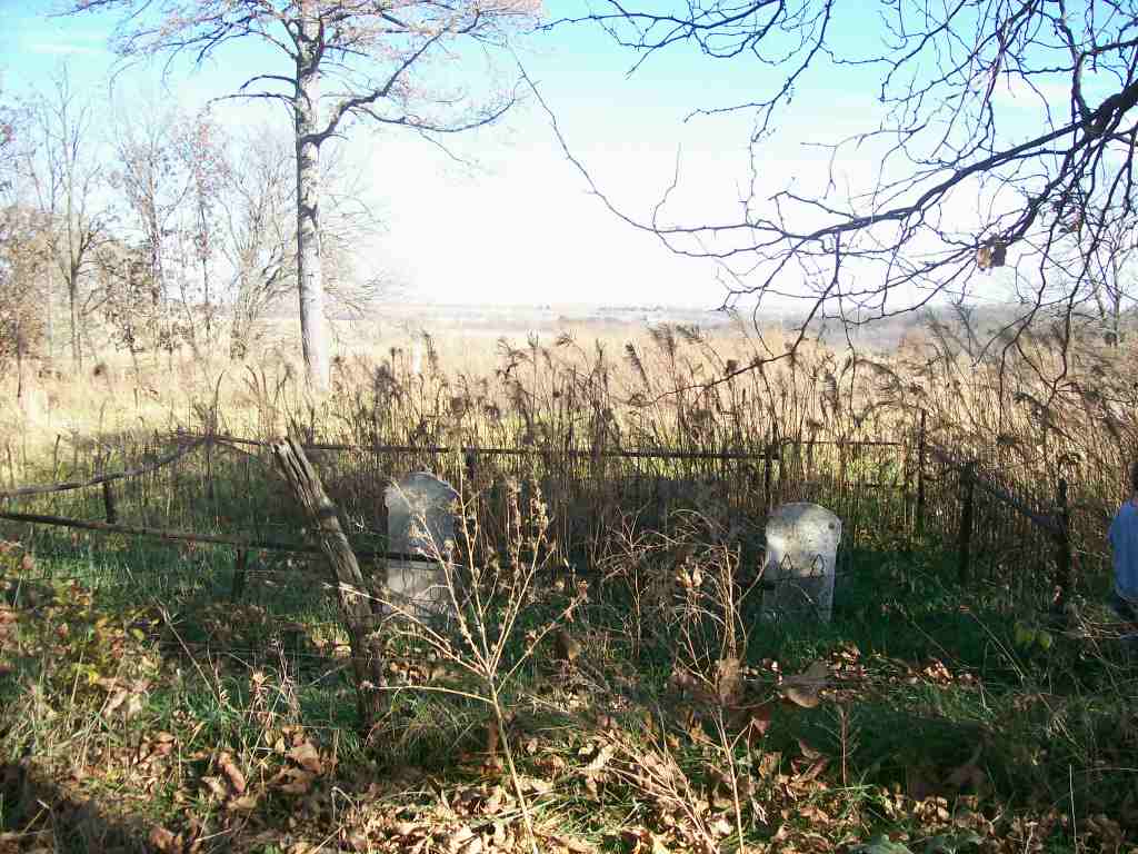
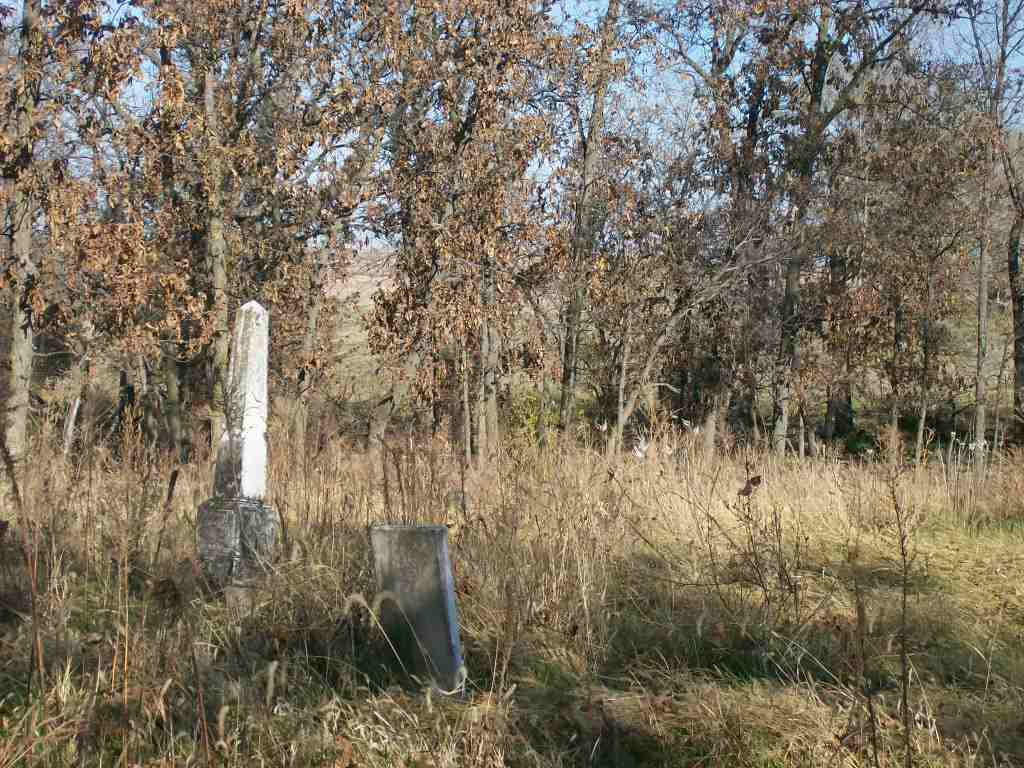
| Description | : | This cemetery is not very large and is fenced in, it has 15 graves. This is an abandoned cemetery and is not kept up. It is overgrown with brush and tall grass. It is about 1/2 mile walk through a field to get to it from a gravel road. |
frequently asked questions (FAQ):
-
Where is Pleasant Ridge Cemetery?
Pleasant Ridge Cemetery is located at Brown County ,Kansas ,USA.
-
Pleasant Ridge Cemetery cemetery's updated grave count on graveviews.com?
1 memorials
-
Where are the coordinates of the Pleasant Ridge Cemetery?
Latitude: 39.7928009
Longitude: -95.3654022
Nearby Cemetories:
1. Upper Wolf Lutheran Cemetery
Robinson, Brown County, USA
Coordinate: 39.7690010, -95.3893509
2. Pleasant Hill Cemetery
Leona, Doniphan County, USA
Coordinate: 39.8162193, -95.3224869
3. Rose Hill Cemetery
Robinson, Brown County, USA
Coordinate: 39.8097000, -95.4139023
4. Madison Cemetery
Robinson, Brown County, USA
Coordinate: 39.7717700, -95.4201700
5. Wolf River Cemetery
Brown County, USA
Coordinate: 39.7476900, -95.3397500
6. Ununda Cemetery
Robinson, Brown County, USA
Coordinate: 39.8582993, -95.4143982
7. Springer Cemetery
Doniphan County, USA
Coordinate: 39.7695389, -95.2683792
8. Zion Lutheran Church Cemetery
Everest, Brown County, USA
Coordinate: 39.7290611, -95.4336777
9. Kimberlin Cemetery
Everest, Brown County, USA
Coordinate: 39.7111015, -95.3964005
10. Oak Hill Cemetery
Severance, Doniphan County, USA
Coordinate: 39.7780991, -95.2557983
11. Denton Cemetery
Denton, Doniphan County, USA
Coordinate: 39.7263985, -95.2838974
12. Carr Cemetery
Everest, Brown County, USA
Coordinate: 39.7254600, -95.4521600
13. Page Cemetery
Brown County, USA
Coordinate: 39.7000600, -95.4015400
14. Dittemore Cemetery
Doniphan County, USA
Coordinate: 39.7911000, -95.2364500
15. Bitner Cemetery
Severance, Doniphan County, USA
Coordinate: 39.7439003, -95.2466965
16. Miller Cemetery
Everest, Brown County, USA
Coordinate: 39.6866989, -95.3628006
17. Highland Cemetery
Highland, Doniphan County, USA
Coordinate: 39.8555984, -95.2514038
18. Claytonville Cemetery
Horton, Brown County, USA
Coordinate: 39.7766991, -95.5046997
19. Saint Marys Cemetery
Doniphan County, USA
Coordinate: 39.6897011, -95.3174973
20. All Saints Cemetery
Everest, Brown County, USA
Coordinate: 39.7008018, -95.4507980
21. Wolf River Cemetery
Troy, Doniphan County, USA
Coordinate: 39.8125000, -95.2200012
22. Victory Cemetery
Denton, Doniphan County, USA
Coordinate: 39.7327995, -95.2358017
23. Kenyon Cemetery
Robinson, Brown County, USA
Coordinate: 39.9122000, -95.3964600
24. Saint Benedict Cemetery
Bendena, Doniphan County, USA
Coordinate: 39.7195015, -95.2285995