
| Memorials | : | 3 |
| Location | : | Belltown, Elk County, USA |
| Coordinate | : | 41.3745400, -79.0065100 |
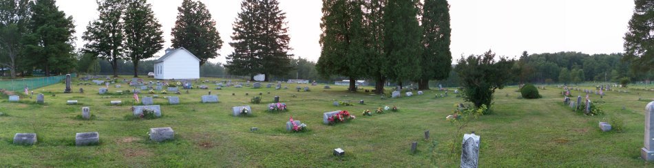
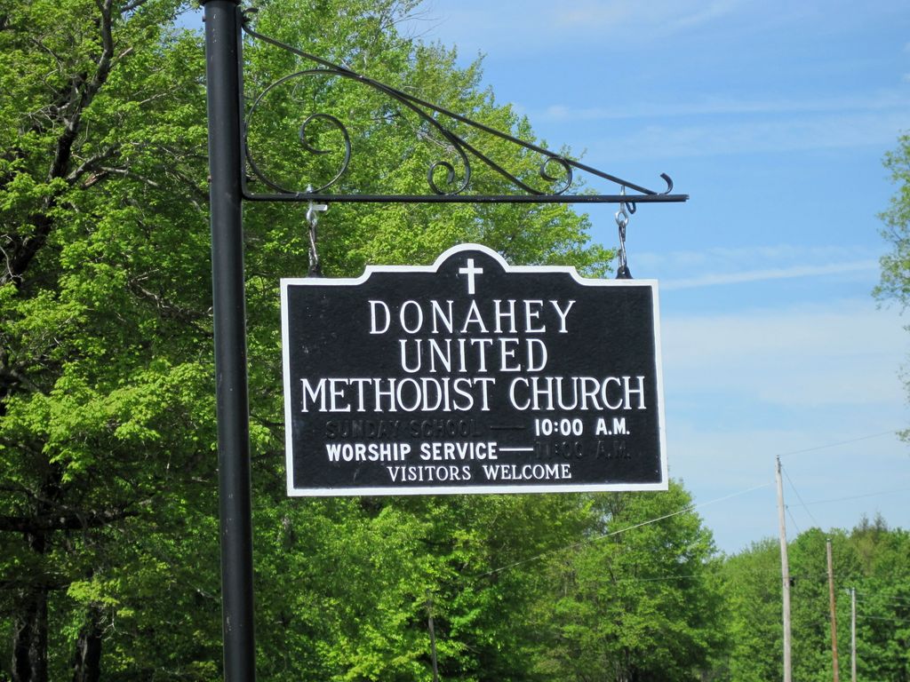
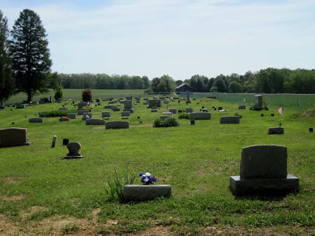
| Description | : | Donahey Hill Cemetery/Parrett Cemetery - at one time known as Donahey Evangelical United Brethren (EUB) Cemetery - Donahey Methodist Episcopal Cemetery - now Donahey Hill United Methodist Cemetery Millstone Township, Elk County, PA Located along Route 24002/3001, near the Clarion River, 2 miles North of Belltown, up the hill directly in back of the Donahey United Methodist Church |
frequently asked questions (FAQ):
-
Where is Donahey Hill Cemetery?
Donahey Hill Cemetery is located at Belltown, Elk County ,Pennsylvania ,USA.
-
Donahey Hill Cemetery cemetery's updated grave count on graveviews.com?
2 memorials
-
Where are the coordinates of the Donahey Hill Cemetery?
Latitude: 41.3745400
Longitude: -79.0065100
Nearby Cemetories:
1. Parrett Farm Cemetery
Millstone, Elk County, USA
Coordinate: 41.3937880, -78.9931740
2. Edeburn Hill Cemetery
Jefferson County, USA
Coordinate: 41.3369000, -79.0498000
3. Maxwell Run Cemetery
Elk County, USA
Coordinate: 41.3875008, -78.9336014
4. Blue Ridge Cemetery
Forest County, USA
Coordinate: 41.3594017, -79.1025009
5. Lake City Cemetery
Lake City, Elk County, USA
Coordinate: 41.3656000, -78.8855000
6. Clarington Methodist Cemetery
Clarington, Forest County, USA
Coordinate: 41.3353000, -79.1197000
7. Munderf Cemetery
Munderf, Jefferson County, USA
Coordinate: 41.2910995, -78.9413986
8. Daniels Cemetery
Port Barnett, Jefferson County, USA
Coordinate: 41.3183817, -79.1300323
9. Redclyffe Methodist Cemetery
Forest County, USA
Coordinate: 41.4019000, -79.1538000
10. Haight - Wing Family Cemetery
Jefferson County, USA
Coordinate: 41.3184000, -79.1440000
11. Donehey Cemetery
Sigel, Jefferson County, USA
Coordinate: 41.2744950, -79.1093610
12. North Forest Cemetery
Marienville, Forest County, USA
Coordinate: 41.4741200, -79.1240100
13. Saint Anns Cemetery
Marienville, Forest County, USA
Coordinate: 41.4745100, -79.1249400
14. Moorhead Cemetery
Jefferson County, USA
Coordinate: 41.2397200, -79.0116400
15. Maze Cemetery
Hottelville, Forest County, USA
Coordinate: 41.3470947, -79.1846251
16. Richardsville Baptist Cemetery
Richardsville, Jefferson County, USA
Coordinate: 41.2365000, -79.0122000
17. Greenwood Cemetery
Forest County, USA
Coordinate: 41.3808000, -79.1904000
18. Mount Tabor Cemetery
Sigel, Jefferson County, USA
Coordinate: 41.2655983, -79.1231003
19. Hominy Ridge Cemetery
Sigel, Jefferson County, USA
Coordinate: 41.3128014, -79.1808014
20. Roses Cemetery
Roses, Forest County, USA
Coordinate: 41.4547005, -79.1680984
21. Gilfoyle Methodist Church Cemetery
Gilfoyle, Forest County, USA
Coordinate: 41.4391230, -79.1819000
22. Saint Dominics Cemetery
Sigel, Jefferson County, USA
Coordinate: 41.2619019, -79.1318970
23. West Warsaw-Riggs Cemetery
Richardsville, Jefferson County, USA
Coordinate: 41.2268982, -79.0064011
24. Cooksburg Cemetery
Forest County, USA
Coordinate: 41.3293991, -79.1980972