
| Memorials | : | 4546 |
| Location | : | Donisthorpe, North West Leicestershire District, England |
| Coordinate | : | 52.7233238, -1.5321259 |
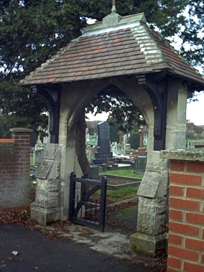
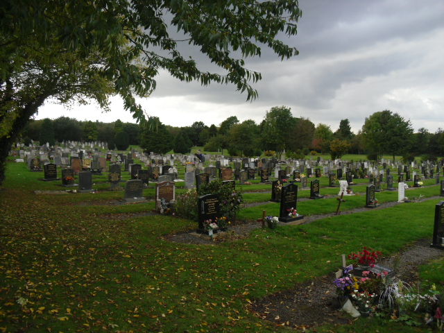
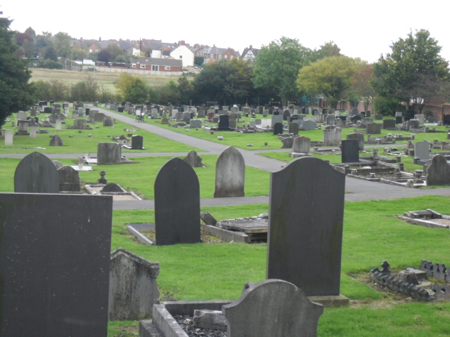
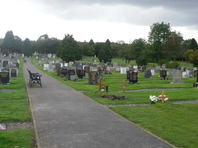
| Description | : | Donisthorpe Cemetery Gate. The Cemetery was opened in 1875, taking over from the church grounds of Donisthorpe Church for the burials of people (of all faiths) from Donisthorpe, Oakthorpe & Moira. It is still in use today. Many of the early burials do not have gravestones, as many of the local people were too poor to pay for them. |
frequently asked questions (FAQ):
-
Where is Donisthorpe Cemetery?
Donisthorpe Cemetery is located at Donisthorpe, North West Leicestershire District ,Leicestershire ,England.
-
Donisthorpe Cemetery cemetery's updated grave count on graveviews.com?
4544 memorials
-
Where are the coordinates of the Donisthorpe Cemetery?
Latitude: 52.7233238
Longitude: -1.5321259

Nearby Cemetories:
1. St. John the Evangelist Churchyard
Donisthorpe, North West Leicestershire District, England
Coordinate: 52.7222760, -1.5353450
2. St Tomas Church
Willesley, North West Leicestershire District, England
Coordinate: 52.7292530, -1.4970639
3. St Michael Churchyard
Stretton en le Field, North West Leicestershire District, England
Coordinate: 52.7040970, -1.5516120
4. St. Laurence Courtyard
Measham, North West Leicestershire District, England
Coordinate: 52.7065910, -1.5053110
5. St Peter Churchyard
Netherseal, South Derbyshire District, England
Coordinate: 52.7128960, -1.5741870
6. Measham Cemetery
Measham, North West Leicestershire District, England
Coordinate: 52.7041430, -1.4987930
7. Holy Rood Churchyard
Packington, North West Leicestershire District, England
Coordinate: 52.7268867, -1.4706219
8. Appleby Magna Cemetery
Appleby Magna, North West Leicestershire District, England
Coordinate: 52.6858670, -1.5358910
9. St Matthew Churchyard
Chilcote, North West Leicestershire District, England
Coordinate: 52.6995200, -1.5804990
10. St. Michael and All Angels Churchyard
Appleby Magna, North West Leicestershire District, England
Coordinate: 52.6854410, -1.5353870
11. St Margaret of Antioch Churchyard
Blackfordby, North West Leicestershire District, England
Coordinate: 52.7598200, -1.5115400
12. Ashby De La Zouch Cemetery
Ashby-de-la-Zouch, North West Leicestershire District, England
Coordinate: 52.7460403, -1.4794090
13. Holy Trinity
Ashby-de-la-Zouch, North West Leicestershire District, England
Coordinate: 52.7460010, -1.4757090
14. St. George and St. Mary Churchyard
Church Gresley, South Derbyshire District, England
Coordinate: 52.7597610, -1.5669370
15. St. Helen's Churchyard
Ashby-de-la-Zouch, North West Leicestershire District, England
Coordinate: 52.7473020, -1.4669660
16. Church Gresley Cemetery
Church Gresley, South Derbyshire District, England
Coordinate: 52.7666760, -1.5626180
17. St Mary the Virgin Churchyard
No Man's Heath, North Warwickshire Borough, England
Coordinate: 52.6770470, -1.5722540
18. Saint Peter Churchyard
Swepstone, North West Leicestershire District, England
Coordinate: 52.6912960, -1.4566030
19. All Saints Churchyard
Lullington, South Derbyshire District, England
Coordinate: 52.7135620, -1.6316530
20. St Peter's Church
Hartshorne, South Derbyshire District, England
Coordinate: 52.7840400, -1.5162100
21. Swadlincote Newhall and Stanton Burial Ground
Swadlincote, South Derbyshire District, England
Coordinate: 52.7818200, -1.5683500
22. St. John's Churchyard
Newhall, South Derbyshire District, England
Coordinate: 52.7825310, -1.5685700
23. St Mary Churchyard
Coton in the Elms, South Derbyshire District, England
Coordinate: 52.7358240, -1.6400740
24. St Mary the Virgin Churchyard
Newton Regis, North Warwickshire Borough, England
Coordinate: 52.6642390, -1.5886760