
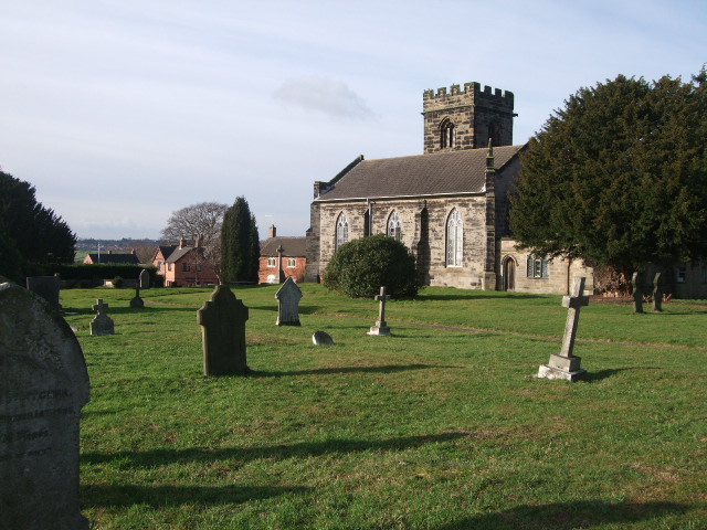
| Memorials | : | 0 |
| Location | : | Hartshorne, South Derbyshire District, England |
| Coordinate | : | 52.7840400, -1.5162100 |
frequently asked questions (FAQ):
-
Where is St Peter's Church?
St Peter's Church is located at Hartshorne, South Derbyshire District ,Derbyshire ,England.
-
St Peter's Church cemetery's updated grave count on graveviews.com?
0 memorials
-
Where are the coordinates of the St Peter's Church?
Latitude: 52.7840400
Longitude: -1.5162100


Nearby Cemetories:
1. St Margaret of Antioch Churchyard
Blackfordby, North West Leicestershire District, England
Coordinate: 52.7598200, -1.5115400
2. Swadlincote Newhall and Stanton Burial Ground
Swadlincote, South Derbyshire District, England
Coordinate: 52.7818200, -1.5683500
3. St. John's Churchyard
Newhall, South Derbyshire District, England
Coordinate: 52.7825310, -1.5685700
4. Church Gresley Cemetery
Church Gresley, South Derbyshire District, England
Coordinate: 52.7666760, -1.5626180
5. St. George's Churchyard
Ticknall, South Derbyshire District, England
Coordinate: 52.8133780, -1.4801570
6. Bretby Crematorium
Burton upon Trent, East Staffordshire Borough, England
Coordinate: 52.8008590, -1.5724250
7. St. George and St. Mary Churchyard
Church Gresley, South Derbyshire District, England
Coordinate: 52.7597610, -1.5669370
8. Ashby De La Zouch Cemetery
Ashby-de-la-Zouch, North West Leicestershire District, England
Coordinate: 52.7460403, -1.4794090
9. Holy Trinity
Ashby-de-la-Zouch, North West Leicestershire District, England
Coordinate: 52.7460010, -1.4757090
10. Holy Trinity Churchyard
Staunton Harold, North West Leicestershire District, England
Coordinate: 52.7841040, -1.4381631
11. Staunton Harold Churchyard
Ashby-de-la-Zouch, North West Leicestershire District, England
Coordinate: 52.7840510, -1.4381150
12. St. Helen's Churchyard
Ashby-de-la-Zouch, North West Leicestershire District, England
Coordinate: 52.7473020, -1.4669660
13. St Tomas Church
Willesley, North West Leicestershire District, England
Coordinate: 52.7292530, -1.4970639
14. St Mark Churchyard
Winshill, East Staffordshire Borough, England
Coordinate: 52.8082040, -1.6048350
15. St. Wystan's Churchyard
Repton, South Derbyshire District, England
Coordinate: 52.8411570, -1.5516380
16. Donisthorpe Cemetery
Donisthorpe, North West Leicestershire District, England
Coordinate: 52.7233238, -1.5321259
17. St. John the Evangelist Churchyard
Donisthorpe, North West Leicestershire District, England
Coordinate: 52.7222760, -1.5353450
18. Holy Rood Churchyard
Packington, North West Leicestershire District, England
Coordinate: 52.7268867, -1.4706219
19. St. Mary's Churchyard
Coleorton, North West Leicestershire District, England
Coordinate: 52.7513600, -1.4224500
20. St. Peter's Parish Churchyard
Stapenhill, East Staffordshire Borough, England
Coordinate: 52.7960899, -1.6230323
21. Stapenhill Cemetery
Burton upon Trent, East Staffordshire Borough, England
Coordinate: 52.8026310, -1.6208900
22. St Michael with St Mary Church
Melbourne, South Derbyshire District, England
Coordinate: 52.8210800, -1.4242900
23. St Michael & St Mary Old Churchyard
Melbourne, South Derbyshire District, England
Coordinate: 52.8221000, -1.4240900
24. Melbourne Cemetery
Melbourne, South Derbyshire District, England
Coordinate: 52.8291310, -1.4271470