
| Memorials | : | 0 |
| Location | : | Newhall, South Derbyshire District, England |
| Coordinate | : | 52.7825310, -1.5685700 |
frequently asked questions (FAQ):
-
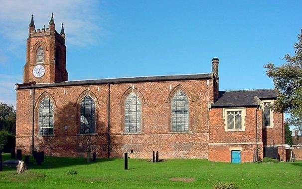
Where is St. John's Churchyard?
St. John's Churchyard is located at Newhall, South Derbyshire District ,Derbyshire ,England.
-
St. John's Churchyard cemetery's updated grave count on graveviews.com?
0 memorials
-
Where are the coordinates of the St. John's Churchyard?
Latitude: 52.7825310
Longitude: -1.5685700
Nearby Cemetories:
1. Swadlincote Newhall and Stanton Burial Ground
Swadlincote, South Derbyshire District, England
Coordinate: 52.7818200, -1.5683500
2. Church Gresley Cemetery
Church Gresley, South Derbyshire District, England
Coordinate: 52.7666760, -1.5626180
3. Bretby Crematorium
Burton upon Trent, East Staffordshire Borough, England
Coordinate: 52.8008590, -1.5724250
4. St. George and St. Mary Churchyard
Church Gresley, South Derbyshire District, England
Coordinate: 52.7597610, -1.5669370
5. St Peter's Church
Hartshorne, South Derbyshire District, England
Coordinate: 52.7840400, -1.5162100
6. St Mark Churchyard
Winshill, East Staffordshire Borough, England
Coordinate: 52.8082040, -1.6048350
7. St. Peter's Parish Churchyard
Stapenhill, East Staffordshire Borough, England
Coordinate: 52.7960899, -1.6230323
8. Stapenhill Cemetery
Burton upon Trent, East Staffordshire Borough, England
Coordinate: 52.8026310, -1.6208900
9. St Modwen Churchyard
Burton upon Trent, East Staffordshire Borough, England
Coordinate: 52.8013990, -1.6291340
10. Garden of Remembrance
Burton upon Trent, East Staffordshire Borough, England
Coordinate: 52.8023045, -1.6283625
11. St Margaret of Antioch Churchyard
Blackfordby, North West Leicestershire District, England
Coordinate: 52.7598200, -1.5115400
12. St. Wystan's Churchyard
Repton, South Derbyshire District, England
Coordinate: 52.8411570, -1.5516380
13. Saint Saviour's Cemetery
Burton upon Trent, East Staffordshire Borough, England
Coordinate: 52.7892907, -1.6668628
14. Saint John the Divine Churchyard
Horninglow, East Staffordshire Borough, England
Coordinate: 52.8237520, -1.6426170
15. St Mary's Churchyard
Stretton, South Staffordshire Borough, England
Coordinate: 52.8336500, -1.6253400
16. St. George's Churchyard
Ticknall, South Derbyshire District, England
Coordinate: 52.8133780, -1.4801570
17. St Mary's Church
Stretton, East Staffordshire Borough, England
Coordinate: 52.8341478, -1.6247215
18. Donisthorpe Cemetery
Donisthorpe, North West Leicestershire District, England
Coordinate: 52.7233238, -1.5321259
19. St. John the Evangelist Churchyard
Donisthorpe, North West Leicestershire District, England
Coordinate: 52.7222760, -1.5353450
20. St Mary Churchyard
Coton in the Elms, South Derbyshire District, England
Coordinate: 52.7358240, -1.6400740
21. Ashby De La Zouch Cemetery
Ashby-de-la-Zouch, North West Leicestershire District, England
Coordinate: 52.7460403, -1.4794090
22. Holy Trinity
Ashby-de-la-Zouch, North West Leicestershire District, England
Coordinate: 52.7460010, -1.4757090
23. St Michael Churchyard
Willington, South Derbyshire District, England
Coordinate: 52.8501540, -1.5636540
24. St. Wilfrid Churchyard
Egginton, South Derbyshire District, England
Coordinate: 52.8474570, -1.6041750