
| Memorials | : | 1 |
| Location | : | Dulverton, West Somerset District, England |
| Coordinate | : | 51.0391963, -3.5379907 |
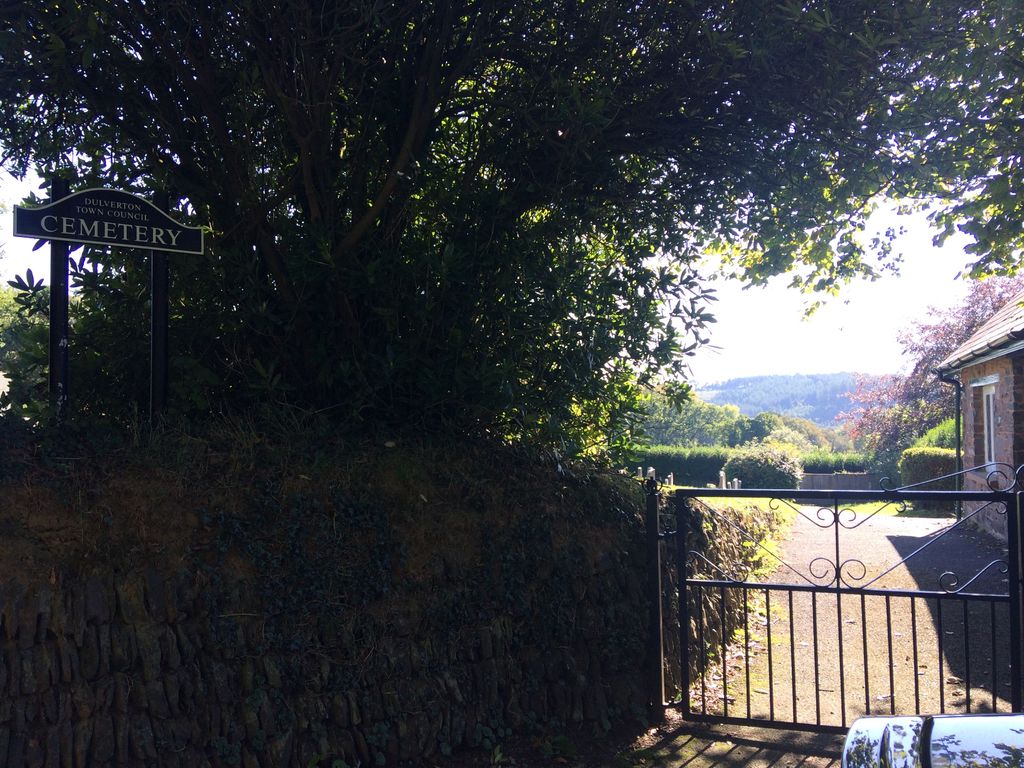
| Description | : | This cemetery is on Jury Road, it has been managed by the Dulverton Council since about 1936. It was opened because the graveyard at the parish church of All Saints was full. |
frequently asked questions (FAQ):
-
Where is Dulverton Cemetery?
Dulverton Cemetery is located at Dulverton, West Somerset District ,Somerset ,England.
-
Dulverton Cemetery cemetery's updated grave count on graveviews.com?
1 memorials
-
Where are the coordinates of the Dulverton Cemetery?
Latitude: 51.0391963
Longitude: -3.5379907
Nearby Cemetories:
1. All Saints Churchyard
Dulverton, West Somerset District, England
Coordinate: 51.0410700, -3.5496400
2. Dulverton Congregational Churchyard
Dulverton, West Somerset District, England
Coordinate: 51.0388932, -3.5516246
3. St. Nicholas Churchyard
Brushford, West Somerset District, England
Coordinate: 51.0207310, -3.5419430
4. St. George's Churchyard
Morebath, Mid Devon District, England
Coordinate: 51.0150600, -3.4922100
5. The Blessed Virgin Mary Churchyard
Brompton Regis, West Somerset District, England
Coordinate: 51.0731500, -3.4987200
6. St Peter's Church Exton
Exton, West Somerset District, England
Coordinate: 51.0925840, -3.5352300
7. Old St. James's Churchyard
Upton, West Somerset District, England
Coordinate: 51.0557770, -3.4563270
8. Saint John the Baptist Churchyard
Skilgate, West Somerset District, England
Coordinate: 51.0355480, -3.4462360
9. St. Michael and All Angels
Bampton, Mid Devon District, England
Coordinate: 50.9899580, -3.4877800
10. St Giles Churchyard
Hawkridge, West Somerset District, England
Coordinate: 51.0638000, -3.6266000
11. St. Petrock's Churchyard
West Anstey, North Devon District, England
Coordinate: 51.0352740, -3.6385530
12. St. James's Churchyard
Upton, West Somerset District, England
Coordinate: 51.0507060, -3.4341540
13. Winsford Churchyard
Winsford, West Somerset District, England
Coordinate: 51.1038000, -3.5665000
14. St Mary Magdalene Churchyard
Withiel Florey, West Somerset District, England
Coordinate: 51.0906773, -3.4478871
15. St. Michael’s Churchyard
Chipstable, Taunton Deane Borough, England
Coordinate: 51.0251300, -3.3982400
16. All Saints Churchyard
Huntsham, Mid Devon District, England
Coordinate: 50.9748900, -3.4237800
17. Saint Andrew's Churchyard
Withypool, West Somerset District, England
Coordinate: 51.1078060, -3.6492700
18. Blesssed Virgin Mary Churchyard
Luxborough, West Somerset District, England
Coordinate: 51.1321490, -3.4680500
19. St. John the Evangelist Churchyard
Cutcombe, West Somerset District, England
Coordinate: 51.1424576, -3.5295319
20. All Saints Churchyard
Rackenford, North Devon District, England
Coordinate: 50.9518940, -3.6378590
21. All Saints Cemetery
Chipstable, Taunton Deane Borough, England
Coordinate: 51.0354480, -3.3665950
22. Treborough Parish Churchyard
Treborough, West Somerset District, England
Coordinate: 51.1180220, -3.4147610
23. St. Mary Magdalene Churchyard
Exford, West Somerset District, England
Coordinate: 51.1341450, -3.6342160
24. St. Peter's Churchyard Huish Champflower
Chipstable, Taunton Deane Borough, England
Coordinate: 51.0543700, -3.3580940