
| Memorials | : | 0 |
| Location | : | Brompton Regis, West Somerset District, England |
| Coordinate | : | 51.0731500, -3.4987200 |
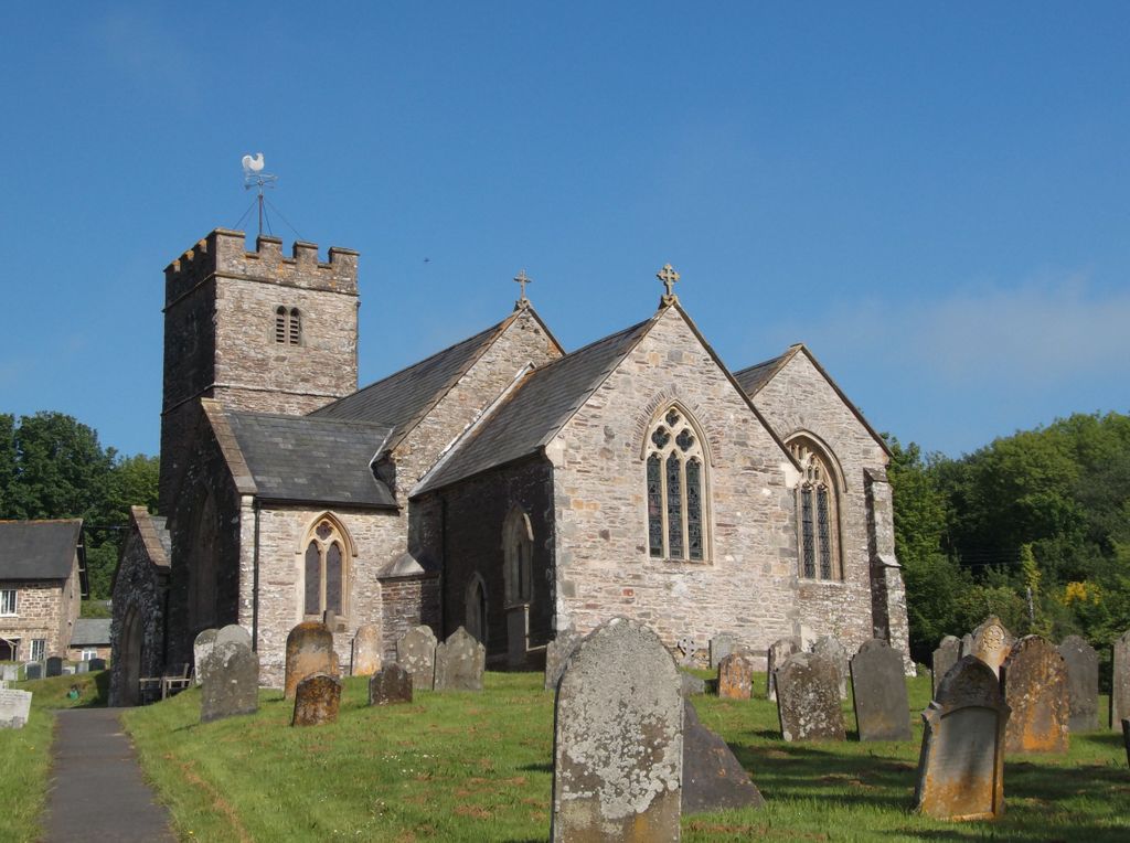
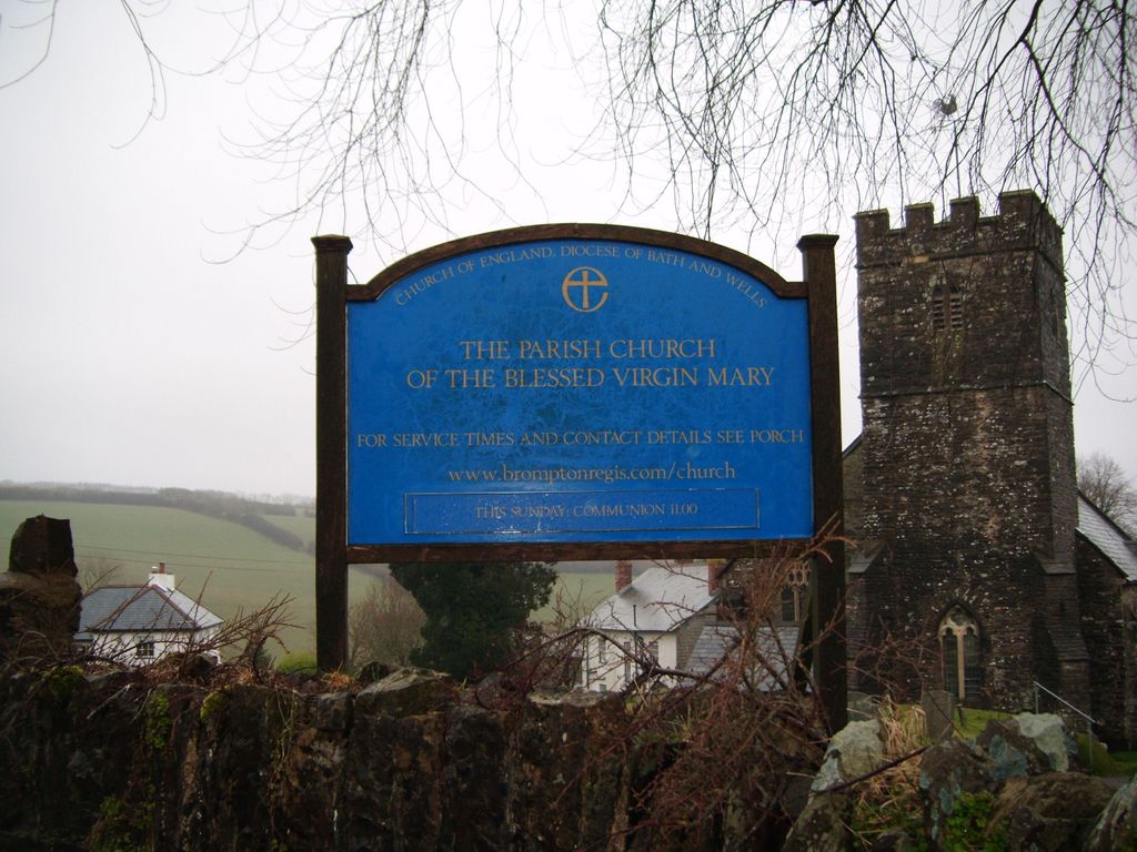
| Description | : | Not to be confused with the The Blessed Virgin Mary Churchyard in Brompton Ralph. Brompton Regis (formerly known as Kingsbrompton) is a village and civil parish in the West Somerset district of Somerset, England about 5 miles north-east of Dulverton. It is situated on the River Haddeo in the Brendon Hills within the Exmoor National Park, close to Wimbleball Lake, a water supply reservoir constructed in the 1970s and completed in 1979. The parish boundary is marked by the River Exe which is crossed by the medieval Chilly Bridge and Hele Bridge. The Haddeo is crossed by Bury Bridge.The village falls... Read More |
frequently asked questions (FAQ):
-
Where is The Blessed Virgin Mary Churchyard?
The Blessed Virgin Mary Churchyard is located at Brompton Regis, West Somerset District ,Somerset , TA22 9NNEngland.
-
The Blessed Virgin Mary Churchyard cemetery's updated grave count on graveviews.com?
0 memorials
-
Where are the coordinates of the The Blessed Virgin Mary Churchyard?
Latitude: 51.0731500
Longitude: -3.4987200

Nearby Cemetories:
1. St Peter's Church Exton
Exton, West Somerset District, England
Coordinate: 51.0925840, -3.5352300
2. Old St. James's Churchyard
Upton, West Somerset District, England
Coordinate: 51.0557770, -3.4563270
3. St Mary Magdalene Churchyard
Withiel Florey, West Somerset District, England
Coordinate: 51.0906773, -3.4478871
4. Dulverton Cemetery
Dulverton, West Somerset District, England
Coordinate: 51.0391963, -3.5379907
5. All Saints Churchyard
Dulverton, West Somerset District, England
Coordinate: 51.0410700, -3.5496400
6. St. James's Churchyard
Upton, West Somerset District, England
Coordinate: 51.0507060, -3.4341540
7. Dulverton Congregational Churchyard
Dulverton, West Somerset District, England
Coordinate: 51.0388932, -3.5516246
8. Saint John the Baptist Churchyard
Skilgate, West Somerset District, England
Coordinate: 51.0355480, -3.4462360
9. Winsford Churchyard
Winsford, West Somerset District, England
Coordinate: 51.1038000, -3.5665000
10. St. George's Churchyard
Morebath, Mid Devon District, England
Coordinate: 51.0150600, -3.4922100
11. St. Nicholas Churchyard
Brushford, West Somerset District, England
Coordinate: 51.0207310, -3.5419430
12. Blesssed Virgin Mary Churchyard
Luxborough, West Somerset District, England
Coordinate: 51.1321490, -3.4680500
13. Treborough Parish Churchyard
Treborough, West Somerset District, England
Coordinate: 51.1180220, -3.4147610
14. St. John the Evangelist Churchyard
Cutcombe, West Somerset District, England
Coordinate: 51.1424576, -3.5295319
15. St. Michael’s Churchyard
Chipstable, Taunton Deane Borough, England
Coordinate: 51.0251300, -3.3982400
16. St Giles Churchyard
Hawkridge, West Somerset District, England
Coordinate: 51.0638000, -3.6266000
17. St. Michael and All Angels
Bampton, Mid Devon District, England
Coordinate: 50.9899580, -3.4877800
18. St. Giles Churchyard of Leighland
Old Cleeve, West Somerset District, England
Coordinate: 51.1199950, -3.3842729
19. St. Peter's Churchyard Huish Champflower
Chipstable, Taunton Deane Borough, England
Coordinate: 51.0543700, -3.3580940
20. All Saints Cemetery
Chipstable, Taunton Deane Borough, England
Coordinate: 51.0354480, -3.3665950
21. Saint Mary Magdalene Churchyard
Clatworthy, West Somerset District, England
Coordinate: 51.0698450, -3.3534250
22. St. Petrock's Churchyard
Timberscombe, West Somerset District, England
Coordinate: 51.1680950, -3.4948210
23. St. Petrock's Churchyard
West Anstey, North Devon District, England
Coordinate: 51.0352740, -3.6385530
24. Saint Andrew's Churchyard
Withypool, West Somerset District, England
Coordinate: 51.1078060, -3.6492700