
| Memorials | : | 15 |
| Location | : | Green Township, Mahoning County, USA |
| Coordinate | : | 40.9835130, -80.8145550 |
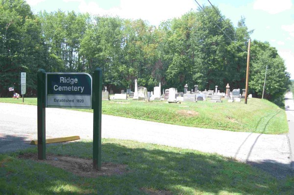
| Description | : | The cemetery is located on the southeast side of Youngstown-Salem Road (US 62) at its intersection with Knauf Road (County Road 75). The cemetery was established in the 1820s. The cemetery is located in Green Township, Mahoning County, Ohio, and is # 7259 (Dutch Ridge Cemetery / Saint Johns Church Ridge Cemetery) in “Ohio Cemeteries 1803-2003”, compiled by the Ohio Genealogical Society. The U.S. Geological Survey (USGS) Geographic Names Information System (GNIS) feature ID for the cemetery is 1039902 (Dutch Ridge Cemetery). |
frequently asked questions (FAQ):
-
Where is Dutch Ridge Cemetery?
Dutch Ridge Cemetery is located at Youngstown-Salem Road (US 62) Green Township, Mahoning County ,Ohio , 44406USA.
-
Dutch Ridge Cemetery cemetery's updated grave count on graveviews.com?
15 memorials
-
Where are the coordinates of the Dutch Ridge Cemetery?
Latitude: 40.9835130
Longitude: -80.8145550
Nearby Cemetories:
1. Cool Family Cemetery
Greenford, Mahoning County, USA
Coordinate: 40.9641100, -80.7815880
2. Calla Cemetery
Calla, Mahoning County, USA
Coordinate: 40.9727600, -80.7716800
3. Bethel Methodist Episcopal Cemetery
Goshen Township, Mahoning County, USA
Coordinate: 40.9757800, -80.8655100
4. Christian Cemetery
Greenford, Mahoning County, USA
Coordinate: 40.9438705, -80.8023529
5. Saint Pauls Monastery Cemetery
Canfield, Mahoning County, USA
Coordinate: 41.0228160, -80.8288300
6. Greenford Lutheran Church Cemetery
Mahoning County, USA
Coordinate: 40.9436700, -80.7970200
7. Greenlawn Cemetery
Greenford, Mahoning County, USA
Coordinate: 40.9430000, -80.7970000
8. New Albany Cemetery
New Albany, Mahoning County, USA
Coordinate: 40.9443640, -80.8388010
9. Ellsworth Cemetery
Ellsworth, Mahoning County, USA
Coordinate: 41.0244700, -80.8510760
10. Dean Hill Cemetery
Canfield, Mahoning County, USA
Coordinate: 41.0353012, -80.7957993
11. Locust Grove Cemetery
Mahoning County, USA
Coordinate: 40.9435300, -80.7631500
12. Dressel Farm Cemetery
Greenford, Mahoning County, USA
Coordinate: 40.9363770, -80.7745730
13. Canfield Village Cemetery
Canfield, Mahoning County, USA
Coordinate: 41.0242830, -80.7536270
14. Callahan Family Cemetery
Greenford, Mahoning County, USA
Coordinate: 40.9160550, -80.8083680
15. Geeburg Methodist Church Cemetery
Ellsworth, Mahoning County, USA
Coordinate: 41.0487850, -80.8380010
16. Old North Cemetery
Canfield, Mahoning County, USA
Coordinate: 41.0393982, -80.7600021
17. Infirmary Cemetery
Canfield, Mahoning County, USA
Coordinate: 41.0482500, -80.7792950
18. Paradise Lutheran Cemetery
Canfield, Mahoning County, USA
Coordinate: 40.9872800, -80.7203500
19. Sharon Mennonite Fellowship Cemetery
Green Township, Mahoning County, USA
Coordinate: 40.9286850, -80.7463390
20. Hope Cemetery
Salem, Columbiana County, USA
Coordinate: 40.9096985, -80.8494034
21. Paradise Cemetery
North Lima, Mahoning County, USA
Coordinate: 40.9728369, -80.7061874
22. Washingtonville Cemetery
Washingtonville, Mahoning County, USA
Coordinate: 40.9033012, -80.7846985
23. Covenanter Cemetery
North Jackson, Mahoning County, USA
Coordinate: 41.0687270, -80.8201110
24. Green Haven Memorial Gardens
Canfield, Mahoning County, USA
Coordinate: 41.0625340, -80.7594670