
| Memorials | : | 0 |
| Location | : | Greenford, Mahoning County, USA |
| Coordinate | : | 40.9363770, -80.7745730 |
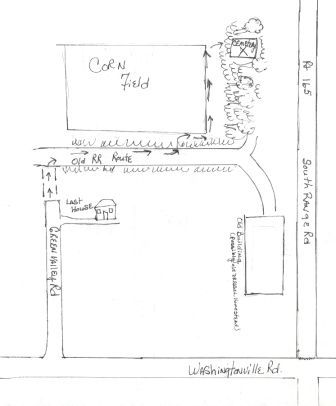
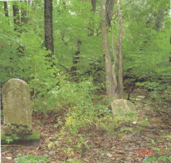
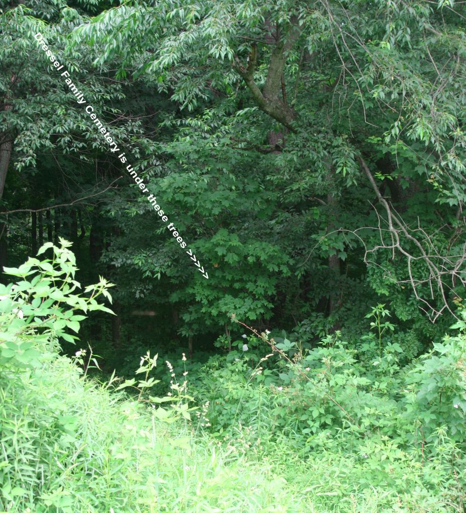
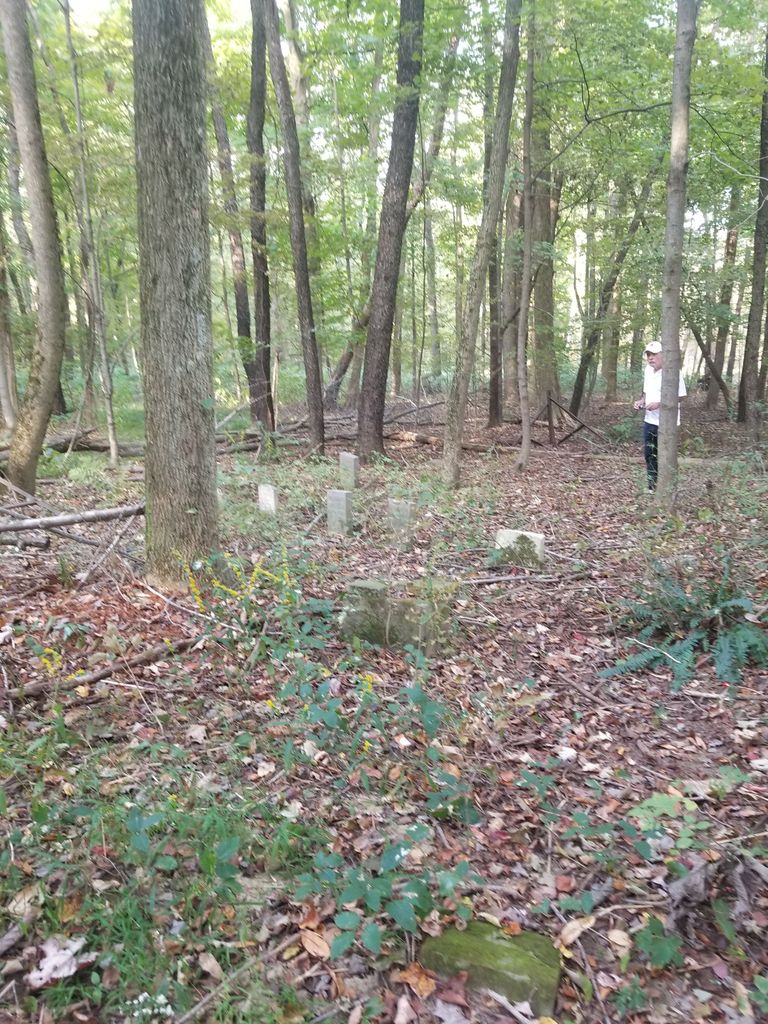
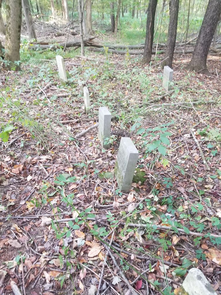
| Description | : | The cemetery is located northwest of the west end of Green Valley Drive (Township Highway 295), which intersects with Washingtonville Road (Township Highway 95). The cemetery is located in Green Township, Mahoning County, Ohio, and is # 7258 (Dressel Cemetery) in “Ohio Cemeteries 1803-2003”, compiled by the Ohio Genealogical Society. |
frequently asked questions (FAQ):
-
Where is Dressel Farm Cemetery?
Dressel Farm Cemetery is located at Green Valley Drive Greenford, Mahoning County ,Ohio , 44460USA.
-
Dressel Farm Cemetery cemetery's updated grave count on graveviews.com?
0 memorials
-
Where are the coordinates of the Dressel Farm Cemetery?
Latitude: 40.9363770
Longitude: -80.7745730
Nearby Cemetories:
1. Locust Grove Cemetery
Mahoning County, USA
Coordinate: 40.9435300, -80.7631500
2. Greenlawn Cemetery
Greenford, Mahoning County, USA
Coordinate: 40.9430000, -80.7970000
3. Greenford Lutheran Church Cemetery
Mahoning County, USA
Coordinate: 40.9436700, -80.7970200
4. Christian Cemetery
Greenford, Mahoning County, USA
Coordinate: 40.9438705, -80.8023529
5. Sharon Mennonite Fellowship Cemetery
Green Township, Mahoning County, USA
Coordinate: 40.9286850, -80.7463390
6. Cool Family Cemetery
Greenford, Mahoning County, USA
Coordinate: 40.9641100, -80.7815880
7. Callahan Family Cemetery
Greenford, Mahoning County, USA
Coordinate: 40.9160550, -80.8083680
8. Washingtonville Cemetery
Washingtonville, Mahoning County, USA
Coordinate: 40.9033012, -80.7846985
9. Robbins Methodist Cemetery
Washingtonville, Mahoning County, USA
Coordinate: 40.9016000, -80.7650800
10. Trinity Lutheran Cemetery
Washingtonville, Mahoning County, USA
Coordinate: 40.9013880, -80.7646550
11. Calla Cemetery
Calla, Mahoning County, USA
Coordinate: 40.9727600, -80.7716800
12. Pleasant View Mennonite Church Cemetery
Mahoning County, USA
Coordinate: 40.9223400, -80.7266500
13. Midway Mennonite Church Cemetery
Mahoning County, USA
Coordinate: 40.9243400, -80.7183500
14. Mount Joy Mennonite Church Cemetery
Leetonia, Columbiana County, USA
Coordinate: 40.8922670, -80.7600100
15. New Albany Cemetery
New Albany, Mahoning County, USA
Coordinate: 40.9443640, -80.8388010
16. Dutch Ridge Cemetery
Green Township, Mahoning County, USA
Coordinate: 40.9835130, -80.8145550
17. Esterly Cemetery
Leetonia, Columbiana County, USA
Coordinate: 40.8886700, -80.7270200
18. Zion Hill Church of the Brethren Cemetery
North Lima, Mahoning County, USA
Coordinate: 40.9067700, -80.7052420
19. Hope Cemetery
Salem, Columbiana County, USA
Coordinate: 40.9096985, -80.8494034
20. Paradise Cemetery
North Lima, Mahoning County, USA
Coordinate: 40.9728369, -80.7061874
21. Nold Mennonite Cemetery
Leetonia, Columbiana County, USA
Coordinate: 40.8771820, -80.7394080
22. Paradise Lutheran Cemetery
Canfield, Mahoning County, USA
Coordinate: 40.9872800, -80.7203500
23. Paupers Field
Salem, Columbiana County, USA
Coordinate: 40.8882050, -80.8388590
24. Evangelical Church Cemetery
North Lima, Mahoning County, USA
Coordinate: 40.9269560, -80.6832690