
| Memorials | : | 0 |
| Location | : | Plymouth, Plymouth Unitary Authority, England |
| Website | : | www.plymouthcentralhall.co.uk/ |
| Coordinate | : | 50.3732824, -4.1391355 |
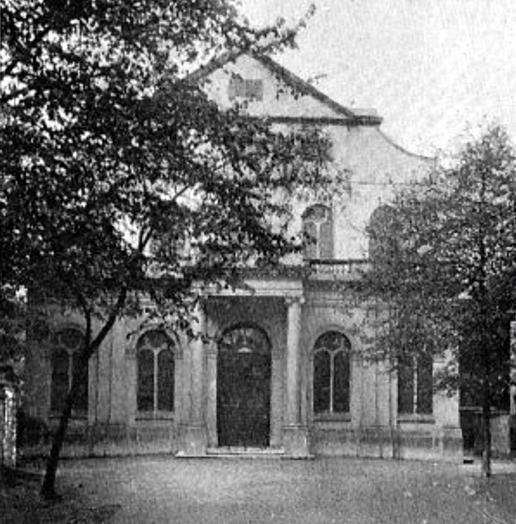
| Description | : | Ebenezer Methodist chapel and burial ground (now defunct) was situated on Saltash Street, Plymouth, England, now Eastlake Street. The burial ground included both graves and a row of vaults along the north side of the grounds. While the chapel is still in existence as the Plymouth Central Methodist Hall, the cemetery and vaults were removed in the early 1970s, all burials relocated into a mass grave in the "Little Quarry" aka Sunken Garden in Milehouse Cemetery at Efford Cemetery, Plymouth. Along with the Ebenezer Methodist chapel cemetery, numerous other now defunct cemeteries such as St Andrew's churchyard,... Read More |
frequently asked questions (FAQ):
-
Where is Ebenezer Methodist Chapel Burial Grounds?
Ebenezer Methodist Chapel Burial Grounds is located at Saltash Street (today Eastlake Street) Plymouth, Plymouth Unitary Authority ,Devon , PL1 1BAEngland.
-
Ebenezer Methodist Chapel Burial Grounds cemetery's updated grave count on graveviews.com?
0 memorials
-
Where are the coordinates of the Ebenezer Methodist Chapel Burial Grounds?
Latitude: 50.3732824
Longitude: -4.1391355
Nearby Cemetories:
1. St Andrew Churchyard (Defunct)
Plymouth, Plymouth Unitary Authority, England
Coordinate: 50.3699100, -4.1399240
2. Plymouth Hoe Old Jews Burial Ground
Plymouth, Plymouth Unitary Authority, England
Coordinate: 50.3667290, -4.1365800
3. Plymouth Naval Memorial
Plymouth, Plymouth Unitary Authority, England
Coordinate: 50.3655739, -4.1422210
4. Ford Park Cemetery
Plymouth, Plymouth Unitary Authority, England
Coordinate: 50.3813700, -4.1446090
5. St Peter and The Holy Apostles Churchyard
Plymouth, Plymouth Unitary Authority, England
Coordinate: 50.3731580, -4.1544280
6. Gifford Place Jewish Cemetery
Plymouth, Plymouth Unitary Authority, England
Coordinate: 50.3841970, -4.1408370
7. St. Andrew with St. Luke Churchyard
Devonport, Plymouth Unitary Authority, England
Coordinate: 50.3747560, -4.1625170
8. Milehouse Cemetery
Devonport, Plymouth Unitary Authority, England
Coordinate: 50.3814650, -4.1636975
9. Oreston Methodist Church Burial Ground
Oreston, Plymouth Unitary Authority, England
Coordinate: 50.3608000, -4.1080700
10. St John's Cemetery
Hooe, Plymouth Unitary Authority, England
Coordinate: 50.3540100, -4.1157900
11. Efford Cemetery and Crematorium
Plymouth, Plymouth Unitary Authority, England
Coordinate: 50.3908900, -4.1100080
12. St. Pancras Church Cemetery
Pennycross, Plymouth Unitary Authority, England
Coordinate: 50.4004000, -4.1497900
13. Howard Road Dissenters Cemetery
Plymstock, Plymouth Unitary Authority, England
Coordinate: 50.3654900, -4.0963000
14. St. Pancras Churchyard
Pennycross, Plymouth Unitary Authority, England
Coordinate: 50.4012300, -4.1510700
15. Weston Mill Cemetery and Crematorium
Plymouth, Plymouth Unitary Authority, England
Coordinate: 50.3954330, -4.1719780
16. St. Edward's Churchyard
Eggbuckland, Plymouth Unitary Authority, England
Coordinate: 50.4007100, -4.1146830
17. St Mary and All Saints Churchyard
Plymstock, Plymouth Unitary Authority, England
Coordinate: 50.3582720, -4.0859640
18. Maker Churchyard
Maker, Cornwall Unitary Authority, England
Coordinate: 50.3472048, -4.1853155
19. Estover
Estover, Plymouth Unitary Authority, England
Coordinate: 50.4100000, -4.1000000
20. Drake Memorial Park
Plympton, Plymouth Unitary Authority, England
Coordinate: 50.3752530, -4.0686940
21. St Budoc Churchyard
St Budeaux, Plymouth Unitary Authority, England
Coordinate: 50.4130353, -4.1769516
22. St Mary Blessed Virgin Churchyard
Plympton, Plymouth Unitary Authority, England
Coordinate: 50.3881800, -4.0595100
23. St Mary's Church
Tamerton Foliot, Plymouth Unitary Authority, England
Coordinate: 50.4279200, -4.1582500
24. Horson Cemetery
Antony, Cornwall Unitary Authority, England
Coordinate: 50.3744400, -4.2283200