
| Memorials | : | 1 |
| Location | : | Plymouth, Plymouth Unitary Authority, England |
| Coordinate | : | 50.3699100, -4.1399240 |
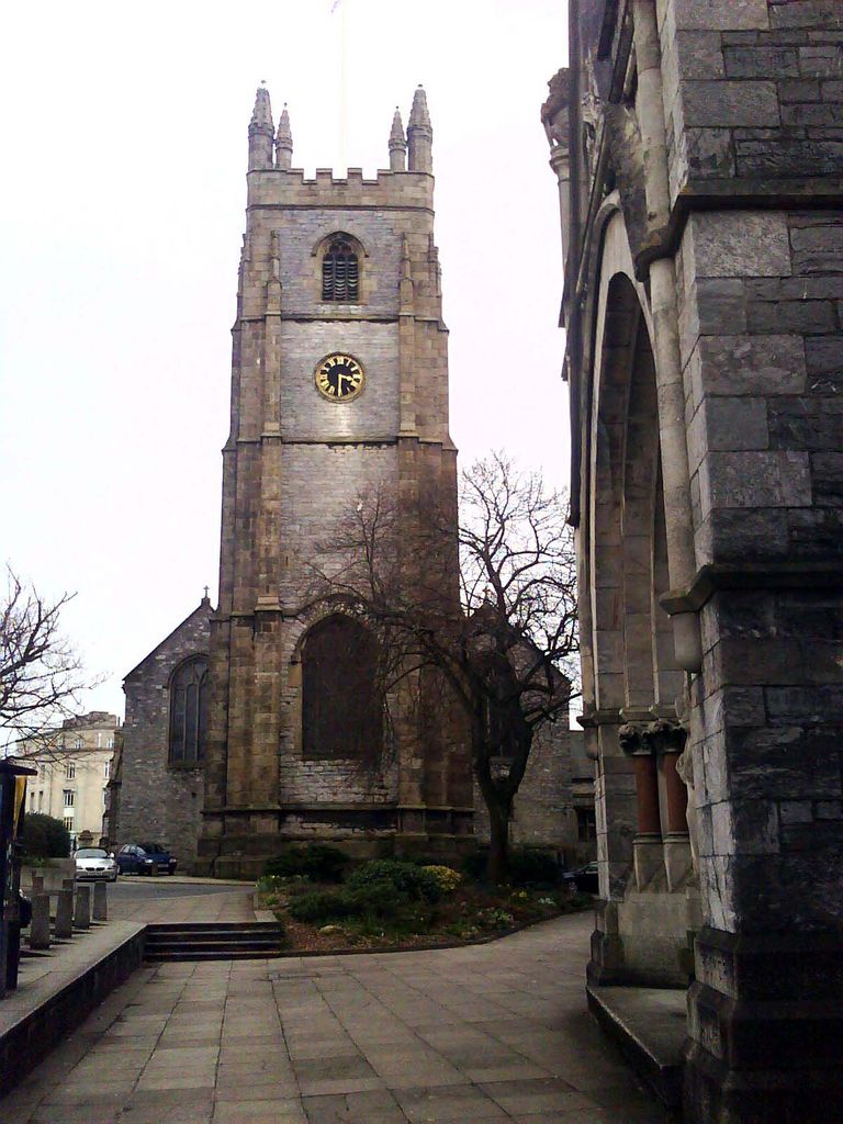
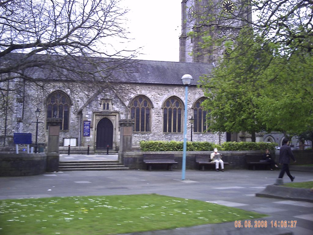
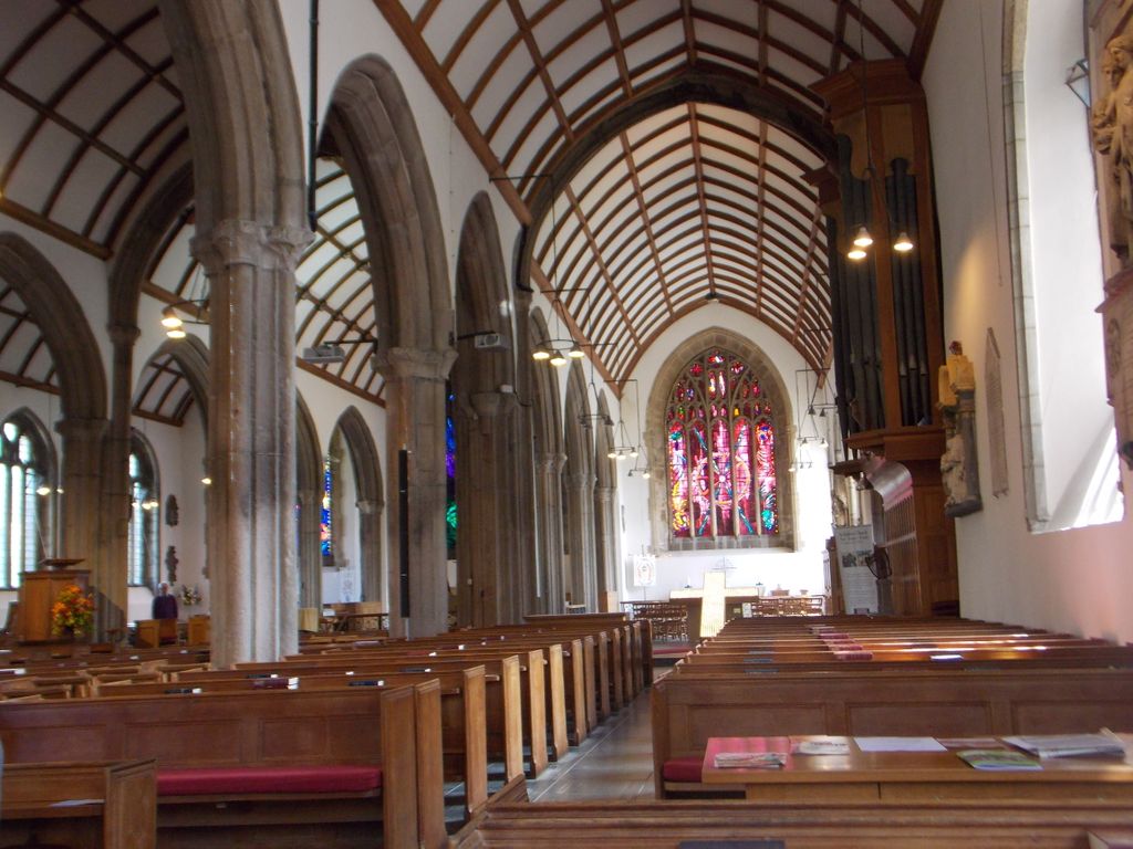
| Description | : | St Andrew's Church, Plymouth, also known as the Minster Church of St Andrew (since 2009), was built in the mid to late 15th century. It is the original parish church of Sutton, one of the three towns which were later combined to form the city of Plymouth. The church is the largest parish church in the historic county of Devon and likely on the site of the original Saxon church that was once attached Plympton Abbey. Bombed and badly damaged in the Blitz 1941, re-roofed and restored in 1957. |
frequently asked questions (FAQ):
-
Where is St Andrew Churchyard (Defunct)?
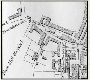
St Andrew Churchyard (Defunct) is located at Royal Parade Plymouth, Plymouth Unitary Authority ,Devon , PL1 2ADEngland.
-
St Andrew Churchyard (Defunct) cemetery's updated grave count on graveviews.com?
1 memorials
-
Where are the coordinates of the St Andrew Churchyard (Defunct)?
Latitude: 50.3699100
Longitude: -4.1399240
Nearby Cemetories:
1. Ebenezer Methodist Chapel Burial Grounds
Plymouth, Plymouth Unitary Authority, England
Coordinate: 50.3732824, -4.1391355
2. Plymouth Hoe Old Jews Burial Ground
Plymouth, Plymouth Unitary Authority, England
Coordinate: 50.3667290, -4.1365800
3. Plymouth Naval Memorial
Plymouth, Plymouth Unitary Authority, England
Coordinate: 50.3655739, -4.1422210
4. St Peter and The Holy Apostles Churchyard
Plymouth, Plymouth Unitary Authority, England
Coordinate: 50.3731580, -4.1544280
5. Ford Park Cemetery
Plymouth, Plymouth Unitary Authority, England
Coordinate: 50.3813700, -4.1446090
6. Gifford Place Jewish Cemetery
Plymouth, Plymouth Unitary Authority, England
Coordinate: 50.3841970, -4.1408370
7. St. Andrew with St. Luke Churchyard
Devonport, Plymouth Unitary Authority, England
Coordinate: 50.3747560, -4.1625170
8. Milehouse Cemetery
Devonport, Plymouth Unitary Authority, England
Coordinate: 50.3814650, -4.1636975
9. St John's Cemetery
Hooe, Plymouth Unitary Authority, England
Coordinate: 50.3540100, -4.1157900
10. Oreston Methodist Church Burial Ground
Oreston, Plymouth Unitary Authority, England
Coordinate: 50.3608000, -4.1080700
11. Howard Road Dissenters Cemetery
Plymstock, Plymouth Unitary Authority, England
Coordinate: 50.3654900, -4.0963000
12. Efford Cemetery and Crematorium
Plymouth, Plymouth Unitary Authority, England
Coordinate: 50.3908900, -4.1100080
13. St. Pancras Church Cemetery
Pennycross, Plymouth Unitary Authority, England
Coordinate: 50.4004000, -4.1497900
14. St. Pancras Churchyard
Pennycross, Plymouth Unitary Authority, England
Coordinate: 50.4012300, -4.1510700
15. Weston Mill Cemetery and Crematorium
Plymouth, Plymouth Unitary Authority, England
Coordinate: 50.3954330, -4.1719780
16. St. Edward's Churchyard
Eggbuckland, Plymouth Unitary Authority, England
Coordinate: 50.4007100, -4.1146830
17. St Mary and All Saints Churchyard
Plymstock, Plymouth Unitary Authority, England
Coordinate: 50.3582720, -4.0859640
18. Maker Churchyard
Maker, Cornwall Unitary Authority, England
Coordinate: 50.3472048, -4.1853155
19. Drake Memorial Park
Plympton, Plymouth Unitary Authority, England
Coordinate: 50.3752530, -4.0686940
20. Estover
Estover, Plymouth Unitary Authority, England
Coordinate: 50.4100000, -4.1000000
21. St Budoc Churchyard
St Budeaux, Plymouth Unitary Authority, England
Coordinate: 50.4130353, -4.1769516
22. St Mary Blessed Virgin Churchyard
Plympton, Plymouth Unitary Authority, England
Coordinate: 50.3881800, -4.0595100
23. Horson Cemetery
Antony, Cornwall Unitary Authority, England
Coordinate: 50.3744400, -4.2283200
24. St Mary's Church
Tamerton Foliot, Plymouth Unitary Authority, England
Coordinate: 50.4279200, -4.1582500