
| Memorials | : | 3 |
| Location | : | Plymouth, Plymouth Unitary Authority, England |
| Coordinate | : | 50.3655739, -4.1422210 |
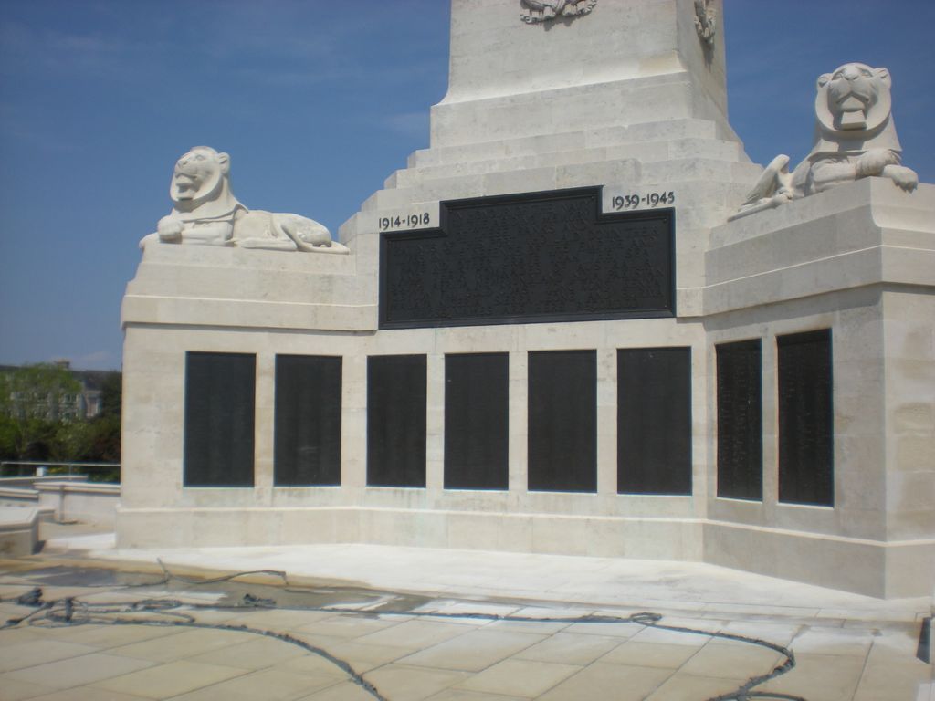
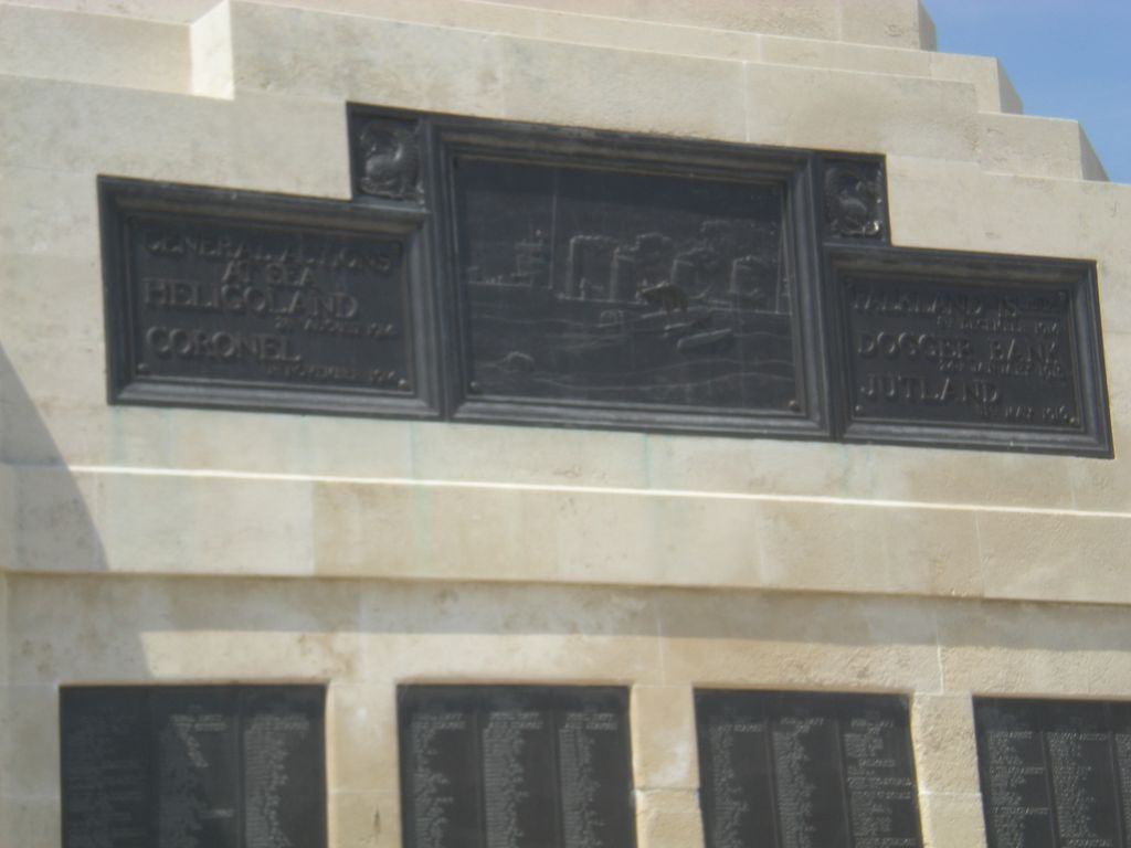
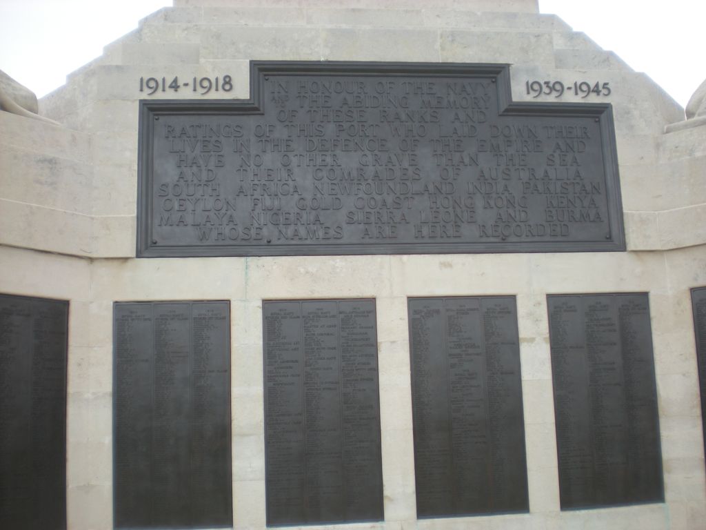
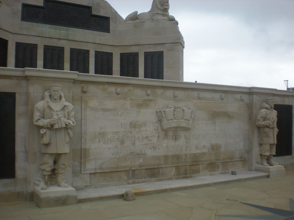
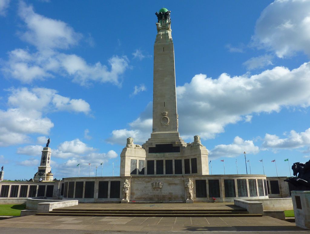
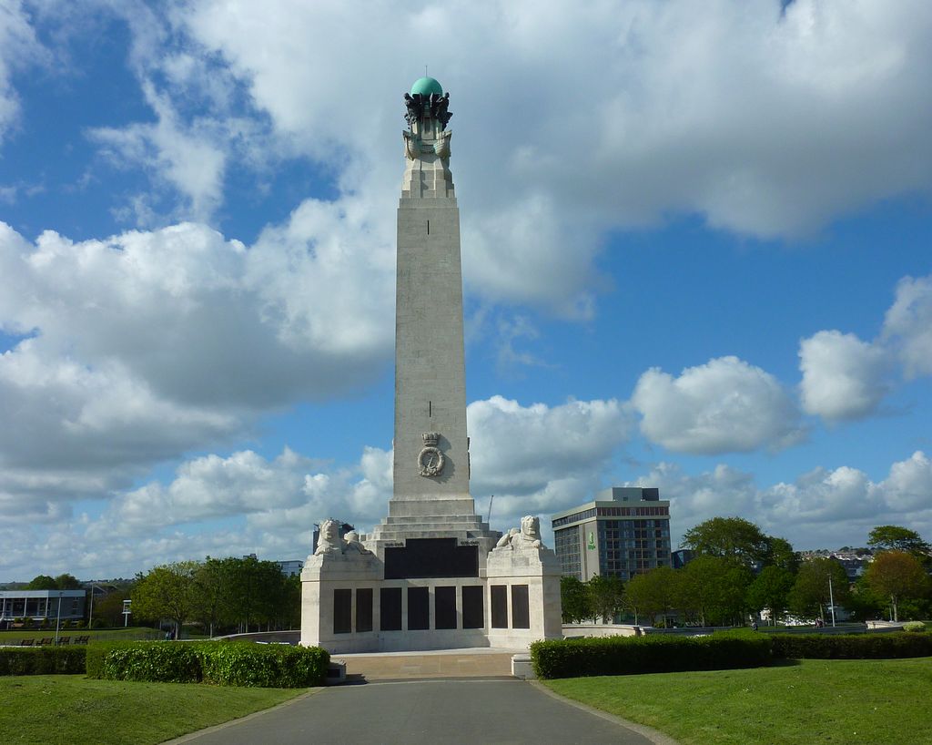
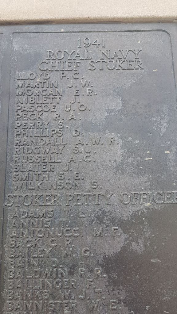
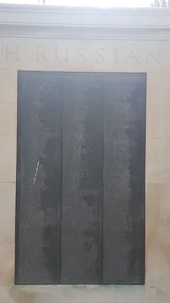
| Description | : | The Memorial is located in the central area of the The Hoe, specifically Hoe Park, bordered on the north by Citadel Road and on the west by Lockyer Street. The Memorial is open to the public at all times, 365 days a year. The Memorial was developed after World War One (architect Sir Robert Lorimer, sculptor Henry Poole) as a way of recognizing members of the Royal Navy who gave their lives at sea and were either lost or buried at sea. The Memorial is one of three, the other two located at Chatham and Portsmouth. An addition was created after... Read More |
frequently asked questions (FAQ):
-
Where is Plymouth Naval Memorial?
Plymouth Naval Memorial is located at Plymouth, Plymouth Unitary Authority ,Devon ,England.
-
Plymouth Naval Memorial cemetery's updated grave count on graveviews.com?
3 memorials
-
Where are the coordinates of the Plymouth Naval Memorial?
Latitude: 50.3655739
Longitude: -4.1422210
Nearby Cemetories:
1. Plymouth Hoe Old Jews Burial Ground
Plymouth, Plymouth Unitary Authority, England
Coordinate: 50.3667290, -4.1365800
2. St Andrew Churchyard (Defunct)
Plymouth, Plymouth Unitary Authority, England
Coordinate: 50.3699100, -4.1399240
3. Ebenezer Methodist Chapel Burial Grounds
Plymouth, Plymouth Unitary Authority, England
Coordinate: 50.3732824, -4.1391355
4. St Peter and The Holy Apostles Churchyard
Plymouth, Plymouth Unitary Authority, England
Coordinate: 50.3731580, -4.1544280
5. Ford Park Cemetery
Plymouth, Plymouth Unitary Authority, England
Coordinate: 50.3813700, -4.1446090
6. St. Andrew with St. Luke Churchyard
Devonport, Plymouth Unitary Authority, England
Coordinate: 50.3747560, -4.1625170
7. Gifford Place Jewish Cemetery
Plymouth, Plymouth Unitary Authority, England
Coordinate: 50.3841970, -4.1408370
8. St John's Cemetery
Hooe, Plymouth Unitary Authority, England
Coordinate: 50.3540100, -4.1157900
9. Milehouse Cemetery
Devonport, Plymouth Unitary Authority, England
Coordinate: 50.3814650, -4.1636975
10. Oreston Methodist Church Burial Ground
Oreston, Plymouth Unitary Authority, England
Coordinate: 50.3608000, -4.1080700
11. Howard Road Dissenters Cemetery
Plymstock, Plymouth Unitary Authority, England
Coordinate: 50.3654900, -4.0963000
12. Efford Cemetery and Crematorium
Plymouth, Plymouth Unitary Authority, England
Coordinate: 50.3908900, -4.1100080
13. Maker Churchyard
Maker, Cornwall Unitary Authority, England
Coordinate: 50.3472048, -4.1853155
14. St. Pancras Church Cemetery
Pennycross, Plymouth Unitary Authority, England
Coordinate: 50.4004000, -4.1497900
15. Weston Mill Cemetery and Crematorium
Plymouth, Plymouth Unitary Authority, England
Coordinate: 50.3954330, -4.1719780
16. St. Pancras Churchyard
Pennycross, Plymouth Unitary Authority, England
Coordinate: 50.4012300, -4.1510700
17. St Mary and All Saints Churchyard
Plymstock, Plymouth Unitary Authority, England
Coordinate: 50.3582720, -4.0859640
18. St. Edward's Churchyard
Eggbuckland, Plymouth Unitary Authority, England
Coordinate: 50.4007100, -4.1146830
19. Drake Memorial Park
Plympton, Plymouth Unitary Authority, England
Coordinate: 50.3752530, -4.0686940
20. Estover
Estover, Plymouth Unitary Authority, England
Coordinate: 50.4100000, -4.1000000
21. St Budoc Churchyard
St Budeaux, Plymouth Unitary Authority, England
Coordinate: 50.4130353, -4.1769516
22. Horson Cemetery
Antony, Cornwall Unitary Authority, England
Coordinate: 50.3744400, -4.2283200
23. St Mary Blessed Virgin Churchyard
Plympton, Plymouth Unitary Authority, England
Coordinate: 50.3881800, -4.0595100
24. St Werburgh's Churchyard
Wembury, South Hams District, England
Coordinate: 50.3178240, -4.0827135