
| Memorials | : | 14 |
| Location | : | Pemberville, Wood County, USA |
| Coordinate | : | 41.3866997, -83.4347000 |
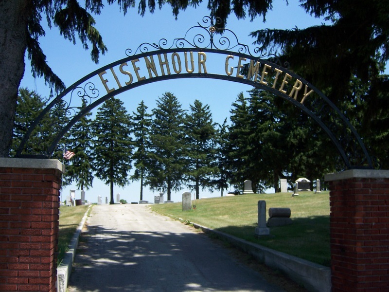
| Description | : | The cemetery is located on the east side of Bradner Road (County Road 16) about 0.1 miles south of its intersection with Eisenhour Road. The first burial in the cemetery occurred in 1841. The cemetery is located in Freedom Township, Wood County, Ohio, and is # 12851 (Eisenhauer Cemetery / Eisenhower Cemetery / Eisenhour Cemetery) in “Ohio Cemeteries 1803-2003”, compiled by the Ohio Genealogical Society. The cemetery is registered with the Ohio Division of Real Estate and Professional Licensing (ODRE) as Eisenhour Ridge Cemetery with registration license number CBR.0000980120. The U.S. Geological Survey (USGS) Geographic Names Information System... Read More |
frequently asked questions (FAQ):
-
Where is Eisenhour Cemetery?
Eisenhour Cemetery is located at Bradner Road Pemberville, Wood County ,Ohio , 43450USA.
-
Eisenhour Cemetery cemetery's updated grave count on graveviews.com?
13 memorials
-
Where are the coordinates of the Eisenhour Cemetery?
Latitude: 41.3866997
Longitude: -83.4347000
Nearby Cemetories:
1. Pemberville Cemetery
Pemberville, Wood County, USA
Coordinate: 41.3958015, -83.4914017
2. Brandeberry Cemetery
Freedom Township, Wood County, USA
Coordinate: 41.3838997, -83.5017014
3. Fish Cemetery
Pemberville, Wood County, USA
Coordinate: 41.3699989, -83.5038986
4. Myers Cemetery
New Rochester, Wood County, USA
Coordinate: 41.3621708, -83.5034170
5. Salem Church Cemetery
Luckey, Wood County, USA
Coordinate: 41.4438300, -83.4344900
6. Chestnut Grove Cemetery
Scott Township, Sandusky County, USA
Coordinate: 41.3268590, -83.4171130
7. Bradner Cemetery
Bradner, Wood County, USA
Coordinate: 41.3267403, -83.4177170
8. Quinshan Cemetery
Gibsonburg, Sandusky County, USA
Coordinate: 41.3539009, -83.3602982
9. Pember Farm Cemetery
Rollersville, Sandusky County, USA
Coordinate: 41.3341904, -83.3812103
10. West Union Cemetery
Gibsonburg, Sandusky County, USA
Coordinate: 41.3842010, -83.3377991
11. Troy Township Cemetery
Luckey, Wood County, USA
Coordinate: 41.4533300, -83.4772000
12. Westwood Cemetery
Woodville, Sandusky County, USA
Coordinate: 41.4510994, -83.3861008
13. Webster Township Cemetery
Scotch Ridge, Wood County, USA
Coordinate: 41.4075429, -83.5305762
14. Saint Lawrence Cemetery
Gibsonburg, Sandusky County, USA
Coordinate: 41.3964005, -83.3146973
15. North Union Cemetery
Gibsonburg, Sandusky County, USA
Coordinate: 41.3981018, -83.3135986
16. Woodville Catholic Cemetery
Woodville, Sandusky County, USA
Coordinate: 41.4621540, -83.3614250
17. Sugar Creek Cemetery
Woodville Township, Sandusky County, USA
Coordinate: 41.4378520, -83.3298720
18. Woodville Cemetery
Woodville, Sandusky County, USA
Coordinate: 41.4641991, -83.3625031
19. Graham Cemetery
Wayne, Wood County, USA
Coordinate: 41.2882996, -83.4655991
20. Metzgar Cemetery
Helena, Sandusky County, USA
Coordinate: 41.3260994, -83.3019028
21. Trinity Cemetery
Girton, Sandusky County, USA
Coordinate: 41.2775002, -83.3503036
22. Restlawn Memorial Park
Perrysburg, Wood County, USA
Coordinate: 41.5133018, -83.4661026
23. Hessville Cemetery
Hessville, Sandusky County, USA
Coordinate: 41.3945000, -83.2465900
24. Harrington Cemetery
Elmore, Ottawa County, USA
Coordinate: 41.4781990, -83.2903100