
| Memorials | : | 1 |
| Location | : | Luckey, Wood County, USA |
| Coordinate | : | 41.4438300, -83.4344900 |
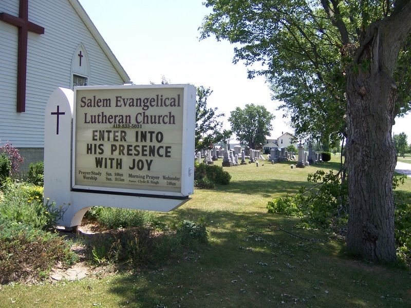
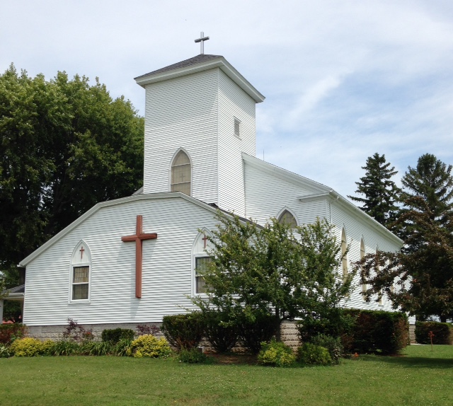
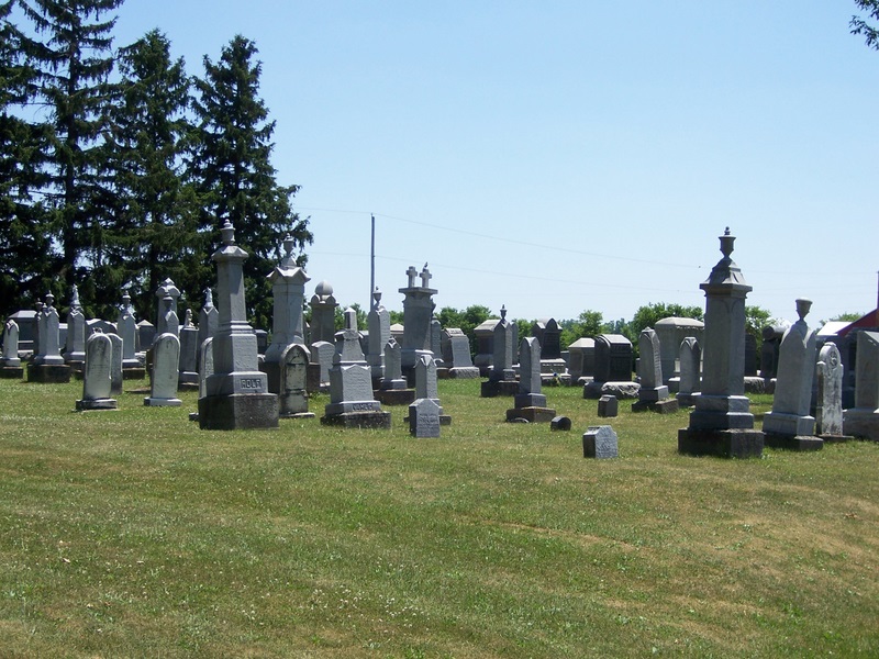
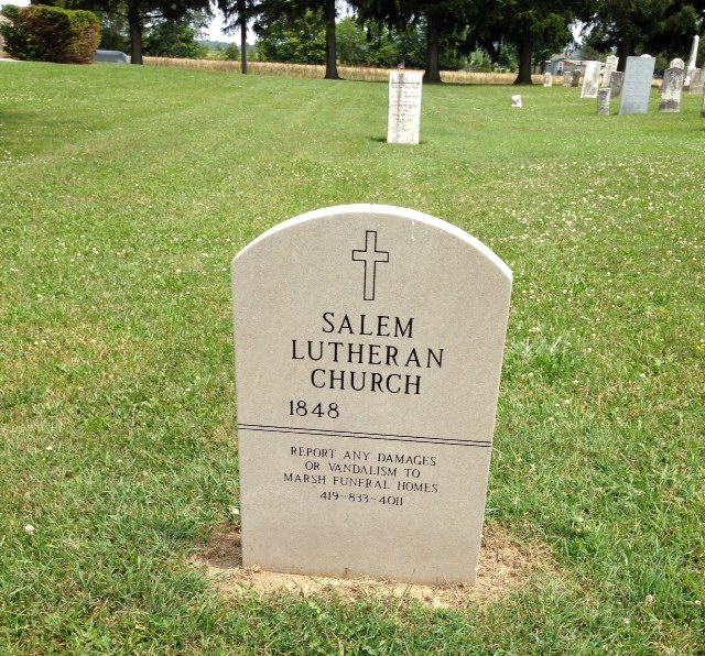
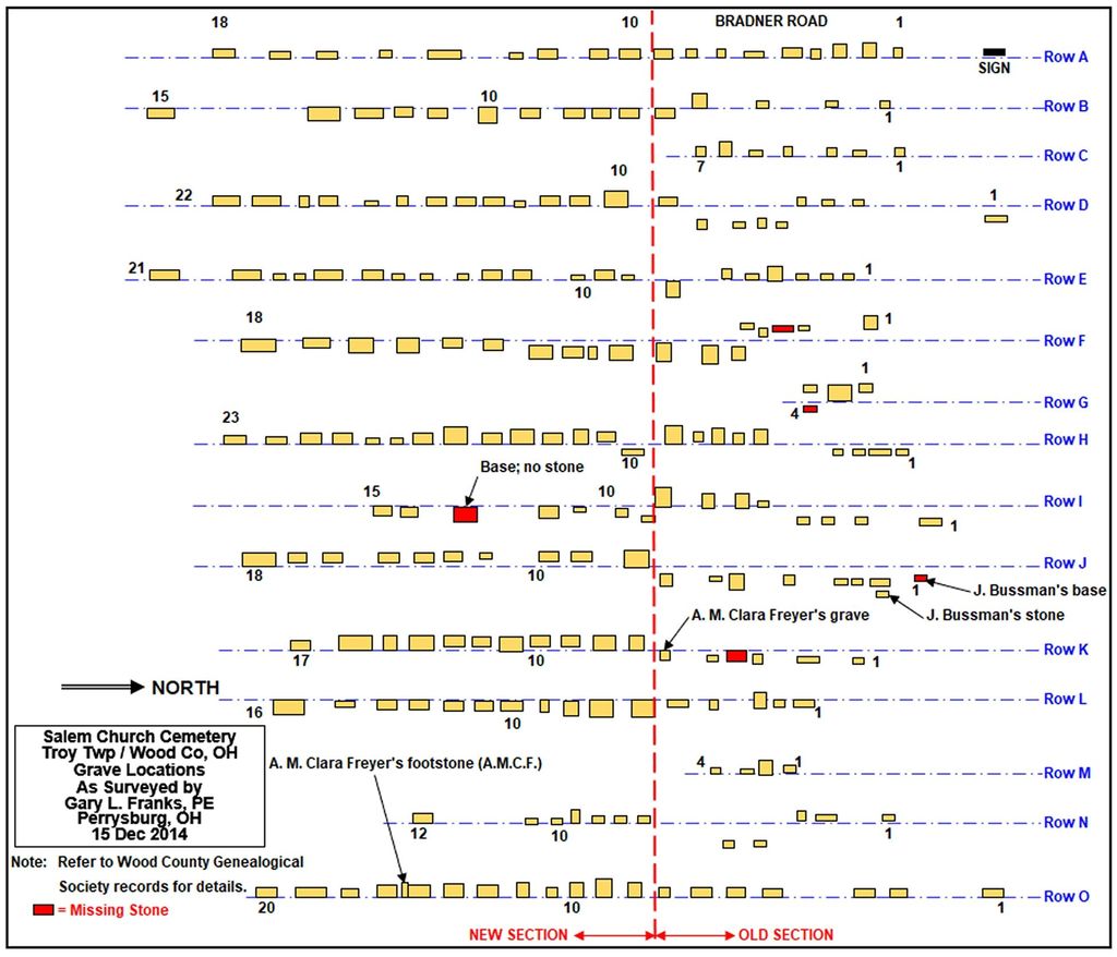
| Description | : | The cemetery is located on the east side of Bradner Road (County Road 16) about 0.1 miles north of its intersection with Devils Hole Road (County Road 61). The cemetery is located in Troy Township, Wood County, Ohio, and is # 12909 (Salem Lutheran Cemetery / Salem Cemetery / Schweitz Cemetery) in “Ohio Cemeteries 1803-2003”, compiled by the Ohio Genealogical Society. The cemetery is registered with the Ohio Division of Real Estate and Professional Licensing (ODRE) as Salem Evangelical Lutheran Church Cemetery with registration license number CGR.0000983242. The U.S. Geological Survey (USGS) Geographic Names Information System (GNIS) feature... Read More |
frequently asked questions (FAQ):
-
Where is Salem Church Cemetery?
Salem Church Cemetery is located at Bradner Road (County Road 16) Luckey, Wood County ,Ohio , 43443USA.
-
Salem Church Cemetery cemetery's updated grave count on graveviews.com?
1 memorials
-
Where are the coordinates of the Salem Church Cemetery?
Latitude: 41.4438300
Longitude: -83.4344900
Nearby Cemetories:
1. Troy Township Cemetery
Luckey, Wood County, USA
Coordinate: 41.4533300, -83.4772000
2. Westwood Cemetery
Woodville, Sandusky County, USA
Coordinate: 41.4510994, -83.3861008
3. Eisenhour Cemetery
Pemberville, Wood County, USA
Coordinate: 41.3866997, -83.4347000
4. Woodville Cemetery
Woodville, Sandusky County, USA
Coordinate: 41.4641991, -83.3625031
5. Woodville Catholic Cemetery
Woodville, Sandusky County, USA
Coordinate: 41.4621540, -83.3614250
6. Pemberville Cemetery
Pemberville, Wood County, USA
Coordinate: 41.3958015, -83.4914017
7. Restlawn Memorial Park
Perrysburg, Wood County, USA
Coordinate: 41.5133018, -83.4661026
8. Brandeberry Cemetery
Freedom Township, Wood County, USA
Coordinate: 41.3838997, -83.5017014
9. Sugar Creek Cemetery
Woodville Township, Sandusky County, USA
Coordinate: 41.4378520, -83.3298720
10. Webster Township Cemetery
Scotch Ridge, Wood County, USA
Coordinate: 41.4075429, -83.5305762
11. Fish Cemetery
Pemberville, Wood County, USA
Coordinate: 41.3699989, -83.5038986
12. West Union Cemetery
Gibsonburg, Sandusky County, USA
Coordinate: 41.3842010, -83.3377991
13. Myers Cemetery
New Rochester, Wood County, USA
Coordinate: 41.3621708, -83.5034170
14. North Union Cemetery
Gibsonburg, Sandusky County, USA
Coordinate: 41.3981018, -83.3135986
15. Saint Lawrence Cemetery
Gibsonburg, Sandusky County, USA
Coordinate: 41.3964005, -83.3146973
16. Quinshan Cemetery
Gibsonburg, Sandusky County, USA
Coordinate: 41.3539009, -83.3602982
17. Clay Township Cemetery
Genoa, Ottawa County, USA
Coordinate: 41.5092010, -83.3186035
18. Harrington Cemetery
Elmore, Ottawa County, USA
Coordinate: 41.4781990, -83.2903100
19. Pember Farm Cemetery
Rollersville, Sandusky County, USA
Coordinate: 41.3341904, -83.3812103
20. Rymers Cemetery
Elmore, Ottawa County, USA
Coordinate: 41.4833900, -83.2871690
21. Chestnut Grove Cemetery
Scott Township, Sandusky County, USA
Coordinate: 41.3268590, -83.4171130
22. Bradner Cemetery
Bradner, Wood County, USA
Coordinate: 41.3267403, -83.4177170
23. Harris-Elmore Union Cemetery
Elmore, Ottawa County, USA
Coordinate: 41.4738998, -83.2789001
24. Old Belleville Ridge Cemetery
Dowling, Wood County, USA
Coordinate: 41.4776700, -83.5895600