
| Memorials | : | 0 |
| Location | : | Eldorado Township, Montgomery County, USA |
| Coordinate | : | 35.4657920, -80.0997170 |
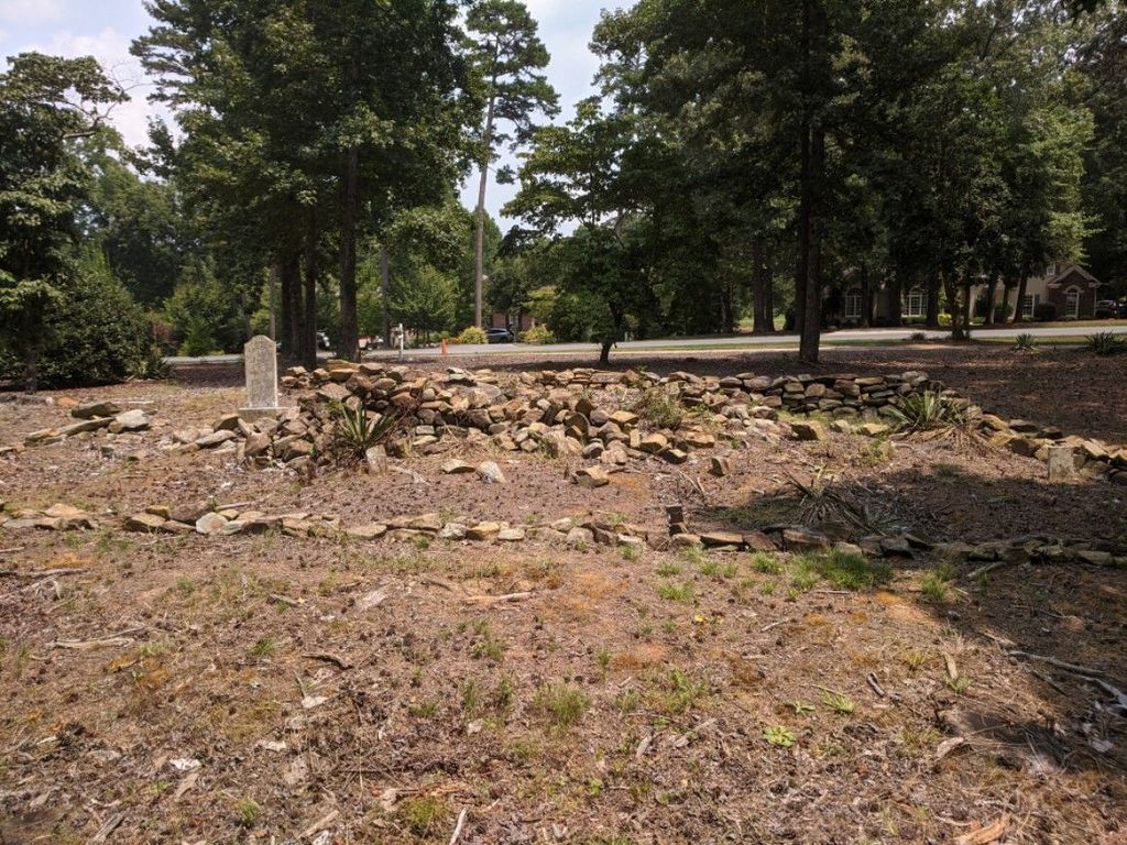
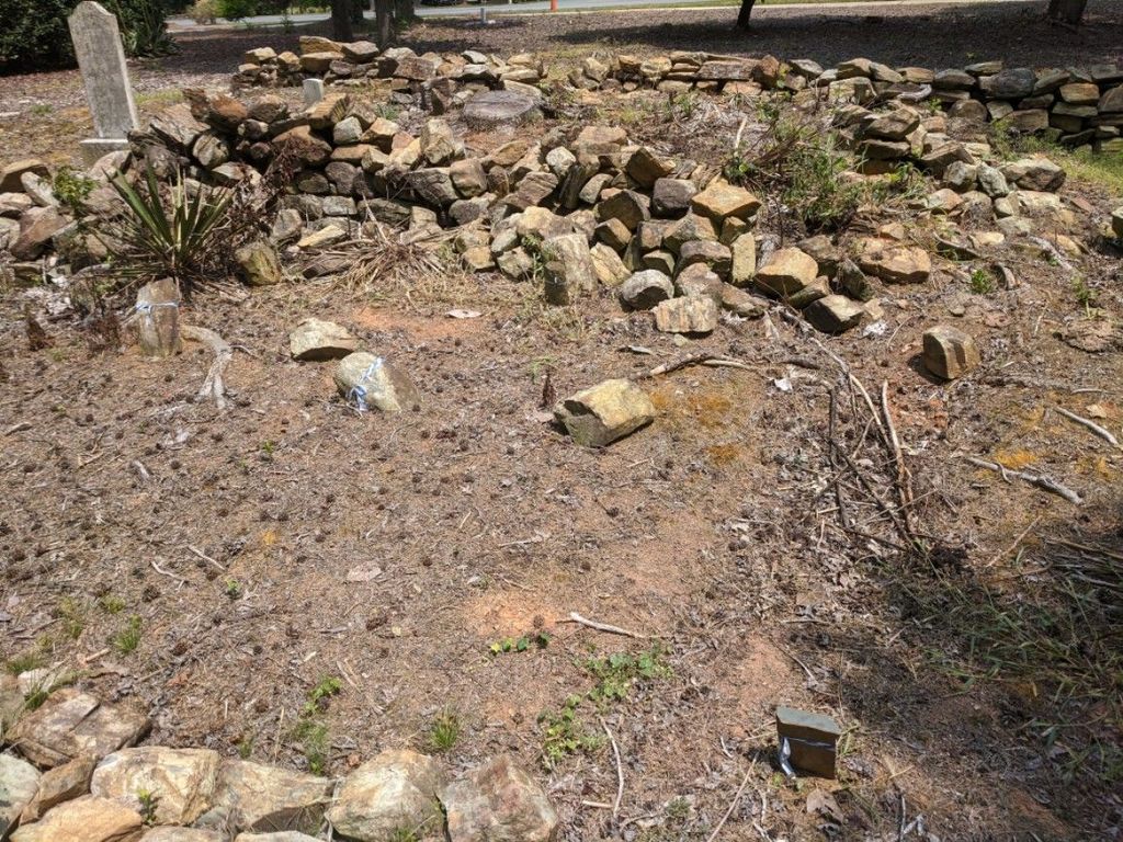
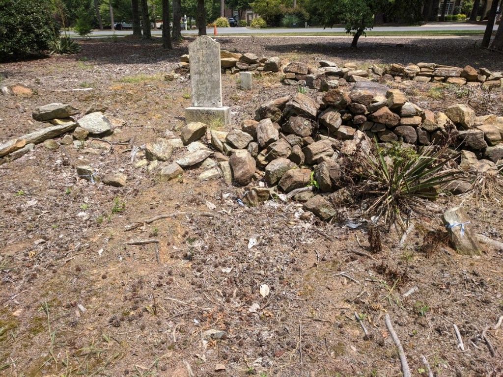
| Description | : | Registrar of Deeds, Montgomery County, North Carolina Book 113 Page 295 "SAVING, EXCEPTING AND RESERVING, from the tract of land above, described, that certain tract or parcel of land known as the Elliott Cemetery which is more particularly described as follows: BEGINNING at a galvanized iron pipe; thence South 24-37 West 211 feet to a galvanized iron pipe; thence North 65-23 West 211 feet to a galvanized iron pipe; thence North 24-29 West 2110feet to a galvanized iron pipe; thence South 65-44 West 212 feet to the beginning, containing 1.0 acres, more or less and leaving a remainder of 1200.4 acres, more... Read More |
frequently asked questions (FAQ):
-
Where is Elliott Cemetery?
Elliott Cemetery is located at 1640 Southpoint Lane (Uhwarrie Point) Eldorado Township, Montgomery County ,North Carolina , 28127USA.
-
Elliott Cemetery cemetery's updated grave count on graveviews.com?
0 memorials
-
Where are the coordinates of the Elliott Cemetery?
Latitude: 35.4657920
Longitude: -80.0997170

Nearby Cemetories:
1. Lanes Chapel Church Cemetery
Montgomery County, USA
Coordinate: 35.4804174, -80.1083843
2. Elliott Home Cemetery
Blaine, Montgomery County, USA
Coordinate: 35.4690600, -80.0771160
3. Graveyard Island
Badin, Stanly County, USA
Coordinate: 35.4580130, -80.1237200
4. Elliotts Grove Cemetery
Troy, Montgomery County, USA
Coordinate: 35.4874200, -80.0856020
5. James Reeves Family Cemetery
Uwharrie, Montgomery County, USA
Coordinate: 35.4929426, -80.1125048
6. New Hope - Cedar Grove Community Cemetery
New London, Stanly County, USA
Coordinate: 35.4478080, -80.1323030
7. Coggin-Russell-Henderson Family Cemetery
Montgomery County, USA
Coordinate: 35.4860260, -80.0660200
8. Palmerville Cemetery
Palmerville, Stanly County, USA
Coordinate: 35.4265030, -80.1162200
9. Center Cemetery
Troy, Montgomery County, USA
Coordinate: 35.4922800, -80.0569600
10. Harris Cemetery at Jones Field
Eldorado, Montgomery County, USA
Coordinate: 35.4628800, -80.0421900
11. Chandlers Grove United Methodist Church Cemetery
Montgomery County, USA
Coordinate: 35.5014400, -80.1376700
12. Eldorado Baptist Church Cemetery
Troy, Montgomery County, USA
Coordinate: 35.4696130, -80.0322210
13. Hannah Grave Yard
New Hope, Randolph County, USA
Coordinate: 35.5147600, -80.0666400
14. William Harris Plot
Eldorado, Montgomery County, USA
Coordinate: 35.4570780, -80.0316940
15. Badin Baptist Church Cemetery
Badin, Stanly County, USA
Coordinate: 35.4056780, -80.1149170
16. Harris Cemetery #1
New London, Stanly County, USA
Coordinate: 35.4740170, -80.1758330
17. Tuckertown Cemetery
Uwharrie, Montgomery County, USA
Coordinate: 35.4859700, -80.1725100
18. Macedonia United Methodist Church Cemetery
Eldorado, Montgomery County, USA
Coordinate: 35.4534730, -80.0219934
19. Russell Cemetery
Montgomery County, USA
Coordinate: 35.4996986, -80.0310974
20. Coggin Family Cemetery
Eldorado, Montgomery County, USA
Coordinate: 35.4871255, -80.0189785
21. Bethel United Methodist Church Cemetery
New London, Stanly County, USA
Coordinate: 35.4522000, -80.1852330
22. Coggin
Davidson County, USA
Coordinate: 35.5357530, -80.1162100
23. Alleghany United Methodist Church Cemetery
Denton, Davidson County, USA
Coordinate: 35.5353690, -80.1247500
24. John Loftin Cemetery
Healing Springs, Davidson County, USA
Coordinate: 35.5292300, -80.1482600