
| Memorials | : | 0 |
| Location | : | Elsham, North Lincolnshire Unitary Authority, England |
| Coordinate | : | 53.5932154, -0.4451006 |
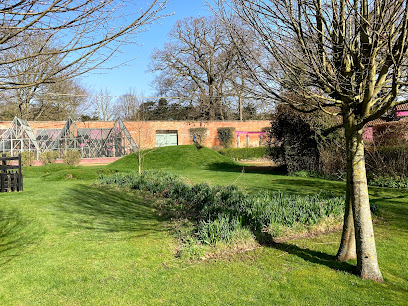
| Description | : | Elsham Hall dates back to the 1760s and was acquired by the Elwes Family in 1931 from King's College Cambridge having previously belonged to the Astley Corbett family. In 1939 the Hall was requisitioned as an Anti-Aircraft H.Q. during the Second World War but was left badly damaged necessitating the demolition of two of the wings. The present house along with a 19th Century orangery in the grounds is Grade II* listed and a private family home. (The Hall is not open to the public). The Park and Gardens were opened as a Country Park in 1970 by Captain and Mrs... Read More |
frequently asked questions (FAQ):
-
Where is Elwes Private Cemetery, Elsham Hall?
Elwes Private Cemetery, Elsham Hall is located at Elsham, North Lincolnshire Unitary Authority ,Lincolnshire ,England.
-
Elwes Private Cemetery, Elsham Hall cemetery's updated grave count on graveviews.com?
0 memorials
-
Where are the coordinates of the Elwes Private Cemetery, Elsham Hall?
Latitude: 53.5932154
Longitude: -0.4451006
Nearby Cemetories:
1. All Saints Church
Elsham, North Lincolnshire Unitary Authority, England
Coordinate: 53.5992620, -0.4355590
2. St. Clement's Churchyard
Worlaby, North Lincolnshire Unitary Authority, England
Coordinate: 53.6129220, -0.4667760
3. St. Mary's Churchyard
Barnetby le Wold, North Lincolnshire Unitary Authority, England
Coordinate: 53.5782540, -0.4088070
4. Saint Mary's Church
Wrawby, North Lincolnshire Unitary Authority, England
Coordinate: 53.5642110, -0.4609630
5. Church of the Holy Ascension Burial Ground
Melton Ross, North Lincolnshire Unitary Authority, England
Coordinate: 53.5824000, -0.3830000
6. St Andrew Churchyard
Bonby, North Lincolnshire Unitary Authority, England
Coordinate: 53.6266000, -0.4838000
7. Brigg Cemetery
Brigg, North Lincolnshire Unitary Authority, England
Coordinate: 53.5559600, -0.4817300
8. All Saints Parish Church
Bigby, West Lindsey District, England
Coordinate: 53.5531600, -0.4019100
9. St John the Evangelist Churchyard
Brigg, North Lincolnshire Unitary Authority, England
Coordinate: 53.5518740, -0.4913750
10. All Saints' Churchyard
Saxby-All-Saints, North Lincolnshire Unitary Authority, England
Coordinate: 53.6372500, -0.5010260
11. St Margaret Churchyard
Somerby, West Lindsey District, England
Coordinate: 53.5455030, -0.3982090
12. St John's Church
Croxton, North Lincolnshire Unitary Authority, England
Coordinate: 53.5955990, -0.3477220
13. St Andrew's Churchyard
Wootton, North Lincolnshire Unitary Authority, England
Coordinate: 53.6306857, -0.3549418
14. St Nicholas Churchyard
Searby, West Lindsey District, England
Coordinate: 53.5384960, -0.3830950
15. St Helen's
Kirmington, North Lincolnshire Unitary Authority, England
Coordinate: 53.5866210, -0.3306200
16. Broughton Church Cemetery
Broughton, North Lincolnshire Unitary Authority, England
Coordinate: 53.5649200, -0.5504110
17. St Maurice Churchyard
Horkstow, North Lincolnshire Unitary Authority, England
Coordinate: 53.6512040, -0.5079660
18. St Marys Churchyard
Broughton, North Lincolnshire Unitary Authority, England
Coordinate: 53.5654330, -0.5514190
19. Broughton Cemetery
Broughton, North Lincolnshire Unitary Authority, England
Coordinate: 53.5732500, -0.5582900
20. St Nicholas Churchyard
Ulceby, North Lincolnshire Unitary Authority, England
Coordinate: 53.6163770, -0.3334470
21. Scawby Cemetery
Scawby, North Lincolnshire Unitary Authority, England
Coordinate: 53.5392100, -0.5266320
22. St Bartholomew's Church
Appleby, North Lincolnshire Unitary Authority, England
Coordinate: 53.6234280, -0.5603240
23. All Saints Churchyard
Cadney, North Lincolnshire Unitary Authority, England
Coordinate: 53.5175500, -0.4671070
24. Saint Hybald's Churchyard
Scawby, North Lincolnshire Unitary Authority, England
Coordinate: 53.5384500, -0.5395500