
| Memorials | : | 31 |
| Location | : | Clay County, USA |
| Coordinate | : | 36.5143600, -85.4685300 |
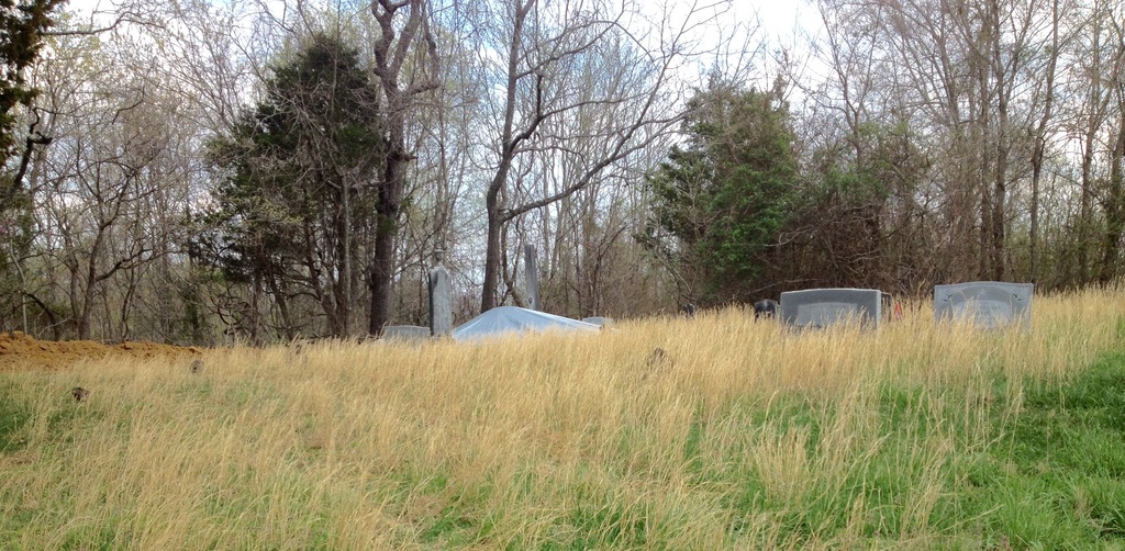
| Description | : | Located north of Livinstonhighway at Dale Hollow Dam Road. From Livingston highway turn onto Dale Hollow Dam Road and get onto Old Hwy 52 and go less than .1 miles. Cemetery is on the left. Well-kept. Cemetery was relocated ca 1942-43 from the Obey River on the old William Dale farm and later the Captain James Knox Polk Davis farm. It was just above the present Dale Hollow Dam in the pool area. Large obelisk in middle of the cemetery with the following inscriptions: North Face: Catherine Dale, Jeff Davis, William Davis East Face: A. J. Dale, Mch 5, 1815,... Read More |
frequently asked questions (FAQ):
-
Where is Dale Davis Cemetery?
Dale Davis Cemetery is located at Clay County ,Tennessee ,USA.
-
Dale Davis Cemetery cemetery's updated grave count on graveviews.com?
31 memorials
-
Where are the coordinates of the Dale Davis Cemetery?
Latitude: 36.5143600
Longitude: -85.4685300
Nearby Cemetories:
1. Walker Cemetery
Celina, Clay County, USA
Coordinate: 36.5372009, -85.4728012
2. Keen Cemetery
Clay County, USA
Coordinate: 36.5116997, -85.4385986
3. Peterman Bend Cemetery
Celina, Clay County, USA
Coordinate: 36.5370750, -85.4846300
4. Robert Arms Cemetery
Pea Ridge, Clay County, USA
Coordinate: 36.5432790, -85.4657820
5. Gates Cemetery
Celina, Clay County, USA
Coordinate: 36.5422640, -85.4891440
6. Tinsley Cemetery
Cave Springs, Clay County, USA
Coordinate: 36.5527992, -85.4800034
7. Smith Family Cemetery
Clay County, USA
Coordinate: 36.5073684, -85.4173430
8. Old Fitzgerald Cemetery
Celina, Clay County, USA
Coordinate: 36.5509750, -85.4958417
9. Fitzgerald Cemetery
Celina, Clay County, USA
Coordinate: 36.5518990, -85.4966965
10. Hamilton Cemetery
Celina, Clay County, USA
Coordinate: 36.5517271, -85.4970509
11. Green Cemetery
Celina, Clay County, USA
Coordinate: 36.5496418, -85.5024450
12. McDonald Cemetery
Baptist Ridge, Clay County, USA
Coordinate: 36.4855995, -85.5119019
13. Rich Cemetery
Baptist Ridge, Clay County, USA
Coordinate: 36.4757080, -85.4991700
14. Page Family Cemetery
Free Hill, Clay County, USA
Coordinate: 36.5623018, -85.4844294
15. Buford Cemetery
Clay County, USA
Coordinate: 36.5405998, -85.4139023
16. Emberton Cemetery
Celina, Clay County, USA
Coordinate: 36.4862150, -85.5237040
17. Hamilton Cemetery
Clay County, USA
Coordinate: 36.5181007, -85.5338974
18. Free Hill Cemetery
Clay County, USA
Coordinate: 36.5628014, -85.4955978
19. McFerrin Cemetery
Overton County, USA
Coordinate: 36.4902992, -85.4075012
20. M R Cemetery
Baptist Ridge, Clay County, USA
Coordinate: 36.4769100, -85.5196770
21. Burchett Cemetery
Overton County, USA
Coordinate: 36.4925003, -85.4041977
22. Hall Cemetery
Clay County, USA
Coordinate: 36.4994011, -85.5366974
23. Doc Hall Cemetery
Clay County, USA
Coordinate: 36.4995390, -85.5369270
24. McClain Cemetery
Baptist Ridge, Clay County, USA
Coordinate: 36.4562840, -85.4838270