
| Memorials | : | 0 |
| Location | : | Amsterdam, Amsterdam Municipality, Netherlands |
| Coordinate | : | 52.3693210, 4.8900540 |
frequently asked questions (FAQ):
-
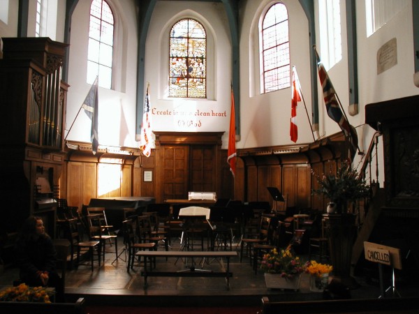
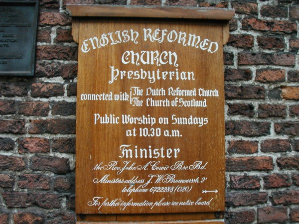
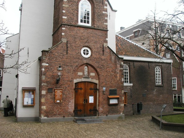
Where is English Reformed Church at the Begijnhof?
English Reformed Church at the Begijnhof is located at Amsterdam, Amsterdam Municipality ,Noord-Holland ,Netherlands.
-
English Reformed Church at the Begijnhof cemetery's updated grave count on graveviews.com?
0 memorials
-
Where are the coordinates of the English Reformed Church at the Begijnhof?
Latitude: 52.3693210
Longitude: 4.8900540
Nearby Cemetories:
1. Nieuwezijds Kapel
Amsterdam, Amsterdam Municipality, Netherlands
Coordinate: 52.3681070, 4.8922740
2. Nieuwe Kerk
Amsterdam, Amsterdam Municipality, Netherlands
Coordinate: 52.3739180, 4.8917450
3. Zuiderkerk
Amsterdam, Amsterdam Municipality, Netherlands
Coordinate: 52.3702900, 4.8998490
4. Westerkerk
Amsterdam, Amsterdam Municipality, Netherlands
Coordinate: 52.3745420, 4.8838520
5. Oude Kerk
Amsterdam, Amsterdam Municipality, Netherlands
Coordinate: 52.3743350, 4.8979600
6. Amsterdam Oude Oosterbegraafplaats (Defunct)
Amsterdam, Amsterdam Municipality, Netherlands
Coordinate: 52.3621570, 4.9209740
7. Amsterdam Begraafplaats Vredenhof
Amsterdam, Amsterdam Municipality, Netherlands
Coordinate: 52.3848600, 4.8621200
8. Sint-Barbara Katholieke Begraafplaats
Amsterdam, Amsterdam Municipality, Netherlands
Coordinate: 52.3915300, 4.8631700
9. Amsterdam Begraafplaats 't Huis te Vraag
Amsterdam, Amsterdam Municipality, Netherlands
Coordinate: 52.3471200, 4.8488400
10. Amsterdam R.K. Begraafplaats Buitenveldert
Buitenveldert, Amsterdam Municipality, Netherlands
Coordinate: 52.3406200, 4.8612100
11. Amsterdam Begraafplaats Zorgvlied
Amsterdam, Amsterdam Municipality, Netherlands
Coordinate: 52.3354500, 4.9050700
12. Buiksloot Kerkhof
Amsterdam, Amsterdam Municipality, Netherlands
Coordinate: 52.4017192, 4.9165272
13. Joodse Begraafplaats Zeeburg
Amsterdam, Amsterdam Municipality, Netherlands
Coordinate: 52.3613840, 4.9491050
14. De Nieuwe Ooster
Amsterdam, Amsterdam Municipality, Netherlands
Coordinate: 52.3464400, 4.9388500
15. Kerkhof Nieuwendam Nieuwendam
Nieuwendam, Amsterdam Municipality, Netherlands
Coordinate: 52.3919138, 4.9409809
16. De Nieuwe Noorder
Amsterdam, Amsterdam Municipality, Netherlands
Coordinate: 52.4065600, 4.9266200
17. Old Diemen Cemetery
Diemen, Diemen Municipality, Netherlands
Coordinate: 52.3490280, 4.9728890
18. Nederlands-Israëlitische Begraafplaats
Diemen, Diemen Municipality, Netherlands
Coordinate: 52.3446530, 4.9711020
19. Begraafplaats Rustoord
Diemen, Diemen Municipality, Netherlands
Coordinate: 52.3364200, 4.9652900
20. Durgerdam Kerkhof
Durgerdam, Amsterdam Municipality, Netherlands
Coordinate: 52.3783100, 4.9880600
21. Zaandam Crematorium and General Cemetery
Zaandam, Zaanstad Municipality, Netherlands
Coordinate: 52.4252200, 4.8398700
22. Ransdorp Algemene Begraafplaats
Ransdorp, Amsterdam Municipality, Netherlands
Coordinate: 52.3929000, 4.9938600
23. Amsterdam Westgaarde Herdenkingspark
Amsterdam, Amsterdam Municipality, Netherlands
Coordinate: 52.3596600, 4.7801600
24. Begraafplaats Kerkbuurt Oostzaan
Oostzaan, Oostzaan Municipality, Netherlands
Coordinate: 52.4408907, 4.8769738