
| Memorials | : | 0 |
| Location | : | Diemen, Diemen Municipality, Netherlands |
| Coordinate | : | 52.3446530, 4.9711020 |
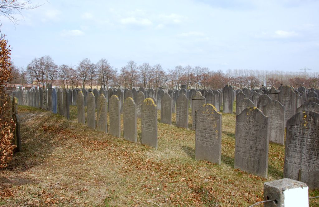
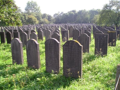
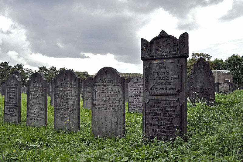
| Description | : | Planning for a new cemetery for Amsterdam began in 1907. The cemetery was opened in 1914 when the older Jewish Cemetery in Zeeburg reached its limit. In 1925 the site was split for the construction of a railway line. Field A is the eastern field, in use from 1914-1927. West of the train line are fields B, C and D, in use from 1928. Unusual for a Jewish cemetery, Field U contains 400 buried urns, holding the cremated remains of 529 Nazi victims from Westerbork. In 1958, 28,000 graves from the Jewish Cemetery in Zeeburg were relocated to Diemen. The... Read More |
frequently asked questions (FAQ):
-
Where is Nederlands-Israëlitische Begraafplaats?
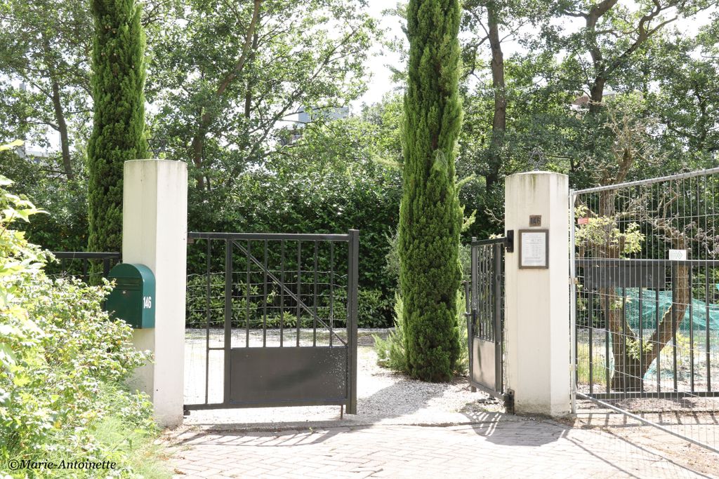
Nederlands-Israëlitische Begraafplaats is located at Ouddiemerlaan 146 Diemen, Diemen Municipality ,Noord-Holland , 1111Netherlands.
-
Nederlands-Israëlitische Begraafplaats cemetery's updated grave count on graveviews.com?
0 memorials
-
Where are the coordinates of the Nederlands-Israëlitische Begraafplaats?
Latitude: 52.3446530
Longitude: 4.9711020
Nearby Cemetories:
1. Old Diemen Cemetery
Diemen, Diemen Municipality, Netherlands
Coordinate: 52.3490280, 4.9728890
2. Begraafplaats Rustoord
Diemen, Diemen Municipality, Netherlands
Coordinate: 52.3364200, 4.9652900
3. De Nieuwe Ooster
Amsterdam, Amsterdam Municipality, Netherlands
Coordinate: 52.3464400, 4.9388500
4. Joodse Begraafplaats Zeeburg
Amsterdam, Amsterdam Municipality, Netherlands
Coordinate: 52.3613840, 4.9491050
5. Durgerdam Kerkhof
Durgerdam, Amsterdam Municipality, Netherlands
Coordinate: 52.3783100, 4.9880600
6. Amsterdam Oude Oosterbegraafplaats (Defunct)
Amsterdam, Amsterdam Municipality, Netherlands
Coordinate: 52.3621570, 4.9209740
7. Amsterdam Begraafplaats Zorgvlied
Amsterdam, Amsterdam Municipality, Netherlands
Coordinate: 52.3354500, 4.9050700
8. Ransdorp Algemene Begraafplaats
Ransdorp, Amsterdam Municipality, Netherlands
Coordinate: 52.3929000, 4.9938600
9. Zuiderkerk
Amsterdam, Amsterdam Municipality, Netherlands
Coordinate: 52.3702900, 4.8998490
10. Kerkhof Nieuwendam Nieuwendam
Nieuwendam, Amsterdam Municipality, Netherlands
Coordinate: 52.3919138, 4.9409809
11. Nieuwezijds Kapel
Amsterdam, Amsterdam Municipality, Netherlands
Coordinate: 52.3681070, 4.8922740
12. Oude Kerk
Amsterdam, Amsterdam Municipality, Netherlands
Coordinate: 52.3743350, 4.8979600
13. English Reformed Church at the Begijnhof
Amsterdam, Amsterdam Municipality, Netherlands
Coordinate: 52.3693210, 4.8900540
14. Nieuwe Kerk
Amsterdam, Amsterdam Municipality, Netherlands
Coordinate: 52.3739180, 4.8917450
15. Muiden General Cemetery
Muiden, Gooise Meren Municipality, Netherlands
Coordinate: 52.3287260, 5.0625620
16. Westerkerk
Amsterdam, Amsterdam Municipality, Netherlands
Coordinate: 52.3745420, 4.8838520
17. Beth Haim Portugees-Israëlietische Begraafplaats
Ouderkerk aan de Amstel, Ouder-Amstel Municipality, Netherlands
Coordinate: 52.2952780, 4.9041670
18. Buiksloot Kerkhof
Amsterdam, Amsterdam Municipality, Netherlands
Coordinate: 52.4017192, 4.9165272
19. Amsterdam R.K. Begraafplaats Buitenveldert
Buitenveldert, Amsterdam Municipality, Netherlands
Coordinate: 52.3406200, 4.8612100
20. De Nieuwe Noorder
Amsterdam, Amsterdam Municipality, Netherlands
Coordinate: 52.4065600, 4.9266200
21. RK Kerkhof Abcoude
Abcoude, De Ronde Venen Municipality, Netherlands
Coordinate: 52.2732000, 4.9771000
22. Amsterdam Begraafplaats 't Huis te Vraag
Amsterdam, Amsterdam Municipality, Netherlands
Coordinate: 52.3471200, 4.8488400
23. Amsterdam Begraafplaats Vredenhof
Amsterdam, Amsterdam Municipality, Netherlands
Coordinate: 52.3848600, 4.8621200
24. Sint-Barbara Katholieke Begraafplaats
Amsterdam, Amsterdam Municipality, Netherlands
Coordinate: 52.3915300, 4.8631700