
| Memorials | : | 10 |
| Location | : | Excelsior Springs, Clay County, USA |
| Coordinate | : | 39.2958984, -94.2221985 |
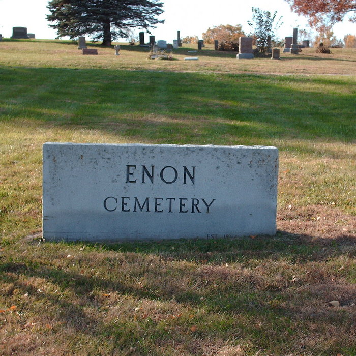
| Description | : | It was a part of the farm of Moses Hutchings, a Civil War veteran, who lost two sons in that conflict, and who are buried there. At it's begining, slaves sought permission to bury their people there. Later neighbors sought permission, then family members. On March 27, 1876, he deeded 2 acres to the Cumberland Presbyterian Church, to be used as a cemetery and church yard. He did this thinking it would be a permanet as opposed to a temporary tenure, He specified that the church erect a church building and to allow all denomininations... Read More |
frequently asked questions (FAQ):
-
Where is Enon Cemetery?
Enon Cemetery is located at Aldredge Road Excelsior Springs, Clay County ,Missouri , 64024USA.
-
Enon Cemetery cemetery's updated grave count on graveviews.com?
10 memorials
-
Where are the coordinates of the Enon Cemetery?
Latitude: 39.2958984
Longitude: -94.2221985
Nearby Cemetories:
1. Siegel Cemetery
Excelsior Springs, Ray County, USA
Coordinate: 39.2943993, -94.1977997
2. Scott Cemetery
Clay County, USA
Coordinate: 39.2708015, -94.2538986
3. Moore Cemetery
Excelsior Springs, Clay County, USA
Coordinate: 39.2696991, -94.2530975
4. Elitzer Cemetery
Miltondale, Clay County, USA
Coordinate: 39.2595640, -94.2289210
5. Elmwood Cemetery
Excelsior Springs, Clay County, USA
Coordinate: 39.3353004, -94.2485962
6. McKee-Moore Cemetery
Clay County, USA
Coordinate: 39.3315630, -94.2608620
7. Bogart Family Cemetery
Ray County, USA
Coordinate: 39.2644400, -94.1777800
8. Welton Cemetery
Clay County, USA
Coordinate: 39.3292800, -94.2663300
9. Union Baptist Cemetery
Orrick, Ray County, USA
Coordinate: 39.2507133, -94.1969070
10. Hillcrest Cemetery
Excelsior Springs, Clay County, USA
Coordinate: 39.3358002, -94.2619019
11. Old New Garden Primitive Baptist Cemetery
Wood Heights, Ray County, USA
Coordinate: 39.3227005, -94.1669006
12. Masonic Cemetery
Excelsior Springs, Clay County, USA
Coordinate: 39.3432655, -94.2482910
13. Cox Cemetery
Wood Heights, Ray County, USA
Coordinate: 39.3368988, -94.1819000
14. Crown Hill Cemetery
Excelsior Springs, Clay County, USA
Coordinate: 39.3446999, -94.2474976
15. Pisgah Cemetery
Wood Heights, Ray County, USA
Coordinate: 39.3376846, -94.1775055
16. North New Garden Primitive Baptist Church Cemetery
Wood Heights, Ray County, USA
Coordinate: 39.3271027, -94.1648026
17. Old Allen Cemetery
Ray County, USA
Coordinate: 39.2433281, -94.1977005
18. Buxton Cemetery
Prathersville, Clay County, USA
Coordinate: 39.2780991, -94.2919006
19. Woodland Cemetery
Mosby, Clay County, USA
Coordinate: 39.2928009, -94.2960968
20. Mount Zion Cemetery
Mosby, Clay County, USA
Coordinate: 39.2881012, -94.3052979
21. O'Dell Cemetery
Excelsior Springs, Ray County, USA
Coordinate: 39.2995987, -94.1346970
22. George Cemetery
Clay County, USA
Coordinate: 39.2700005, -94.3052979
23. Rowland Cemetery
Ray County, USA
Coordinate: 39.2694016, -94.1389008
24. Hamers Farm Cemetery
Ray County, USA
Coordinate: 39.3560400, -94.1762900