
| Memorials | : | 0 |
| Location | : | Cheraw, Chesterfield County, USA |
| Coordinate | : | 34.7041400, -79.8822950 |
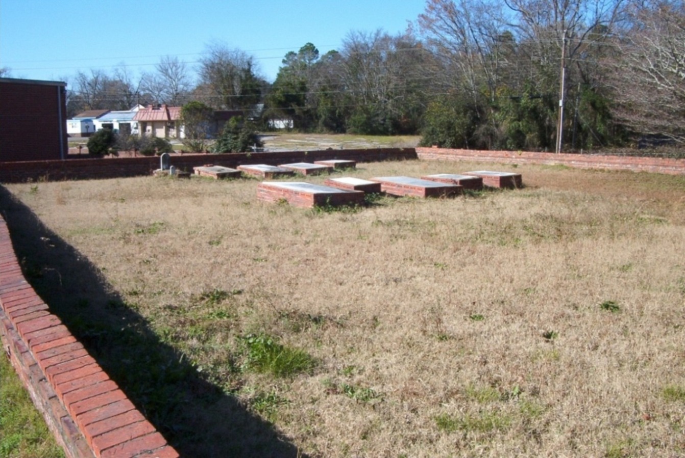
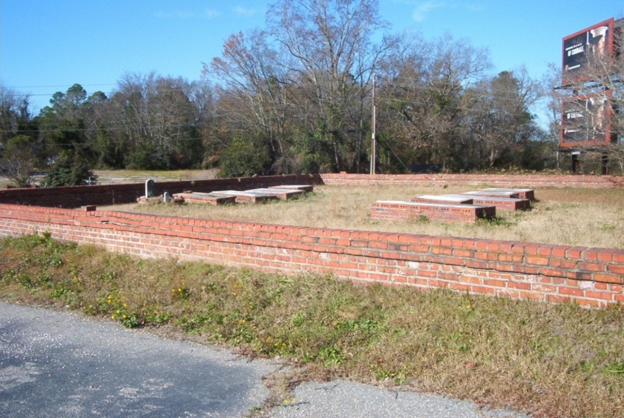
| Description | : | The Erasmus Powe Family Cemetery was established around 1820 near the banks of the Pee Dee River in Cheraw, near what used to be the town railway station. In the early 1900's B. C. Moore & Sons Department Stores acquired the property surrounding the cemetery and constructed a buying, administration, and distribution warehouse for its 74 stores. The cemetery is located at the rear of the warehouse near the loading docks. Over the years the company has maintained the cemetery in good condition. In 2006 the department store chain was acquired by another corporation and the... Read More |
frequently asked questions (FAQ):
-
Where is Erasmus Powe Family Cemetery?
Erasmus Powe Family Cemetery is located at Cheraw, Chesterfield County ,South Carolina ,USA.
-
Erasmus Powe Family Cemetery cemetery's updated grave count on graveviews.com?
0 memorials
-
Where are the coordinates of the Erasmus Powe Family Cemetery?
Latitude: 34.7041400
Longitude: -79.8822950
Nearby Cemetories:
1. Pee Dee Union Baptist Church Cemetery
Cheraw, Chesterfield County, USA
Coordinate: 34.6968440, -79.8775160
2. Old Saint Davids Episcopal Church Cemetery
Cheraw, Chesterfield County, USA
Coordinate: 34.6956140, -79.8794250
3. Foundry Hill Cemetery
Cheraw, Chesterfield County, USA
Coordinate: 34.6957350, -79.8998800
4. Gillespie - Shipp Family Graveyard
Wallace, Marlboro County, USA
Coordinate: 34.7179060, -79.8657610
5. Wallace Baptist Church Cemetery
Wallace, Marlboro County, USA
Coordinate: 34.7199530, -79.8609130
6. Mission of Faith Church Cemetery
Wallace, Marlboro County, USA
Coordinate: 34.7246090, -79.8598550
7. Greater White Creek Baptist Church Cemetery
Wallace, Marlboro County, USA
Coordinate: 34.7346600, -79.8667400
8. Chatham Hill Memorial Gardens
Cheraw, Chesterfield County, USA
Coordinate: 34.6719017, -79.9019012
9. Progressive Church of Our Lord Jesus Christ Cemete
Cheraw, Chesterfield County, USA
Coordinate: 34.6910300, -79.9387430
10. Robinson Zion Church
Cheraw, Chesterfield County, USA
Coordinate: 34.7328090, -79.9323420
11. Fisher Hill Community Cemetery
Cheraw, Chesterfield County, USA
Coordinate: 34.6738360, -79.9319040
12. J. C. Broome Memorial Garden
Cheraw, Chesterfield County, USA
Coordinate: 34.6753830, -79.9346970
13. Goodman Creek Missionary Baptist Church
Cheraw, Chesterfield County, USA
Coordinate: 34.7356390, -79.9347530
14. Prince Of Peace Church Cemetery
Cheraw, Chesterfield County, USA
Coordinate: 34.7076230, -79.9484660
15. Hickory Grove Road Cemetery
Wallace, Marlboro County, USA
Coordinate: 34.6950640, -79.8162270
16. Smith Family Cemetery
Wallace, Marlboro County, USA
Coordinate: 34.7216060, -79.8162530
17. Pleasant Grove United Methodist Church Cemetery
Cheraw, Chesterfield County, USA
Coordinate: 34.7048630, -79.9539520
18. Faith Freewill Baptist Church Cemetery
Cheraw, Chesterfield County, USA
Coordinate: 34.6717450, -79.9451980
19. Oak Grove United Methodist Church Cemetery
Wallace, Marlboro County, USA
Coordinate: 34.7430992, -79.8174973
20. Ebenezer United Methodist Church Cemetery
Wallace, Marlboro County, USA
Coordinate: 34.7326498, -79.8078380
21. Gibson Family Cemetery
Wallace, Marlboro County, USA
Coordinate: 34.7425300, -79.8137700
22. Smithville Cemetery
Chesterfield County, USA
Coordinate: 34.7047005, -79.9669037
23. True Gospel Emanuel Holiness Church Cemetery
Wallace, Marlboro County, USA
Coordinate: 34.7146900, -79.7958800
24. Saint Josephs Cemetery
Cheraw, Chesterfield County, USA
Coordinate: 34.7175410, -79.9702010